

- Usage in publication:
-
- Sepulcher Formation*
- Modifications:
-
- Named
- Dominant lithology:
-
- Volcanics
- AAPG geologic province:
-
- Yellowstone province
- Montana folded belt
Summary:
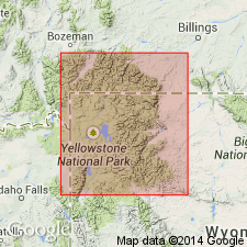
Named for Sepulcher Mountain (its type area), Yellowstone National Park (p. C12), WY in the Yellowstone province as the basal formation of Washburn Group (mew) of Absaroka Volcanic Supergroup (new). Divided into the conglomerate facies (base), epiclastic volcanic sediments, Elk Creek Basalt Member, Lost Creek Tuff Member, and epiclastic volcanic sediments (top). Is known in the Park area at Crescent Hill and Sepulcher Mountain, WY, Yellowstone province, and Bighorn Peak, MT in the Montana folded belt province. Divisible into a basal andesitic and dacitic volcanic conglomerate facies that is interlayered with trachybasalt lavas of Elk Creek Basalt Member, rhyodacite of Lost Creek Tuff Member, light-colored Daly Creek Member, and the upper dark-colored Fortress Mountain Member. Grades from dominantly vent to dominantly alluvial facies. Lower one-half is probably correlative of Hyalite Peak Volcanics. Thickens eastward from less than 1,000 ft to 2,300+ ft. Is 3,000 ft thick at Sepulcher Mountain. Grades south and southeast into Lamar River Formation. Intertongues with overlying Crescent Hill Basalt. Source area thought to be in Gallatin Range. Is of early and middle Eocene age. Eocene plant fossils found in basal conglomerate facies. Lost Creek Member has a 49.2 +/-1.5 m.y. age (K-Ar on sanidine).
Source: GNU records (USGS DDS-6; Denver GNULEX).
For more information, please contact Nancy Stamm, Geologic Names Committee Secretary.
Asterisk (*) indicates published by U.S. Geological Survey authors.
"No current usage" (†) implies that a name has been abandoned or has fallen into disuse. Former usage and, if known, replacement name given in parentheses ( ).
Slash (/) indicates name conflicts with nomenclatural guidelines (CSN, 1933; ACSN, 1961, 1970; NACSN, 1983, 2005, 2021). May be explained within brackets ([ ]).