

- Usage in publication:
-
- Sehoo formation*
- Modifications:
-
- Named
- Dominant lithology:
-
- Gravel
- Clay
- AAPG geologic province:
-
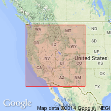
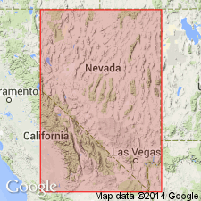
- Great Basin province
Summary:
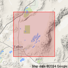
Named for Sehoo Mountain as intertonguing unit with Indian Lakes formation (new) of Lahontan Valley group (new). Type area is western end of Wyemaha Valley near Sehoo Mountain, southern Carson Desert near Fallon, NV. Consists of three tongues of lacustrine gravel to clay and tufa, separated by tongues of Indian Lakes formation. Each tongue, locally differentiated, records separate lake cycle of Lake Lahontan. Lower tongue extends to 4,370 ft elevation; middle tongue (dendritic) extends to as high as 4,180 ft; upper tongue extends to 3990 ft elevation. Thickness is as much as 96 ft. Overlies Wyemaha formation and middle Lake Lahontan soil with slight or no disconformity; underlies Turupah formation with local disconformity (both new and of Lahontan Valley group). Age of group given as late Pleistocene.
Source: GNU records (USGS DDS-6; Menlo GNULEX).
- Usage in publication:
-
- Sehoo formation*
- Modifications:
-
- Adopted
- Overview
- AAPG geologic province:
-
- Great Basin province
Summary:
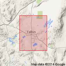
Type locality designated in saddle between Sehoo Mountain and Eetza Mountain at west end of Wyemaha Valley, E/2 sec.21 T18N R30E, Carson Desert [Carson Lake 15' quad] near Fallon, Churchill Co, NV. Report includes detailed description of unit and informal members (lower, dendritic, thinolite, and upper) which record late deep-lake period of Lake Lahontan. Lists of fossils of Sehoo age also included in report. Unit intertongues with subaerial Indian Lakes formation (Lahontan Valley group). In some places underlies Turupah formation (Lahontan Valley group) or Fallon formation. Shown on geologic maps of Stillwater, Carson Lake, and Fallon 15' quads. Age given as Pleistocene.
Source: GNU records (USGS DDS-6; Menlo GNULEX).
- Usage in publication:
-
- Sehoo Formation*
- Modifications:
-
- Age modified
- Geochronologic dating
- AAPG geologic province:
-
- Great Basin province
Summary:
Age of Sehoo Formation is Pleistocene and Holocene based on radiometric ages of Broecker and Kaufman (1968), Morrison and Frye (1965), and R.B. Morrison (written commun., 1970). [Radiocarbon ages range from approximately 28,000 to 8,500 yr B.P.]
Source: GNU records (USGS DDS-6; Menlo GNULEX).
- Usage in publication:
-
- Sehoo Alloformation
- Modifications:
-
- Redescribed
- AAPG geologic province:
-
- Great Basin province
Summary:
Sehoo Formation (Morrison, 1961) redescribed as Sehoo Alloformation as defined in 1983 North American Stratigraphic Code. Description of unit and lower, dendritic, and upper members in Wadsworth Amphitheatre included. Disconformably underlies Turupah Alloformation. Stratigraphic chart shows Pleistocene and Holocene age.
Source: GNU records (USGS DDS-6; Menlo GNULEX).
For more information, please contact Nancy Stamm, Geologic Names Committee Secretary.
Asterisk (*) indicates published by U.S. Geological Survey authors.
"No current usage" (†) implies that a name has been abandoned or has fallen into disuse. Former usage and, if known, replacement name given in parentheses ( ).
Slash (/) indicates name conflicts with nomenclatural guidelines (CSN, 1933; ACSN, 1961, 1970; NACSN, 1983, 2005, 2021). May be explained within brackets ([ ]).