

- Usage in publication:
-
- Segovia Formation
- Modifications:
-
- Original reference
- Dominant lithology:
-
- Limestone
- Dolomite
- AAPG geologic province:
-
- Kerr basin
- Permian basin
Summary:
Pg. 34-43. Segovia Formation of Edwards Group. Chiefly marly limestone, dolomite, biosparite limestone. Thickness 64 m at type section. Includes Burt Ranch Member, Allen Ranch Breccia Member, informal "Gryphaea bed" [not included in this lexicon], Orr Ranch Bed, and Black Bed. Overlies Fort Terrett Formation of Edwards Group; underlies Del Rio Clay. Age is Early Cretaceous (Comanchean).
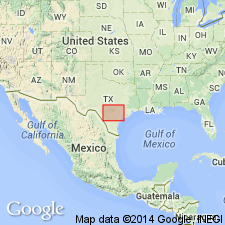
Type section: Joy Creek composite section in roadcuts of U.S. Highway I-10 from 8 to 16 km southeast of Segovia, Kimble Co., TX.
Source: US geologic names lexicon (USGS Bull. 1520, p. 275).

- Usage in publication:
-
- Segovia Member
- Modifications:
-
- Areal extent
- AAPG geologic province:
-
- Kerr basin
- Permian basin
Summary:
Is upper member of two of Edwards Limestone (Lower Cretaceous). Is mapped in northernmost part of sheet from Pecos River valley and eastward in Val Verde and Edwards Cos, TX (Permian basin) and Real Co, TX (Kerr basin). Overlies Fort Terrett Member of Edwards. Overlain by Del Rio Clay or Buda Limestone. Map unit described as limestone and dolomite; in upper part--cherty, light-gray, miliolid, shell fragment, rudistid limestone; in middle--dolomite, medium brownish-gray, porous, massive to thin-bedded, cherty, collapse breccia; in lower part--light yellowish-gray miliolid limestone and marl and marly limestone with EXOGYRA TEXANA and oxytropidocerid ammonites; key bed mapped is "Calvert's Zone"; thickness 300-380 ft, thickens southward. Is not mapped south of [what appears to be an arbitrary] east-west line that separates the unit from the Devils River Limestone. In map explanation, is schematically depicted to be equivalent to upper part of Devils River Limestone, upper part of McKnight Formation, Salmon Peak Limestone, upper part of Sue Peaks Formation, and Santa Elena Limestone.
Source: GNU records (USGS DDS-6; Denver GNULEX).

- Usage in publication:
-
- Segovia Member
- Modifications:
-
- Mapped 1:250k
- AAPG geologic province:
-
- Kerr basin
Summary:
Segovia Member of Edwards Limestone. Is upper member of Edwards Limestone. Overlies Fort Terrett Member of Edwards; underlies Del Rio Clay. Age is Early Cretaceous.
Exposed on plateau in northwestern part of map sheet, in Real, Bandera, and Kerr Counties, southern Texas. Not mapped beyond apparent arbitrary limit in southern Real County.
Source: Publication.
For more information, please contact Nancy Stamm, Geologic Names Committee Secretary.
Asterisk (*) indicates published by U.S. Geological Survey authors.
"No current usage" (†) implies that a name has been abandoned or has fallen into disuse. Former usage and, if known, replacement name given in parentheses ( ).
Slash (/) indicates name conflicts with nomenclatural guidelines (CSN, 1933; ACSN, 1961, 1970; NACSN, 1983, 2005, 2021). May be explained within brackets ([ ]).