The National Geologic Map Database is migrating to a new infrastructure. We apologize for any service disruptions during this process.
|
|---|


- Usage in publication:
-
- Sego sandstone*
- Modifications:
-
- First used
- Dominant lithology:
-
- Sandstone
- Shale
- AAPG geologic province:
-
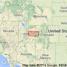
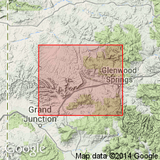
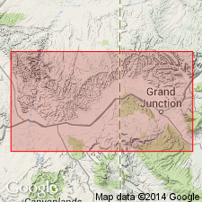
- Piceance basin
Summary:
First published use as the basal formation of the Mesaverde group along main part of Book Cliffs coal field, Garfield and Mesa Cos, CO in the Piceance basin. Type locality stated to be the village of Sego in Book Cliffs, Grand Co, UT in the Paradox basin. Overlies Mancos shale, a contact that represents a transition from marine shale to littoral deposits. Divisible into a lower member and an upper member by the Anchor Mine tongue (first used) of the Mancos shale. Underlies Mount Garfield formation (new), middle formation of Mesaverde group. Lower member is 112+/-ft thick at Salt Creek where it is described in a measured section as consisting of a basal gray fine- to medium-grained sandstone that grades into thinly laminated, cross-bedded sandy shale and clay shale and an overlying buff to brown, medium-grained, massive locally cross-bedded sandstone. Upper member a cliff-former described in a measured section at Mount Garfield as a 33 ft thick, buff to white, medium- to coarse-grained, sugary-textured, quartz sandstone separated into 4 units by three gray shales. Fossil mollusks. Stratigraphic table, geologic map. Late Cretaceous age.
Source: GNU records (USGS DDS-6; Denver GNULEX).
- Usage in publication:
-
- Sego sandstone member*
- Modifications:
-
- Named
- Dominant lithology:
-
- Sandstone
- AAPG geologic province:
-
- Paradox basin
- Piceance basin
Summary:
Named as a member of Price River formation of Mesaverde group for the town of Sego, T20S, R20E, Grand Co, UT in the Paradox basin. No type locality designated. Is a cliff-forming unit that can be traced from Beckwith Plateau, Emery Co, UT, Paradox basin into Garfield Co, CO, Piceance basin where it is split by the west-extending tongue, the Anchor Mine tongue, of the Mancos shale. Ranges from 115 to 213 ft thick. Lower contact with Buck tongue (new) of Mancos shale is gradational. Upper contact with Neslen coal-bearing member (new) of Price River formation is conformable. Five measured sections described. Described in general as a buff, brown to buff-gray, massive to thick-bedded, cross-bedded sandstone. Gray shale present in one section. Buff thin-bedded siltstone present at one section. Ranges from 84 ft to 213 ft thick in these sections. Rich fauna, mainly marine collected. Late Cretaceous age. Geologic maps.
Source: GNU records (USGS DDS-6; Denver GNULEX).
- Usage in publication:
-
- Sego sandstone*
- Modifications:
-
- Revised
- AAPG geologic province:
-
- Paradox basin
Summary:
Raised in stratigraphic rank from Sego sandstone member of Price River formation of Mesaverde group to Sego sandstone of Mesaverde group. Overlies Castlegate sandstone (raised in rank); underlies Neslen formation (raised in rank). Of Campanian, Late Cretaceous age. Occurs in the central Book Cliffs, UT in the Paradox basin. Correlation chart.
Source: GNU records (USGS DDS-6; Denver GNULEX).
- Usage in publication:
-
- Sego member
- Modifications:
-
- Revised
- AAPG geologic province:
-
- Paradox basin
- Piceance basin
Summary:
Name changed from Sego sandstone member to Sego member because it contains sandstone and the "overlying and closely related coal-bearing rocks." Is assigned to the coal-bearing facies or Neslen facies (formerly Neslen member) of the Price River formation as one of five members. Overlies marine shale of Mancos shale (east area) or Castlegate member of Price River (west area). Underlies shale of Mancos or Corcoran member (new) of Price River. Averages 200 ft thick. Has fossils of Campanian, Late Cretaceous age. Deposited in a littoral marine to brackish water environment. Cross sections. Divisible into several thin sandstone tongues; each main tongue is overlain by sandstone, sandy shale or shale of brackish water origin. Recognized along Book Cliffs from Emery and Grand Cos, UT in the Paradox basin into Garfield and Mesa Cos, CO in the Piceance basin.
Source: GNU records (USGS DDS-6; Denver GNULEX).
- Usage in publication:
-
- Sego sandstone*
- Modifications:
-
- Overview
- AAPG geologic province:
-
- Paradox basin
Summary:
Sego removed from Price River formation, raised to formation rank as a unit above Buck tongue of Mancos shale and below Neslen formation in central Book Cliffs, Emery Co, UT in the Paradox basin, and as a unit above Anchor Mine tongue of Mancos shale and beneath Mount Garfield formation in eastern Book Cliffs, Garfield and Mesa Cos, CO in the Piceance basin. Is a marine cliff-forming sandstone in basal part of second escarpment of Book Cliffs. Not present west of Green River in western Book Cliffs. Average 175 ft thick. Eleven measured sections described. Brackish- and fresh-water species identified. Of Late Cretaceous age. Columnar sections.
Source: GNU records (USGS DDS-6; Denver GNULEX).
- Usage in publication:
-
- Sego Member
- Modifications:
-
- Revised
- Areal extent
- Age modified
- Overview
- AAPG geologic province:
-
- Piceance basin
Summary:
Reassigned to Mesaverde Formation (revised) as its lowermost member. Fig. 2 is electric log correlation across southern Piceance basin, western CO, from surface section at Hunter Canyon, Mesa Co, east to surface section at South Canyon Creek, Garfield Co. Along Book Cliffs west of Hunter Canyon, Sego is up to 300 ft thick and consists of two sandstones separated by Anchor Mine tongue of Mancos Shale; lower sandstone interfingers with marine shale eastward and only upper sandstone is present at Hunter Canyon. Sego thins rapidly eastward from Hunter Canyon into subsurface and becomes part of Mancos due to facies change. Fig. 3 is correlation of measured sections along Grand Hogback from North Thompson Creek, Pitkin Co, Eagle basin, northward to White River, Rio Blanco Co, Piceance basin. As Sego does not persist across southernmost part of Piceance basin, it is difficult to define its stratigraphic position along Grand Hogback. At Harvey Gap a sandstone 88 ft below main sandstone of Corcoran Member (revised) of Mesaverde probably can be assigned to Sego; this sandstone also appears to correlate with lowermost sandstone of Iles Formation (revised) of Mesaverde Group at Rifle Gap and north to White River. [Sego not specifically assigned to Iles.] Overlies Mancos Shale; underlies Corcoran. Fossils within BACULITES SCOTTI faunal zone date unit as Campanian (Late Cretaceous) age.
Source: GNU records (USGS DDS-6; Denver GNULEX).
- Usage in publication:
-
- Sego? Sandstone Member
- Modifications:
-
- Revised
- AAPG geologic province:
-
- Piceance basin
Summary:
Reassigned to Iles Formation (revised) of Mesaverde Group. Plate 2 is cross section of measured sections along Grand Hogback, western CO, from Coal Basin area, Pitkin Co, Eagle basin, north to White River, near Meeker, Rio Blanco Co, Piceance basin (Mancos Shale and Iles parts of sections are taken from Warner (1964)). Sego? occurs along hogback as far south as just south of Harvey Gap, Piceance basin, where it pinches out. Sego? is basal sandstone of Iles from Piceance Gap south to Harvey Gap (southward from this point, the overlying Corcoran Sandstone Member of Iles becomes basal sandstone of Iles). Overlies Mancos or tongue of Mancos; tongue of Mancos separates Sego? from overlying Corcoran. Thickness is 40 ft at Piceance Gap. Chart comparing nomenclature of previous workers. Late Cretaceous age.
Source: GNU records (USGS DDS-6; Denver GNULEX).

- Usage in publication:
-
- Sego Sandstone*
- Modifications:
-
- Age modified
- AAPG geologic province:
-
- Paradox basin
Summary:
Is of late Campanian age (an age refinement) in the Paradox basin where it overlies the Buck Tongue of Mancos Shale and underlies Neslen Formation. Intertongues near Green River with Bluecastle Tongue (formerly a member of Price River Formation) of Castlegate Sandstone.
Source: GNU records (USGS DDS-6; Denver GNULEX).
- Usage in publication:
-
- Sego Sandstone*
- Modifications:
-
- Overview
- AAPG geologic province:
-
- Piceance basin
- Paradox basin
Summary:
Traceable from west of Green River in Emery Co in Beckwith Plateau along Book Cliffs, Grand Co, northeast UT in the Paradox basin into Garfield and Mesa Cos, northeast CO in the Piceance basin. Is a single sandstone unit in UT above the Buck Tongue of the Mancos Shale and beneath the Neslen Formation. East of the UT-CO state line, Sego is split into a lower and upper part by the Anchor Mine Tongue of the Mancos. Rocks above Sego in CO called Mount Garfield Formation. Basal contact usually gradational is placed at base of first continuous sandstone. Upper contact placed at top of thick, cliff-forming sandstone. Averages 350 ft thick. Deposited during last regression of Cretaceous sea. Composed of 6 backbarrier and shoreface deposits. Backbarrier deposits vary from tidal flat, tidal delta, tidal channel, washovers, marshes, swamps, lagoons, and bays. Shoreface deposits were microtidal barrier-island coastline. Of late Campanian, Late Cretaceous age. Measured sections. Cross sections. Correlation chart.
Source: GNU records (USGS DDS-6; Denver GNULEX).
- Usage in publication:
-
- Sego Sandstone*
- Modifications:
-
- Overview
- Dominant lithology:
-
- Sandstone
- AAPG geologic province:
-
- Paradox basin
Summary:
Western pinchout of Sego is on the Beckwith Plateau, west of Green River and south of Price River in Emery Co, UT in the Paradox basin. Eastward Sego thickens, then thins and grades into the Mancos Shale in western CO. Basal contact with Buck Tongue of Mancos is gradational. Upper contact with Neslen Formation sharp and is placed at top of thick cliff-forming sandstone. Section measured in Sego Canyon, secs 3, 15, 28, 33, T20S, R20E, Sego Canyon, Grand Co, UT, designated the type section. At type, consists of 180 ft of stacked upward-coarsening sandstone. Some beds are hummocky cross-stratified, horizontally laminated, or ripple cross-laminated; other beds are current- and wave-ripple laminated, planar-laminated, wavy and flaser. Two carbonaceous shale and siltstone beds. No palynomorphs collected from Sego. Late Campanian mollusks found in upper part of Sego by previous workers.
Source: GNU records (USGS DDS-6; Denver GNULEX).
For more information, please contact Nancy Stamm, Geologic Names Committee Secretary.
Asterisk (*) indicates published by U.S. Geological Survey authors.
"No current usage" (†) implies that a name has been abandoned or has fallen into disuse. Former usage and, if known, replacement name given in parentheses ( ).
Slash (/) indicates name conflicts with nomenclatural guidelines (CSN, 1933; ACSN, 1961, 1970; NACSN, 1983, 2005, 2021). May be explained within brackets ([ ]).