


- Usage in publication:
-
- Seeleyville coal member
- Modifications:
-
- Named
- Dominant lithology:
-
- Coal
- AAPG geologic province:
-
- Illinois basin
Summary:
Seeleyville [misspelled] coal of Ashley (1902) assigned member status in Spoon formation (new name). Only named member of formation in area. Has been referred to as Coal III in Indiana.
Source: GNU records (USGS DDS-6; Reston GNULEX).
- Usage in publication:
-
- Seelyville Coal Member
- Modifications:
-
- Overview
- Reference
Summary:
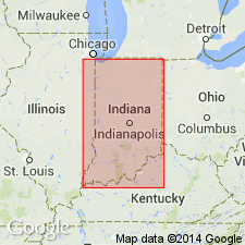
Indiana Geological Survey drillhole SDH 306 is herein designated the reference core for the Houchin Creek Coal Member of the Petersburg Formation; the Survant Coal, Velpen Limestone, Mecca Quarry Shale, and Colchester Coal Members of the Linton Formation; the Seelyville Coal Member of the Staunton Formation; and the boundary between the Petersburg and Linton Formations. SDH 306 is located near the type section of the Survant Coal Member, in SW1/4 NE1/4 sec. 2, T2S, R7W, Pike Co., southern IN. Seelyville measures 4.85 ft in the SDH 306 core. Correlates with the Rock Creek Coal in Pike, Warrick, and Gibson Cos. Unit is difficult to correlate in places in the subsurface. Use of name Seelyville in the southern counties of the Indiana coal field is tentative.
Source: GNU records (USGS DDS-6; Reston GNULEX).
For more information, please contact Nancy Stamm, Geologic Names Committee Secretary.
Asterisk (*) indicates published by U.S. Geological Survey authors.
"No current usage" (†) implies that a name has been abandoned or has fallen into disuse. Former usage and, if known, replacement name given in parentheses ( ).
Slash (/) indicates name conflicts with nomenclatural guidelines (CSN, 1933; ACSN, 1961, 1970; NACSN, 1983, 2005, 2021). May be explained within brackets ([ ]).