


- Usage in publication:
-
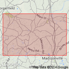
- Sebree scarp-making sandstone
- Modifications:
-
- Named
- Dominant lithology:
-
- Sandstone
- AAPG geologic province:
-
- Illinois basin
Summary:
Name introduced for coarse massive sandstone, 10 to 50 ft thick forming basal member of DeKoven formation in Webster Co., western KY. Rests unconformably on Tradewater formation. Age is Pennsylvanian.
Source: GNU records (USGS DDS-6; Reston GNULEX).
- Usage in publication:
-
- Sebree sandstone
- Modifications:
-
- Revised
- AAPG geologic province:
-
- Illinois basin
Summary:
Sebree sandstone revised as basal member of Carbondale formation. Caps Sebree Hills. Forms ridge that extends from Sebree east to Green River. Named for prominent development between Sebree and Steamport Ferry, where it caps the hills and in places forms prominent cliffs. Age is Pennsylvanian.
Source: GNU records (USGS DDS-6; Reston GNULEX).
- Usage in publication:
-
- Sebree sandstone member
- Modifications:
-
- Overview
- AAPG geologic province:
-
- Illinois basin
Summary:
Sebree sandstone member at base of Carbondale formation is cliff-forming sandstone. Lies between No. 8a above and Dekoven coals. Age is Pennsylvanian.
Source: GNU records (USGS DDS-6; Reston GNULEX).
For more information, please contact Nancy Stamm, Geologic Names Committee Secretary.
Asterisk (*) indicates published by U.S. Geological Survey authors.
"No current usage" (†) implies that a name has been abandoned or has fallen into disuse. Former usage and, if known, replacement name given in parentheses ( ).
Slash (/) indicates name conflicts with nomenclatural guidelines (CSN, 1933; ACSN, 1961, 1970; NACSN, 1983, 2005, 2021). May be explained within brackets ([ ]).