- Usage in publication:
-
- Scranton shales of Bennett
- Modifications:
-
- Original reference
Summary:
Pg. 71-85. Scranton shales of Bennett. Previously called Burlingame shales, but that name is retained for the limestone, both being named at same time. Is top formation of Shawnee stage. Underlies Burlingame limestone and overlies Howard limestone. Age is Pennsylvanian.
Source: US geologic names lexicon (USGS Bull. 896, p. 1946).

- Usage in publication:
-
- Scranton shale member
- Modifications:
-
- Revised
- AAPG geologic province:
-
- Forest City basin
Summary:
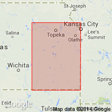
Pg. 41 (table 5). Scranton shale member of Shawnee formation. Includes the following beds (descending): Silver Lake shale, Rulo limestone, White Cloud shale, Cass limestone, Plattford shale, South Bend limestone, and Rock Lake shale. Thickness 137 feet. Age is Pennsylvanian (Missouri age). Report includes cross sections, measured sections, geologic maps, stratigraphic tables.
[Cass and Plattford later discarded by Condra and by Moore. Condra explained (Nebraska Geol. Survey Bull., no. 3, 1930, p. 11) the misapplication of names South Bend and Rock Lake in this bulletin from Scranton shale to Stanton limestone, inclusive.]
Source: Publication; GNC KS-NE Pennsylvanian Corr. Chart, sheet 1, Oct. 1936.

- Usage in publication:
-
- Scranton shale member
- Modifications:
-
- Revised
- AAPG geologic province:
-
- Nemaha anticline
Summary:
Scranton shale member of Shawnee group. Thickness 60+/- feet. Includes the following beds (descending): Silver Lake shale, 3+/- feet; Rulo limestone, 1+/- feet; Cedarvale [Cedar Vale] shale; Happy Hollow limestone; and White Cloud shale restricted. Underlies Burlingame limestone member of Wabaunsee group; overlies Howard limestone member of Shawnee. Age is Pennsylvanian.
Source: GNC KS-NE Pennsylvanian Corr. Chart, sheet 1, Oct. 1936.

- Usage in publication:
-
- Scranton shale†
- Modifications:
-
- Abandoned
Summary:
Pg. 49 (fig. 11), 211-214. †Scranton shale. Term Scranton discarded. Named subdivisions treated as formations in Wabaunsee group [(descending) Silver Lake shale, Rulo limestone, Cedar Vale shale, Happy Hollow limestone, and White Cloud shale].
Source: US geologic names lexicon (USGS Bull. 1200, p. 3505-3506); GNC KS-NE Pennsylvanian Corr. Chart, sheet 2, Oct. 1936.

- Usage in publication:
-
- Scranton shale*
- Scranton shale member*
- Modifications:
-
- Overview
- AAPG geologic province:
-
- Nemaha anticline
Summary:
Scranton shale is still [ca. 1938] applied by Nebraska Geol. Survey and the USGS to the beds underlying Burlingame limestone and overlying Howard limestone, but R.C. Moore in 1936 (Kansas Geol. Survey Bull., no. 22) discarded the name from the Kansas classification, treating the named subdivisions into which Condra had in 1930 divided it as formations in Wabaunsee group. Moore stated (p. 210) that Rock Lake shale, South Bend limestone, Plattford shale, and Cass limestone of Condra do not belong to Scranton shale. Condra in 1930 transferred his Rock Lake shale and South Bend limestone to Stanton limestone, and in 1935 stated (Nebraska Geol. Survey Paper, no. 8) his Plattford shale is same as Weston shale, but did not explain what replaces his Cass limestone, although he abandoned that name in 1930.
Source: US geologic names lexicon (USGS Bull. 896, p. 1946); GNC KS-NE Pennsylvanian Corr. Chart, 2 sheets, Oct. 1936.

- Usage in publication:
-
- Scranton shale*
- Modifications:
-
- Revised
- Reference
- AAPG geologic province:
-
- Forest City basin
Summary:
Pg. 2274 (fig. 1), 2277. Scranton shale reintroduced as a formation with same stratigraphic span assigned originally to it by Haworth and Bennett. Consists predominantly of shale but contains some thin limestones and shaly sandstones. Comprises upper half of Sac-Fox subgroup [informal] of Wabaunsee group; includes strata between Bern limestone (new) above and Howard limestone below. Thickness about 125 feet. Includes (ascending) White Cloud shale, Happy Hollow limestone, Cedar Vale shale, Rulo limestone, and Silver Lake shale members. Age is Late Pennsylvanian (Virgilian). Reference section proposed.
Reference section: exposures along eastward-flowing stream extending through middle part of sec. 34, T. 12 S., R. 15 E., Shawnee Co., eastern KS.
["Subgroup" not recognized as a formal stratigraphic rank term (CSN, 1933; ACSN, 1961, 1970; NACSN, 1983, 2005, 2021). Considered informal and should not be capitalized.]
Source: US geologic names lexicon (USGS Bull. 1200, p. 3505-3506).
For more information, please contact Nancy Stamm, Geologic Names Committee Secretary.
Asterisk (*) indicates published by U.S. Geological Survey authors.
"No current usage" (†) implies that a name has been abandoned or has fallen into disuse. Former usage and, if known, replacement name given in parentheses ( ).
Slash (/) indicates name conflicts with nomenclatural guidelines (CSN, 1933; ACSN, 1961, 1970; NACSN, 1983, 2005, 2021). May be explained within brackets ([ ]).

