

- Usage in publication:
-
- Scotts Corners Formation
- Modifications:
-
- Named
- Dominant lithology:
-
- Sand
- Silt
- Gravel
- AAPG geologic province:
-
- Atlantic Coast basin
Summary:
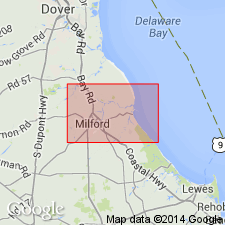
Scotts Corners, a new formation, is described here as a heterogeneous unit of light gray to brown to light yellowish brown, coarse to fine sand with discontinuous beds of clayey silt (some organic-rich), coarse to very coarse quartz sand, and pebble gravel. Type section is designated as Lf14-p (shown on map). Reference sections are designated as Lf23-x, Mf25-a, and Mg33-g. Unconformably overlies Lynch Heights Formation (new) and unconformably underlies unnamed Pleistocene and Holocene Carolina Bay deposits. Maximum thickness about 15 ft. Interpreted as a transgressive unit composed of swamp, marsh, estuarine channel, beach, and bay deposits. Mapped as Delaware Bay deposits by Ramsey and Schenck (1990). Nomenclature of Owens and Minard (1979) and Owens and Denny (1979) is rejected. Age is late Pleistocene.
Source: GNU records (USGS DDS-6; Reston GNULEX).
- Usage in publication:
-
- Scotts Corners Formation
- AAPG geologic province:
-
- Atlantic Coast basin
Ramsey, K.W., 2010, Stratigraphy, correlation, and depositional environments of the middle to late Pleistocene interglacial deposits of southern Delaware: Delaware Geological Survey Report of Investigations, no. 76, 43 p.
Summary:
Pg. 10+. Scotts Corners Formation of Delaware Bay Group. [Not synopsized to date. See also Ramsey, K.W., 2010, Geol. map Georgetown quadrangle, Delaware Geol. Survey, Geol. Map Ser., no. 15, scale 1:24,000, and references therein.]
Source: NA
For more information, please contact Nancy Stamm, Geologic Names Committee Secretary.
Asterisk (*) indicates published by U.S. Geological Survey authors.
"No current usage" (†) implies that a name has been abandoned or has fallen into disuse. Former usage and, if known, replacement name given in parentheses ( ).
Slash (/) indicates name conflicts with nomenclatural guidelines (CSN, 1933; ACSN, 1961, 1970; NACSN, 1983, 2005, 2021). May be explained within brackets ([ ]).