The National Geologic Map Database is migrating to a new infrastructure. We apologize for any service disruptions during this process.
|
|---|


- Usage in publication:
-
- Scotland schist
- Modifications:
-
- Named
- Dominant lithology:
-
- Schist
- AAPG geologic province:
-
- New England province
Summary:
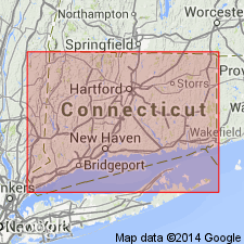
Named Scotland schist for town of Scotland, Windham Co., CT. Consists of coarse muscovite schist squeezed into minute folds as result of metamorphism. It is practically a mass of muscovite with some biotite and occasionally garnet and quartz. It is of sedimentary origin. The Scotland schist is believed to be older than the Willimantic gneiss. Evidence indicates that Putnam gneiss underlies the Scotland schist. The two formations are conformable and pass into each other without noticeable change. Hebron gneiss grades into Scotland schist. Is thought to be of Late Carboniferous or post Carboniferous age.
Source: GNU records (USGS DDS-6; Reston GNULEX).
- Usage in publication:
-
- Scotland Schist Member*
- Modifications:
-
- Revised
- Age modified
- AAPG geologic province:
-
- New England province
Summary:
The Scotland Member of the Oakdale Formation (Pease, 1980) is here renamed the Scotland Schist Member in the lower part of the Oakdale. It extends from the Honey Hill fault zone in the Fitchville quad N to the Hampton quad where it is cut off against the Canterbury Gneiss. It was formerly mapped as a separate formation younger than the Hebron Formation. Maximum thickness is 600 m in the Shetucket River section. Age is Late Proterozoic(?).
Source: GNU records (USGS DDS-6; Reston GNULEX).
For more information, please contact Nancy Stamm, Geologic Names Committee Secretary.
Asterisk (*) indicates published by U.S. Geological Survey authors.
"No current usage" (†) implies that a name has been abandoned or has fallen into disuse. Former usage and, if known, replacement name given in parentheses ( ).
Slash (/) indicates name conflicts with nomenclatural guidelines (CSN, 1933; ACSN, 1961, 1970; NACSN, 1983, 2005, 2021). May be explained within brackets ([ ]).