The National Geologic Map Database is migrating to a new infrastructure. We apologize for any service disruptions during this process.
|
|---|


- Usage in publication:
-
- [Schoolhouse Glacis Alluvium]
- Modifications:
-
- Named
- Dominant lithology:
-
- Silt
- Sand
- Gravel
- AAPG geologic province:
-
- Basin-and-Range province
Summary:
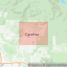
Named for School House [two words] Rd. Type locality is roadcut at western end of Rockaway Hills Dr 0.25 mi west of Fleming Springs Rd, Cave Creek quad, northern Maricopa Co, central AZ (table 1). [Compare p. 47: "type locality is in Rowe Wash, 0.5 mi northeast of School House Rd, T6N, R4E, sec 27" with the p. 10, table 1 version chosen above for this review]. Extends westward from Lone Mountain to Cave Creek and southward to Cave Creek Rd forming widespread veneer in western Carefree basin. Deposited on gently southwest-dipping slope. Consists of tan to brown to gray, unconsolidated, moderately sorted and bedded, meta-argillite-rich (62%) silt, sand, and gravel; assorted subangular to subrounded clasts. Upper 3 to 10 feet contains moderately to well-developed soil horizon. Total thickness varies from 3 to 25 feet, locally up to 65 feet along Carefree basin's northern boundary. Lies unconformably over Precambrian meta-argillite-phyllite complex, Miocene basalt, andesite, White Eagle Mine Formation (new), and tuff, and all members of late Miocene and early Pliocene Carefree Formation (new). Grades into Pleistocene Cahava Ranch Terrace deposits (new, [informal]), thus showing by stratigraphic position that Schoolhouse Glacis Alluvium is also Pleistocene. Report includes geologic map and cross section, and stratigraphic nomenclature table.
Source: GNU records (USGS DDS-6; Denver GNULEX).
For more information, please contact Nancy Stamm, Geologic Names Committee Secretary.
Asterisk (*) indicates published by U.S. Geological Survey authors.
"No current usage" (†) implies that a name has been abandoned or has fallen into disuse. Former usage and, if known, replacement name given in parentheses ( ).
Slash (/) indicates name conflicts with nomenclatural guidelines (CSN, 1933; ACSN, 1961, 1970; NACSN, 1983, 2005, 2021). May be explained within brackets ([ ]).