The National Geologic Map Database is migrating to a new infrastructure. We apologize for any service disruptions during this process.
|
|---|


- Usage in publication:
-
- Schodack shales and limestones
- Modifications:
-
- Original reference
- Dominant lithology:
-
- Shale
- Limestone
- AAPG geologic province:
-
- New England province
Summary:
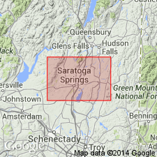
Pg. 67-70 and map. Schodack shales and limestones. Black shales and limestones overlying Eddy Hill grit; all Lower Cambrian.
Named from exposures 2 mi south of Schodack Landing, eastern NY.
Source: US geologic names lexicon (USGS Bull. 896, p. 1940).
- Usage in publication:
-
- Schodack beds
- Modifications:
-
- Revised
- AAPG geologic province:
-
- New England province
Summary:
Pg. 414. Placed Schodack beds beneath Nassau beds.
Source: US geologic names lexicon (USGS Bull. 896, p. 1940).
- Usage in publication:
-
- Schodack shales and limestone
- Modifications:
-
- Revised[?]
- AAPG geologic province:
-
- New England province
Summary:
Pg. 25, 73, 79, and map. Gave following downward succession: Schodack shales and limestones, Troy shales and limestones, Diamond Rock quartzite, Bomoseen grit, and Nassau beds. On p. 27 he gave following downward succession: Troy shales and limestones, Diamond Rock quartzite, Nassau beds, Schodack shale and limestone, and Bomoseen grit.
Source: US geologic names lexicon (USGS Bull. 896, p. 1940).
- Usage in publication:
-
- Schodack formation
- Modifications:
-
- Revised
- Overview
- AAPG geologic province:
-
- New England province
Summary:
Pg. 277. Schodack formation. Thinly bedded black shale containing thin beds of impure blue limestone that carries fragments of Lower Cambrian trilobites in northern Part of Hoosick quadrangle, which establish age of formation as [Early] Cambrian. The black shale itself has so far yielded only sponge spicules found by [T.N.] Dale. The formation is = Schodack shale and limestone of Ruedemann in Capital district, New York. Rests, with apparent conformity, on Mettawee slate and is conformably overlain by Eagle Bridge quartzite.
Source: US geologic names lexicon (USGS Bull. 896, p. 1940).
For more information, please contact Nancy Stamm, Geologic Names Committee Secretary.
Asterisk (*) indicates published by U.S. Geological Survey authors.
"No current usage" (†) implies that a name has been abandoned or has fallen into disuse. Former usage and, if known, replacement name given in parentheses ( ).
Slash (/) indicates name conflicts with nomenclatural guidelines (CSN, 1933; ACSN, 1961, 1970; NACSN, 1983, 2005, 2021). May be explained within brackets ([ ]).