

- Usage in publication:
-
- Schnebly Hill Formation
- Modifications:
-
- Named
- Dominant lithology:
-
- Sandstone
- Siltstone
- Mudstone
- Evaporite
- Carbonate
- AAPG geologic province:
-
- Basin-and-Range province
- Plateau sedimentary province
Summary:
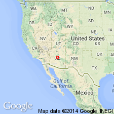
Named for exposures on south side of Casner Canyon, Schnebly Hill area, sec 3, T17N, R6E, Munds Park quad, Coconino Co, AZ, Plateau sedimentary province. Extends into Basin-and-Range province. Recognized throughout Mogollon Rim, adjacent subsurface, north to Defiance Plateau. Replaces former use of Supai Formation, Supai Group, De Chelly Sandstone in these areas. Overlies Hermit Formation, underlies Coconino Sandstone between Sedona and western Mogollon Rim. Overlies Supai (restricted), underlies Coconino at Fossil and Carrizo Creeks, Fort Apache, South Defiance Plateau. Includes sandstone, siltstone, mudstone, evaporites, carbonate. Type section sec 3 to top of butte in south-central part of section. Forms southeast thickening mass. Ranges few ft-nearly 900 ft thick in central and eastern Mogollon Rim. Thickest section (900 ft) in Holbrook basin. Absent Chino Point and Grand Canyon. Present in subsurface in wells east of Grand Canyon. Exposed only in Mogollon Rim, Mount Elden near Flagstaff, Defiance Plateau, in some quarries north of Williams. Bell Rock (new), Fort Apache (reassigned from Supai), Sycamore Pass (new) Members present at type. Bell Rock and Rojo Ranch Members, both new, present south of Sedona. Big A Butte, Corduroy Members both reassigned from Supai. Big A Butte present only at and near Big A Butte. Corduroy not recognized west of Fossil Creek. Cross sections; nomenclature chart. Early Permian, Leonardian age.
Source: GNU records (USGS DDS-6; Denver GNULEX).
For more information, please contact Nancy Stamm, Geologic Names Committee Secretary.
Asterisk (*) indicates published by U.S. Geological Survey authors.
"No current usage" (†) implies that a name has been abandoned or has fallen into disuse. Former usage and, if known, replacement name given in parentheses ( ).
Slash (/) indicates name conflicts with nomenclatural guidelines (CSN, 1933; ACSN, 1961, 1970; NACSN, 1983, 2005, 2021). May be explained within brackets ([ ]).