The National Geologic Map Database is migrating to a new infrastructure. We apologize for any service disruptions during this process.
|
|---|


- Usage in publication:
-
- Scanlan conglomerate*
- Modifications:
-
- Named
- Dominant lithology:
-
- Conglomerate
- AAPG geologic province:
-
- Southwestern Basin-and-Range region
Summary:
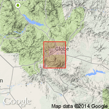
Named from Scanlan Pass just east of Barnes Peak, Gila Co, AZ, Globe quad, Southwestern Basin-and-Range region. The basal formation of Apache group (new). Rests on Ruin quartzite (new). Overlain by Pioneer shale (new). No type locality designated. Not separately distinguished on geologic map. Is a conglomerate from 1- to 6-ft thick composed of pebbles of vein quartz and schist held together by a pink matrix consisting of cleavage particles of orthoclase or microcline and quartz. Components were locally derived. Appears to represent the surficial detritus of a granitic plain slightly reworked by waves of an encroaching sea. Assigned a Cambrian? age. Mapped with Apache group.
Source: GNU records (USGS DDS-6; Denver GNULEX).

- Usage in publication:
-
- Scanlan conglomerate*
- Modifications:
-
- Overview
- Areal extent
- AAPG geologic province:
-
- Southwestern Basin-and-Range region
Summary:
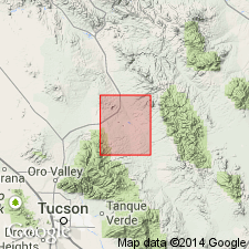
Extended into Dragoon quad, Cochise Co, AZ in Southwestern Basin-and-Range region as the basal formation of Apache group. Mapped on geologic map with Pioneer shale, a unit with which Scanlan is co-extensive. Measured sections at 1) SW1/4 sec 16, T15S, R22E, and 2) NE1/4 NW1/4 sec 21, T21S, R14E described. At 1) it is 4 ft thick, overlies Pinal schist unconformably and underlies Pioneer shale and at 2) it is 2 ft thick, overlies unconformably Johnny Lyon granodiorite (new) and underlies Pioneer shale. Assigned to the Upper Precambrian.
Source: GNU records (USGS DDS-6; Denver GNULEX).
- Usage in publication:
-
- Scanlan Conglomerate Member*
- Modifications:
-
- Mapped 1:48k (Mammoth quad, Pinal and Pima Cos, AZ)
- Dominant lithology:
-
- Conglomerate
- AAPG geologic province:
-
- Southwestern Basin-and-Range region
Summary:
Is younger Precambrian basal member of Pioneer Formation; mapped undivided with middle member of Pioneer in southeastern Pinal and northeastern Pima Cos, AZ (Southwestern Basin-and-Range region). Scanlan is described as consisting of extremely well rounded pebbles and cobbles, composed of quartz, quartzite, and jasper or chert. Map unit outcrops in southeastern corner of quad. Scanlan is older than older Precambrian aplite and alaskite unit; underlies middle member of Pioneer. On ridge west of Mary West mine, Scanlan ranges from 2-6 ft thick; from Oracle Ridge southeastward to quad boundary, Scanlan is up to 15 ft, averaging 10 ft thick.
Source: GNU records (USGS DDS-6; Denver GNULEX).
- Usage in publication:
-
- Scanlan Conglomerate Member*
- Modifications:
-
- Revised
- AAPG geologic province:
-
- Southwestern Basin-and-Range region
Summary:
Accepted as the thin basal member of Pioneer Shale of Apache Group in Southwestern Basin-and-Range region. Formerly considered a member of Pioneer Formation. Cannot be depicted separately even on large-scale maps. Detailed lithologic description. Assigned a younger Precambrian age.
Source: GNU records (USGS DDS-6; Denver GNULEX).
For more information, please contact Nancy Stamm, Geologic Names Committee Secretary.
Asterisk (*) indicates published by U.S. Geological Survey authors.
"No current usage" (†) implies that a name has been abandoned or has fallen into disuse. Former usage and, if known, replacement name given in parentheses ( ).
Slash (/) indicates name conflicts with nomenclatural guidelines (CSN, 1933; ACSN, 1961, 1970; NACSN, 1983, 2005, 2021). May be explained within brackets ([ ]).