

- Usage in publication:
-
- Scales Formation
- Modifications:
-
- Original reference
- Dominant lithology:
-
- Shale
- AAPG geologic province:
-
- Wisconsin arch
- Illinois basin
Summary:
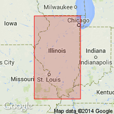
Pg. 135-136. Scales Formation of Maquoketa Group. Name applied to unit which in many reports has been referred to as lower brown shale member of lower shale zone of Maquoketa Formation. Lower part of formation commonly consists of brown to black shale. In some areas it is calcareous and interbedded with dark-gray to brown argillaceous limestone, and in others it consists of dark-brown sandstone, siltstone, and shale. Somewhat higher, the shale is generally medium-gray and contains varying proportions of interbedded limestone, but in places this interval is also largely dark colored. This variable interval is differentiated as Elgin Member in areas where it is separated from Fort Atkinson Limestone above by 10 to 20 feet of light- to medium-gray or greenish-gray shale that is referred to the Clermont Member. Frequently this differentiation cannot be made. In Thebes area, Alexander County, Illinois, the Scales is largely dark-brown sandstone and shale (the Thebes Sandstone Member) 75 to 100 feet thick, overlain by greenish-gray shale (Orchard Creek Shale Member) 20 to 30 feet thick. Thickness of formation commonly 75 to 100 feet but ranges from 50 to 175 feet. Present throughout area of Maquoketa Group. Unconformably overlies Dubuque, Wise Lake, and Dunleith Formations of Galena Group. In southwestern Illinois overlaps and truncates Cape Limestone. Appears to be conformable to overlying Fort Atkinson Formation. Age is Late Ordovician; Edenian or probably Maysvillian in age, rather than Richmondian as long classified.
Type section: railroad in Scales Mound in which 30 feet of Scales Formation overlies 10 feet of Dubuque Dolomite. Top of formation is exposed about 5 mi farther east in another railroad cut, in SW/4 SW/4 SW/4 sec. 15, T. 29 N., R. 3 E., Elizabeth quadrangle, where 20 feet of Fort Atkinson Limestone overlies 18 feet of Scales Formation. Named from town of Scales Mound, Jo Daviess Co., northwestern IL.
Source: US geologic names lexicon (USGS Bull. 1350, p. 672-673).
- Usage in publication:
-
- Scales Member
- Modifications:
-
- Revised
Summary:
Shown on stratigraphic column as Scales Member of Maquoketa Formation. Age is Late Ordovician (Cincinnatian).
Source: US geologic names lexicon (USGS Bull. 1350, p. 672-673).
For more information, please contact Nancy Stamm, Geologic Names Committee Secretary.
Asterisk (*) indicates published by U.S. Geological Survey authors.
"No current usage" (†) implies that a name has been abandoned or has fallen into disuse. Former usage and, if known, replacement name given in parentheses ( ).
Slash (/) indicates name conflicts with nomenclatural guidelines (CSN, 1933; ACSN, 1961, 1970; NACSN, 1983, 2005, 2021). May be explained within brackets ([ ]).