- Usage in publication:
-
- Sayreville sand member*
- Modifications:
-
- Named
- Dominant lithology:
-
- Sand
- AAPG geologic province:
-
- Atlantic Coast basin
Summary:
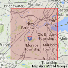
Sayreville sand member of Raritan formation named in Middlesex Co., NJ. Described as bed of variable composition, but dominantly fine- to medium-grained, white, micaceous sand (No. 2 sand of previous reports). Separated from overlying Old Bridge sand member (new name) by South Amboy fire clay, and from underlying Farrington sand member (new name) by Woodbridge clay. North of Raritan River consists of fine white micaceous sand, cross-bedded fine- to coarse-grained white sand, with or without layers of white clay, and beds of arkosic sand; here thickness is 35 to 40 ft. Near Sayreville thickness is 6 to 7 ft. In this report, Woodbridge and South Amboy clays are considered informal economic names. Age is Late Cretaceous.
Source: GNU records (USGS DDS-6; Reston GNULEX).

- Usage in publication:
-
- Sayreville Sand Member*
- Modifications:
-
- Age modified
- AAPG geologic province:
-
- Atlantic Coast basin
Summary:
Woodbridge Clay and Sayreville Sand Members of the Raritan Formation in NJ and the Raritan equivalent on eastern shore of VA are assigned to early Turonian.
Source: GNU records (USGS DDS-6; Reston GNULEX).
For more information, please contact Nancy Stamm, Geologic Names Committee Secretary.
Asterisk (*) indicates published by U.S. Geological Survey authors.
"No current usage" (†) implies that a name has been abandoned or has fallen into disuse. Former usage and, if known, replacement name given in parentheses ( ).
Slash (/) indicates name conflicts with nomenclatural guidelines (CSN, 1933; ACSN, 1961, 1970; NACSN, 1983, 2005, 2021). May be explained within brackets ([ ]).

