The National Geologic Map Database is migrating to a new infrastructure. We apologize for any service disruptions during this process.
|
|---|


- Usage in publication:
-
- Saypo limestone member
- Modifications:
-
- Original reference
- Dominant lithology:
-
- Limestone
- AAPG geologic province:
-
- Montana folded belt
Summary:
Pg. 46+. Saypo limestone member of Madison limestone. In lower part of Madison limestone. Thickness 72 to 141 feet. Lower 91 feet is shaly fine-grained argillaceous limestones interbedded with white smooth and thicker-bedded argillaceous limestones; weathers bright buff. Overlying 20 feet is massive thick-bedded gray crinoidal limestones that weather gray. Upper 30 feet is massive chocolate-colored crinoidal limestones, thick-bedded in upper part and thinner-bedded in lower part. In Pentagon Mountain area the very top of the Saypo is a thin zone of shaly thin-bedded tan limestone crowded with poorly preserved fenestellid BRYOZOA. Underlies Dean Lake chert member and overlies Silvertip conglomerate, basal member of Madison. Age is Mississippian.
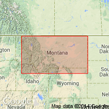
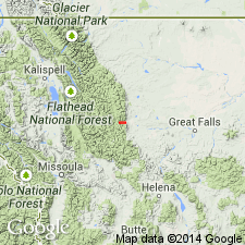
Type locality: on south side of upper part of Pentagon Mountain, in SW/4 sec. 14, T. 25 N., R. 12 W., [Pentagon Mountain 7.5-min quadrangle, Flathead Co.], northwestern MT, where it forms a buff-colored, relatively gentle slope beneath the harder Dean Lake chert. Named from Saypo quadrangle, over much of which it is well exposed.
Source: US geologic names lexicon (USGS Bull. 896, p. 1938).
- Usage in publication:
-
- Saypo limestone
- Modifications:
-
- Revised
- AAPG geologic province:
-
- Montana folded belt
- Sweetgrass arch
Summary:
Pl. 2 (column 38). Saypo limestone in Hannan limestone. Shown on correlation chart as the lowermost unit in Hannan limestone. Underlies Dean Lake chert. Age is Early Mississippian (Kinderhook).
Source: US geologic names lexicon (USGS Bull. 1200, p. 3487-3488).
- Usage in publication:
-
- Saypo limestone
- Modifications:
-
- Revised
- AAPG geologic province:
-
- Montana folded belt
Summary:
Pg. 89. Saypo limestone. [Considered a formation.] Assignment of group status to the Madison of northwestern Montana precludes any need for term Hannan. [= part of Sloss and Laird's MC unit. Age is Early Mississippian (Kinderhook).]
Source: US geologic names lexicon (USGS Bull. 1200, p. 3487-3488).
- Usage in publication:
-
- Saypo Limestone Member
- Modifications:
-
- Not used
- AAPG geologic province:
-
- Montana folded belt
- Sweetgrass arch
Summary:
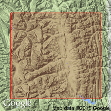
Pg. 2009, 2012. Deiss' Saypo Limestone Member of Madison Limestone is essentially = to the lower member of Allan Mountain Limestone (new). Type section of the lower member is [within the Saypo quadrangle, scale 1:125,000], on ridge north of Gibson Reservoir, east of the SE corner of sec. 36, T. 22 N., R. 10 W., Patricks Basin 7.5-min quadrangle, [Teton County], northwestern Montana.
Source: Publication.
For more information, please contact Nancy Stamm, Geologic Names Committee Secretary.
Asterisk (*) indicates published by U.S. Geological Survey authors.
"No current usage" (†) implies that a name has been abandoned or has fallen into disuse. Former usage and, if known, replacement name given in parentheses ( ).
Slash (/) indicates name conflicts with nomenclatural guidelines (CSN, 1933; ACSN, 1961, 1970; NACSN, 1983, 2005, 2021). May be explained within brackets ([ ]).