

- Usage in publication:
-
- Sawtooth formation
- Modifications:
-
- Named
- Dominant lithology:
-
- Sandstone
- Shale
- Siltstone
- AAPG geologic province:
-
- Sweetgrass arch
- Montana folded belt
Summary:
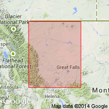
Named as oldest formation of Ellis group (rank raised) for Sawtooth Range. Type section is in Rierdon Gulch, W1/2 sec 23, T24N, R9W, Teton Co, MT on Sweetgrass arch where a section 137 ft thick was measured. Divided into basal sandstone, middle shale, and siltstone members. Basal member composed of subangular, colorless quartz that is gray, very fine grained, calcareous, pyritic, and hard. Middle member composed of alternating dark gray, calcareous shale and black gray noncalcareous shale. A few dark gray, hard, dense limestone beds occur near base of middle member. Upper member is a gray, highly calcareous siltstone composed of colorless quartz grains, minor amounts of pyrite and glauconite in a calcareous matrix. Lower part of upper member is poorly bedded and earthy. Reddish and yellowish shale and siltstone containing gypsum common in lower part in central MT. Isopach map. Ranges from 0 to 200 ft thick. Occurs in Liberty, Toole, Glacier, Pondera, Teton, and Cascade Cos, MT on Sweetgrass arch, and into Lewis and Clark Co, MT, in Montana folded belt province. Eight measured sections, 3 of which are subsurface logs. Underlies Rierdon formation (new) of Ellis group. Overlies Hannan limestone or Madison limestone locally. Contains many fossils (p. 1276-77). Of Middle Jurassic, late Bathonian age. Of marine origin.
Source: GNU records (USGS DDS-6; Denver GNULEX).

- Usage in publication:
-
- Sawtooth Formation*
- Modifications:
-
- Overview
- AAPG geologic province:
-
- Sweetgrass arch
- Central Montana uplift
- Montana folded belt
Summary:
Is lower formation of Ellis Group [term not mentioned in this report]. Is of late middle Bajocian age in basal part according to fossils found at Swift Reservoir. Middle member is late Bajocian (pelecypods), and upper member is early to middle Bathonian (ammonites). Is as much as 230 ft thick. Its three informal members recognized over a large area. These members do thin eastward and pinch out on Sweetgrass arch. Middle member passes into Piper Formation. Westernmost exposure is in Little Water Canyon, Beaverhead Co, MT. Correlation chart shows formation at Swift Reservoir east to north bank of Smith River, 22 mi south of Great Falls, MT, Central Montana uplift. Occurs on Sweetgrass arch and Montana folded belt province. Paleogeography of Middle Jurassic time discussed.
Source: GNU records (USGS DDS-6; Denver GNULEX).
For more information, please contact Nancy Stamm, Geologic Names Committee Secretary.
Asterisk (*) indicates published by U.S. Geological Survey authors.
"No current usage" (†) implies that a name has been abandoned or has fallen into disuse. Former usage and, if known, replacement name given in parentheses ( ).
Slash (/) indicates name conflicts with nomenclatural guidelines (CSN, 1933; ACSN, 1961, 1970; NACSN, 1983, 2005, 2021). May be explained within brackets ([ ]).