

- Usage in publication:
-
- Sawtooth Peak Formation
- Modifications:
-
- Named
- Dominant lithology:
-
- Tuff
- AAPG geologic province:
-
- Great Basin province
Summary:
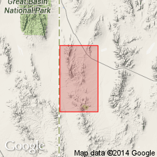
Named for Sawtooth Peak, Beaver Co., UT. Covers about 50 sq mi in the study area. Type section is at the peak in the northwestern part of T28S, R18W in the Great Basin province. Is a thick persistent ignimbrite that is separable into three units. Basal unit, about 100 ft thick, has a low percentage of lithic fragments and pink feldspar crystals as much as 4 mm long. The middle unit, about 50 ft thick, has white to gray feldspar crystals as much as 3 mm long; lithic fragments make up 50 percent of the unit near the top. Almost half the lithic fragments are flattened pumice. The upper unit, as much as 150 ft thick, is more vitric and has a smaller percentage of crystals than either of the lower two units. Lies on Paleozoic rocks and is overlain by Needles Range Formation at type. Is probably equivalent to Windows Butte Formation. Assigned an Oligocene age.
Source: GNU records (USGS DDS-6; Denver GNULEX).
- Usage in publication:
-
- Sawtooth Peak Formation*
- Modifications:
-
- Adopted
- AAPG geologic province:
-
- Great Basin province
Summary:
Sawtooth Peak Formation of Conrad (1969) is Adopted. Age is Oligocene.
Source: GNU records (USGS DDS-6; Menlo GNULEX).
- Usage in publication:
-
- Sawtooth Peak Formation*
- Modifications:
-
- Geochronologic dating
- AAPG geologic province:
-
- Great Basin province
Summary:
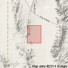
A K-Ar age on biotite of 33.5 +/-1.2 m.y. and a fission-track age on zircon of 33.6 +/-1.8 m.y. obtained from one sample. Location of type section clarified as being in NE1/4 sec 15, T28S, R18W, Great Basin province, Beaver Co, UT. Stratigraphic chart.
Source: GNU records (USGS DDS-6; Denver GNULEX).

- Usage in publication:
-
- Sawtooth Peak Formation*
- Modifications:
-
- Mapped 1:24k
- Dominant lithology:
-
- Tuff
- AAPG geologic province:
-
- Great Basin province
Summary:
Is Oligocene formation mapped in the vicinity of The Needles, western Beaver Co, southwest UT (Great Basin province). Is shown on correlation of map units to be above older Oligocene sedimentary rocks and below Escalante Desert Formation (Oligocene). Map unit described as porous, weakly welded and foliated, light-greenish-gray tuff; phenocrysts (in decreasing order of abundance) of quartz, plagioclase and biotite compose about one-half of the rock. Lithic fragments and white pumice lapilli compose 10-20% of the rock. Exposed thickness is about 50 m.
Source: GNU records (USGS DDS-6; Denver GNULEX).
For more information, please contact Nancy Stamm, Geologic Names Committee Secretary.
Asterisk (*) indicates published by U.S. Geological Survey authors.
"No current usage" (†) implies that a name has been abandoned or has fallen into disuse. Former usage and, if known, replacement name given in parentheses ( ).
Slash (/) indicates name conflicts with nomenclatural guidelines (CSN, 1933; ACSN, 1961, 1970; NACSN, 1983, 2005, 2021). May be explained within brackets ([ ]).