- Usage in publication:
-
- Savage Dam Member
- Modifications:
-
- Named
- Dominant lithology:
-
- Sandstone
- Shale
- Siltstone
- AAPG geologic province:
-
- Appalachian basin
Summary:
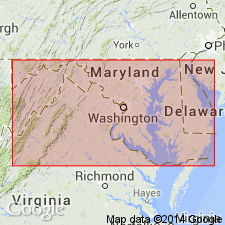
Greenbrier Formation in western MD and adjacent area is here revised. Subdivided into (ascending) Loyalhanna Limestone, Deer Valley Limestone, Savage Dam (new name), and Wymps Gap Limestone Members. Savage Dam previously mapped as "clastic interval" by Hoque (1968: AAPG Bull., v. 52, p. 246-263). Equivalent to middle member of Martin (1902: The geology of Garrett County: MD Geol. Survey, p. 55-182). Unit is characterized by interbedded thin white sandstone, green-gray silty shales, and red-brown to chocolate siltstone, sandstone, and shale. Similar to red-brown Mauch Chunk, which overlies Greenbrier, but includes many interdigitated marine beds. Savage Dam is thickest member of the Greenbrier in MD. Maximum thickness over 200 ft near Barrelville; thins westward to 76 ft at Gaylord Quarry, Garrett Co., MD, and 32 ft near Rowlesburg, Preston Co., WV. Intertongues with and grades upsection into Wymps Gap Limestone Member. Diverse macrofaunal assemblage present in marine intervals near type section including bivalves, gastropods, bryozoans, and brachiopods. Crinoid remains and bryozoan fragments found in PA outcrop. Age is Late Mississippian (Chesterian). Correlates with Cypress, Beech Creek and Fraileys of upper Mississippi Valley and Taggard Shale and Pickaway Limestone of Randolph Co., WV. Measured sections. Correlation charts.
Source: GNU records (USGS DDS-6; Reston GNULEX).
For more information, please contact Nancy Stamm, Geologic Names Committee Secretary.
Asterisk (*) indicates published by U.S. Geological Survey authors.
"No current usage" (†) implies that a name has been abandoned or has fallen into disuse. Former usage and, if known, replacement name given in parentheses ( ).
Slash (/) indicates name conflicts with nomenclatural guidelines (CSN, 1933; ACSN, 1961, 1970; NACSN, 1983, 2005, 2021). May be explained within brackets ([ ]).

