

- Usage in publication:
-
- Satan tongue*
- Modifications:
-
- Original reference
- Dominant lithology:
-
- Shale
- AAPG geologic province:
-
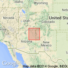
- San Juan basin
Summary:
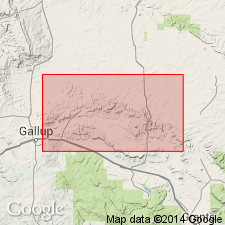
Satan tongue of Mancos shale. The upper tongue of Mancos shale (marine) that grades laterally into Hosta sandstone member of Mesaverde formation in part of area from Gallup eastward toward Mount Taylor is here named Satan tongue of Mancos shale, because its beginning and growth are well shown in Satan Pass, [in T. 16 N., R. 13 W., McKinley Co.], Gallup region, northwestern New Mexico. Is of Colorado age [Late Cretaceous].
Source: US geologic names lexicon (USGS Bull. 896, p. 1931).
- Usage in publication:
-
- Satan Tongue*
- Modifications:
-
- Mapped 1:500k
- Overview
- Dominant lithology:
-
- Shale
- AAPG geologic province:
-
- San Juan basin
Summary:
Is mapped as uppermost named unit of the Mancos Shale (Upper Cretaceous) in type area in vicinity of Satan Pass and Mesa de los Lobos, McKinley Co, and south of Toadlena, San Juan Co, NM (San Juan basin). Where present, the Satan lies between the main body of the Point Lookout Sandstone (above) and the Hosta Tongue of the Point Lookout (below). The Satan Tongue, like the Mulatto Tongue of the Mancos, is considerably sandier than the main body of the Mancos. It too, intertongues southwestward with units of the Mesaverde Group, but it does not extend as far southwestward as does the Mulatto. Satan has maximum thickness of 330 ft near Toadlena and thins to 70 ft at Todilto Park. Allen and Balk (1954, p. 94) assigned 120 ft of sandy shale to the Satan Tongue, but did not delineate the Satan on their map nor in their stratigraphic sections; thus, the vertical and lateral limits of the Satan in the Tohachi quad are in doubt. The Satan Tongue is as thick as 120 ft in the Mesa de los Lobos area. In the Mesa de los Lobos area, the Hosta Tongue of the Point Lookout Sandstone contains a marine fauna belonging to the zone of CLIOSCAPHITES VERMIFORMIS (Sabins and Bonham, 1960) and is correlative to the upper part of the Niobrara Formation of the reference sequence for the Western Interior of Cobban and Reeside (1952). The overlying Satan Tongue in this area is therefore considered to be at least of late Niobrara age and may be partly equivalent in age to the Telegraph Creek Formation.
Source: GNU records (USGS DDS-6; Denver GNULEX).
For more information, please contact Nancy Stamm, Geologic Names Committee Secretary.
Asterisk (*) indicates published by U.S. Geological Survey authors.
"No current usage" (†) implies that a name has been abandoned or has fallen into disuse. Former usage and, if known, replacement name given in parentheses ( ).
Slash (/) indicates name conflicts with nomenclatural guidelines (CSN, 1933; ACSN, 1961, 1970; NACSN, 1983, 2005, 2021). May be explained within brackets ([ ]).