The National Geologic Map Database is migrating to a new infrastructure. We apologize for any service disruptions during this process.
|
|---|


- Usage in publication:
-
- Sasakwa limestone member
- Modifications:
-
- Original reference
- Dominant lithology:
-
- Limestone
- AAPG geologic province:
-
- Chautauqua platform
- Arkoma basin
Summary:
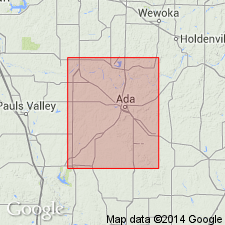
Named as uppermost of two members of Holdenville formation (revised in this report) for town of Sasakwa, Seminole Co, OK, Chautauqua platform, for which it is named. No type locality designated. Occurs 35 ft below top of Holdenville. Underlies Seminole formation conformably (except at one locality--NE1/4 sec 18, T6N, R8E). Overlies sandstones of Holdenville; this sandstone interval varies in thickness from place to place. one or several of these quite often develops into a massive chert conglomerate. The sandstones in turn overlie Homer limestone member of Holdenville (new). Outcrop passes through town of Sasakwa. Bed is especially well exposed in the RR cut and quarry about 1/4 mi south of town. At ford on the Canadian River, between Sasakwa and Francis (Pototoc Co, Arkoma basin), also well exposed. Southwestward from crossing on Canadian River can be traced easily to southern part sec 9, T3N, R6E, where it grades into a limey shale and from there westward not identified with certainty. Variable thickness--at northeast corner of quad is 2 ft; just south of Sasakwa it is at least 15 ft, but from there southward gradually thins to about 1 ft. Latter average thickness is maintained to point at which the bed could no longer be mapped. Sasakwa is fossiliferous throughout, but carries its largest fauna in northern part of quad. Fossil list for the Holdenville. Generalized columnar section. Geologic map.
Source: GNU records (USGS DDS-6; Denver GNULEX).
For more information, please contact Nancy Stamm, Geologic Names Committee Secretary.
Asterisk (*) indicates published by U.S. Geological Survey authors.
"No current usage" (†) implies that a name has been abandoned or has fallen into disuse. Former usage and, if known, replacement name given in parentheses ( ).
Slash (/) indicates name conflicts with nomenclatural guidelines (CSN, 1933; ACSN, 1961, 1970; NACSN, 1983, 2005, 2021). May be explained within brackets ([ ]).