- Usage in publication:
-
- Sapulpa group
- Modifications:
-
- Revised
- AAPG geologic province:
-
- Chautauqua platform
Summary:
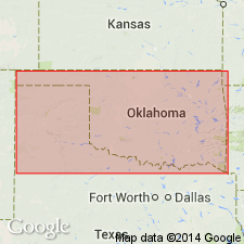
Is a group (1 of 4) of Pennsylvanian rocks of eastern OK. Is seen on the Chautauqua platform. Includes those rocks lying between the base of the Lenapah limestone (new) and the top of the Wann formation (new, northern area) or top of the Ramona formation (new, southern area). Includes Lenapah limestone, Curl (new) and Wann formations in north. Includes Skiatook (new) and Ramona formations in south. Area of the group is about 40 mi wide occurring in a trapezoidal region covering all of Washington and a large part of Nowata, Rogers and Tulsa Cos and eastern half of the Osage Nation. For purposes of simplification of discussion, this area divided into two parts with the latitude of the Nowata-Claremore quadrangle line being the approximate line of division between them. Overlies the Tulsa group; underlies the Ralston group. (Ralston does not occur in the region under discussion). Stratigraphic chart.
Source: GNU records (USGS DDS-6; Denver GNULEX).
For more information, please contact Nancy Stamm, Geologic Names Committee Secretary.
Asterisk (*) indicates published by U.S. Geological Survey authors.
"No current usage" (†) implies that a name has been abandoned or has fallen into disuse. Former usage and, if known, replacement name given in parentheses ( ).
Slash (/) indicates name conflicts with nomenclatural guidelines (CSN, 1933; ACSN, 1961, 1970; NACSN, 1983, 2005, 2021). May be explained within brackets ([ ]).

