The National Geologic Map Database is migrating to a new infrastructure. We apologize for any service disruptions during this process.
|
|---|


- Usage in publication:
-
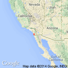
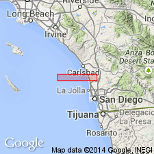
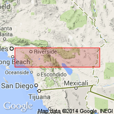
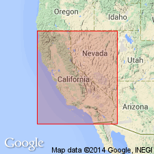
- Santiago Peak volcanics*
- Modifications:
-
- Named
- Dominant lithology:
-
- Volcanics
- AAPG geologic province:
-
- Peninsular Ranges province
Summary:
Unit is named for Santiago Peak, Santa Ana Mountains, Corona 30' quad (lat 33 deg 42' 30'N, long 117 deg 32' 10"W), Orange Co., CA. Was formerly called the Black Mountain Volcanics (Hanna, 1926). Has exposed length of 80 mi and width of 10 mi south of La Jolla 30' quad across San Luis Rey 30' quad to Santa Ana River. Is probably 1000's ft thick. Consists of dark green to black andesites, quartz latites with rhyolite forming alternating flows, tuffs, and breccias, all slightly metamorphosed. Unconformably overlies the Bedford Canyon Formation (new). Intruded by fine-grained granodiorites of Late Cretaceous age. Age is Jurassic(?) based on stratigraphic position.
Source: GNU records (USGS DDS-6; Menlo GNULEX).
- Usage in publication:
-
- Santiago Peak volcanics*
- Modifications:
-
- Mapped
- AAPG geologic province:
-
- Peninsular Ranges province
Summary:
Santiago Peak Volcanics unconformably overlies older series of metasedimentary and metavolcanic rocks designated as the "Julian group", "Julian schist series", "Julian schist", "Santa Ana slates", and "Bedford Canyon formation".
Source: GNU records (USGS DDS-6; Menlo GNULEX).
- Usage in publication:
-
- Santiago Peak volcanics*
- Modifications:
-
- Areal extent
- AAPG geologic province:
-
- Peninsular Ranges province
Summary:
Santiago Peak Volcanics are mapped and extended to the Mexican border. Called "older volcanic rocks" of Jurassic(?) age but text refers to the Santiago Peak Volcanics.
Source: GNU records (USGS DDS-6; Menlo GNULEX).
- Usage in publication:
-
- Santiago Peak volcanics*
- Modifications:
-
- Biostratigraphic dating
- AAPG geologic province:
-
- Peninsular Ranges province
Summary:
Santiago Peak Volcanics are correlated with similar volcanic and pyroclastic rocks and stratigraphic relationships of the Alisitos Formation of Baja California, Mexico. Age of the Alisitos Formation is Aptian-Albian [Early Cretaceous] based on fossils [Gastropoda] from Punta China.
Source: GNU records (USGS DDS-6; Menlo GNULEX).
- Usage in publication:
-
- Santiago Peak volcanics*
- Modifications:
-
- Mapped
- AAPG geologic province:
-
- Peninsular Ranges province
Summary:
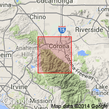
Santiago Peak volcanics is mapped in the Corona South 7.5-min quadrangle, Riverside and Orange Counties, California. Age is Jurassic(?) and Early Cretaceous(?), based on stratigraphic relations.
Source: Modified from GNU records (USGS DDS-6; Menlo GNULEX).

- Usage in publication:
-
- Santiago Peak volcanics*
- Modifications:
-
- Age modified
- AAPG geologic province:
-
- Peninsular Ranges province
Summary:
Alisitos Formation is used for Lower Cretaceous volcanics and sediments (="Santiago Peak Volcanics", Larsen, 1948). Unconformably overlies the Bedford Canyon Formation and unconformably underlies the Rosario Formation. Age is Aptian(?)-middle Albian (Early Cretaceous).
Source: GNU records (USGS DDS-6; Menlo GNULEX).
- Usage in publication:
-
- Santiago Peak volcanics*
- Modifications:
-
- Age modified
- AAPG geologic province:
-
- Peninsular Ranges province
Summary:
Santiago Peak Volcanics unconformably overlie the Bedford Canyon Formation of Late Jurassic age and unconformably underlie sandstone and conglomerate of Turonian (Late Cretaceous) age; thus age of the Santiago Peak Volcanics is Late Jurassic(?) to Early Cretaceous(?) based on stratigraphic position.
Source: GNU records (USGS DDS-6; Menlo GNULEX).
- Usage in publication:
-
- Santiago Peak volcanics*
- Modifications:
-
- Age modified
- Geochronologic dating
- AAPG geologic province:
-
- Peninsular Ranges province
Summary:
"Dacite" sample from Santiago Peak measured approximately 150 Ma (Late Jurassic age) based on lead-alpha dates for zircons.
Source: GNU records (USGS DDS-6; Menlo GNULEX).
- Usage in publication:
-
- Santiago Peak volcanics*
- Modifications:
-
- Mapped
- AAPG geologic province:
-
- Peninsular Ranges province
Summary:
Santiago Peak Volcanics are mapped in San Diego Co., CA. Called the Black Mountain Volcanics of La Jolla quad and called the Santiago Peak Volcanics to the north.
Source: GNU records (USGS DDS-6; Menlo GNULEX).
- Usage in publication:
-
- Santiago Peak volcanics*
- Modifications:
-
- Age modified
- Biostratigraphic dating
- AAPG geologic province:
-
- Peninsular Ranges province
Summary:
Interbedded metavolcanic rocks in Lusardi Canyon contain BUCHIA PIOCHII which indicates a Portlandian (Late Jurassic) age.
Source: GNU records (USGS DDS-6; Menlo GNULEX).
- Usage in publication:
-
- Santiago Peak Volcanics*
- AAPG geologic province:
-
- Peninsular Ranges province
Summary:
Unconformably underlies the Lusardi Formation (new) of Early to mid-Late Cretaceous age in 25 sq mi area near Rancho Santa Fe, CA.
Source: GNU records (USGS DDS-6; Menlo GNULEX).

- Usage in publication:
-
- Santiago Peak Volcanics*
- Modifications:
-
- Age modified
- AAPG geologic province:
-
- Peninsular Ranges province
Summary:
Age of the Santiago Peak Volcanics is Late Jurassic and Early Cretaceous(?) based on earlier reports.
Source: GNU records (USGS DDS-6; Menlo GNULEX).
- Usage in publication:
-
- Santiago Peak Volcanics*
- Modifications:
-
- Age modified
- AAPG geologic province:
-
- Peninsular Ranges province
Summary:
Age of the Santiago Peak Volcanics is Jurassic to Cretaceous.
Source: GNU records (USGS DDS-6; Menlo GNULEX).
- Usage in publication:
-
- Santiago Peak Volcanics*
- Modifications:
-
- Geochronologic dating
- AAPG geologic province:
-
- Peninsular Ranges province
Summary:
K-Ar ages of 131+/-2.6 Ma to 85+/-2 Ma on andesite porphyry and dacite tuff samples (R. Armstrong) from Silvardo Canyon area indicate Cretaceous age (Neocomian through Coniacian) for the Santiago Peak Volcanics.
Source: GNU records (USGS DDS-6; Menlo GNULEX).
- Usage in publication:
-
- Santiago Peak Volcanics*
- Modifications:
-
- Age modified
- AAPG geologic province:
-
- Peninsular Ranges province
Summary:
Santiago Peak Volcanics unconformably underlies the Lusardi Formation (Late Cretaceous) of the Rosario Group. Intruded by southern California batholith (minimum age of 105+/-10 Ma). Age is Portlandian (Late Jurassic).
Source: GNU records (USGS DDS-6; Menlo GNULEX).
- Usage in publication:
-
- Santiago Peak Volcanics*
- AAPG geologic province:
-
- Peninsular Ranges province
Summary:
Santiago Peak Volcanics unconformably underlies the Trabuco Formation (Late Cretaceous); unconformably intrudes and overlies the Bedford Canyon Formation in area of report (south half of Canada Gobernadora quad, Orange Co., CA).
Source: GNU records (USGS DDS-6; Menlo GNULEX).

- Usage in publication:
-
- Santiago Peak Volcanics*
- AAPG geologic province:
-
- Peninsular Ranges province
Summary:
"Santiago Peak Formation" for Jurassic (Portlandian) strata north of border, "Alisitos Formation" for Aptian and Albian strata and "Jurassic(?)" for pre-Alisitos strata of the San Jose area, Baja CA.
Source: GNU records (USGS DDS-6; Menlo GNULEX).
- Usage in publication:
-
- Santiago Peak Volcanics*
- Modifications:
-
- Mapped
- AAPG geologic province:
-
- Peninsular Ranges province
Summary:
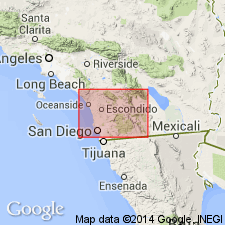
Santiago Peak Volcanics are mapped in Del Mar, La Mesa, Poway, and SW 1/4 of Escondido quads, San Diego Co., CA. Unconformably underlies the Lusardi Formation of the Rosario Group and the Friars Formation of La Jolla Group.
Source: GNU records (USGS DDS-6; Menlo GNULEX).
- Usage in publication:
-
- Santiago Peak Volcanics*
- Modifications:
-
- Age modified
- Biostratigraphic dating
- AAPG geologic province:
-
- Peninsular Ranges province
Summary:
Age of the Santiago Peak Volcanics is Tithonian (Late Jurassic) based on fossils (Fife and others, 1967).
Source: GNU records (USGS DDS-6; Menlo GNULEX).
- Usage in publication:
-
- Santiago Peak Volcanics*
- Modifications:
-
- Mapped
- AAPG geologic province:
-
- Peninsular Ranges province
Summary:
Santiago Peak Volcanics are mapped in Orange Co., CA. Underlies the San Marcos Gabbro. Age is Jurassic [no basis given].
Source: GNU records (USGS DDS-6; Menlo GNULEX).
- Usage in publication:
-
- Santiago Peak Volcanics*
- Modifications:
-
- Mapped
- AAPG geologic province:
-
- Peninsular Ranges province
Summary:
Santiago Peak Volcanics are mapped in Black Star Canyon and part of El Toro quads. In Silverado Canyon, the basal 15 m consists of breccia made up of boulders and cobbles (derived from the underlying Bedford Canyon Formation) imbedded in silicified, sandy, altered igneous matrix. Age is Late Jurassic(?) and Early(?) Cretaceous based on stratigraphic relations.
Source: GNU records (USGS DDS-6; Menlo GNULEX).

- Usage in publication:
-
- Santiago Peak Volcanics*
- AAPG geologic province:
-
- Peninsular Ranges province
Summary:
Santiago Peak Volcanics composite section approximately 1,440 m thick is located near Lusardi Creek and Black Mountain Road, San Diego Co., CA.
Source: GNU records (USGS DDS-6; Menlo GNULEX).
- Usage in publication:
-
- Santiago Peak Volcanics*
- Modifications:
-
- Biostratigraphic dating
- AAPG geologic province:
-
- Peninsular Ranges province
Summary:
Santiago Peak Volcanics measured sections are located at Los Penasquitos, Circo Diegueno and in Lusardi Canyons. Bivalves and belemnites collected at Los Penasquitos and Circo Diegueno Canyons give ages of Tithonian (D.L.Jones, pers. communication, 1981) and Middle Jurassic to earliest Cretaceous (J.A. Jeletzky, communication, 1982).
Source: GNU records (USGS DDS-6; Menlo GNULEX).
- Usage in publication:
-
- Santiago Peak Volcanics*
- Modifications:
-
- Overview
- AAPG geologic province:
-
- Peninsular Ranges province
Summary:
Santiago Peak Volcanics are divided into two groups; one, comprising basalts and andesites of tholeiitic series and two, comprising dacites and rhyolites of subalkaline or silicic series. The spatial and temporal relationships and tholeiitic nature of basalts and andesites indicate common origin with the Peninsular Ranges gabbros.
Source: GNU records (USGS DDS-6; Menlo GNULEX).
- Usage in publication:
-
- Santiago Peak Volcanics*
- Modifications:
-
- Age modified
- Geochronologic dating
- AAPG geologic province:
-
- Peninsular Ranges province
GNU Staff, 1993, Draft copy of Todd, V.R., and Shaw, S.E., Petrology and preliminary geochemistry of plutonic rocks in the Peninsular Ranges batholith, southern San Diego County, California, USGS Prof. Paper XXXX (unpublished): U.S. Geological Survey Digital Data Series, DDS-6, 1 CD-ROM., release 3
Summary:
Age of the Santiago Peak Volcanics is everywhere revised from Late Jurassic and Early(?) Cretaceous to: Early Cretaceous based on radiometric (U-Pb; zircon) ages from the unit of 120-130 Ma.
Source: GNU records (USGS DDS-6; Menlo GNULEX).
For more information, please contact Nancy Stamm, Geologic Names Committee Secretary.
Asterisk (*) indicates published by U.S. Geological Survey authors.
"No current usage" (†) implies that a name has been abandoned or has fallen into disuse. Former usage and, if known, replacement name given in parentheses ( ).
Slash (/) indicates name conflicts with nomenclatural guidelines (CSN, 1933; ACSN, 1961, 1970; NACSN, 1983, 2005, 2021). May be explained within brackets ([ ]).