The National Geologic Map Database is migrating to a new infrastructure. We apologize for any service disruptions during this process.
|
|---|


- Usage in publication:
-
- Santa Teresa Granite*
- Modifications:
-
- Named
- Geochronologic dating
- Dominant lithology:
-
- Granite
- AAPG geologic province:
-
- Basin-and-Range province
Summary:
Pg. 9 (table), 62-66, pl. 1. Santa Teresa Granite. A uniform very pale red to very pale red-purple or grayish-pink equigranular granite. Consists mostly of medium-grained orthoclase microperthite and quartz. Sparse accessory minerals include iron ore, biotite, sphene, apatite, zircon, epidote, and fluorite. Very resistant to erosion. Forms a large mass, from Waterfall and upper Buford Canyons northward to the South Fork of Goodwin Canyon, and forms several dikes. About 17 sq mi, or 7 percent of Klondyke quadrangle, is underlain by Santa Teresa Granite. Intrudes Pinal Schist and Laurel Canyon Granodiorite (new), both Precambrian, and is in fault contact with these rocks and probably with Goodwin Canyon Quartz Monzonite (new). Underlies alluvium. Age is early Tertiary; calculated Pb-alpha age on zircon 60 +/-10 Ma (T.W. Stern, USGS rpt. no. WA-93, Oct. 23, 1961). Report includes geologic map, detailed petrographic description, chemical analyses.
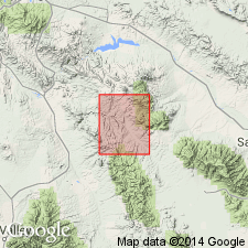
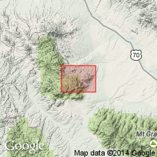
Type locality not designated. Forms peaks of Santa Teresa Mountains. Typical Santa Teresa exposed on prominent peak, Rocky Top, in sec. 1, T. 6 S., R. 20 E., Santa Teresa Mountains, Klondyke quadrangle, Graham Co., AZ. Named from Santa Teresa Mountains.
Source: Publication; US geologic names lexicon (USGS Bull. 1350, p. 668).

- Usage in publication:
-
- Santa Teresa Granite*
- Modifications:
-
- Geochronologic dating
- AAPG geologic province:
-
- Basin-and-Range province
Summary:
Pg. 7, geologic time scale (inside front cover). Santa Teresa Granite. Sample from Santa Teresa Mountains, Lat. 32 deg. 52 min. 00 sec. N., Long. 110 deg. 17 min. 00 sec. W., Klondyke quadrangle, Graham County, Arizona, yielded a Pb-alpha age of 60 +/-10 Ma (zircon); age published by Simons (USGS Prof. Paper 461, 1964). Age recalculated using decay constants of Steiger and Jager, 1977 (Earth Planet. Sci. Letters, v. 36, p. 359-362). [Cretaceous to Eocene, based partly on time scale of Berggren, 1972, Lethaia, v. 5, no. 2, p. 195-215.]
Source: Publication.
- Usage in publication:
-
- Santa Teresa Granite*
- Modifications:
-
- Age modified
- AAPG geologic province:
-
- Basin-and-Range province
Summary:
Age changed from Tertiary --to-- Oligocene, based on K-Ar age on biotite 24.9 +/-0.7 Ma from the related Goodwin Canyon Quartz Monzonite. Report area in Graham County, Arizona.
Source: Modified from GNU records (USGS DDS-6; Denver GNULEX).
For more information, please contact Nancy Stamm, Geologic Names Committee Secretary.
Asterisk (*) indicates published by U.S. Geological Survey authors.
"No current usage" (†) implies that a name has been abandoned or has fallen into disuse. Former usage and, if known, replacement name given in parentheses ( ).
Slash (/) indicates name conflicts with nomenclatural guidelines (CSN, 1933; ACSN, 1961, 1970; NACSN, 1983, 2005, 2021). May be explained within brackets ([ ]).