The National Geologic Map Database is migrating to a new infrastructure. We apologize for any service disruptions during this process.
|
|---|


- Usage in publication:
-
- Santa Rosa Hills Limestone
- Modifications:
-
- Original reference
- Dominant lithology:
-
- Limestone
- AAPG geologic province:
-
- Great Basin province
Summary:
Santa Rosa Hills Limestone. A previously unrecognized unit in the Santa Rosa Hills and a unit previously mapped as Lee Flat Limestone in the carbonate facies region of the Argus and Panamint Ranges to the east and southeast are here named the Santa Rosa Hills Limestone. Consists of medium- to light-gray, massive-appearing, thick- and thin-bedded limestone or marble containing pelmatozoan debris and interbedded chert. Gradationally overlies the Perdido Formation; sharply and disconformably underlies the Rest Spring Shale. Forms a northwestward-thinning wedge that varies from 245 to 610 feet thick. Thickness at the type section is 272 feet. Age is Late Mississippian (middle and perhaps late Visean) based on corals, conodonts, and foraminifers.
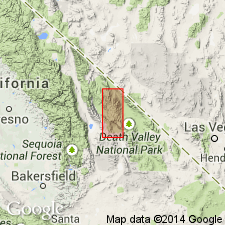
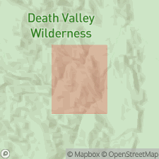
Type section: northwest side of hill 6170 in Santa Rosa Hills, from 5,860 ft elevation to saddle at 6,035 ft elevation, in T. 17 S., R. 40 E., Lat. 117 deg. 39 min. 21 sec. N., Long. 36 min. 28 min. 41 sec. W., Darwin 15-min quadrangle, Inyo Co., CA.
Source: US geologic names lexicon (USGS Bull. 1564, p. 279).
- Usage in publication:
-
- Santa Rosa Hills Limestone*
- Modifications:
-
- Biostratigraphic dating
- AAPG geologic province:
-
- Great Basin province
Summary:
Santa Rosa Hills Limestone of Dunne and others (1981) adopted. Type section on NW side of hill 6170 in Santa Rosa Hills, NW/4 Darwin 15' quad, Inyo Co, CA. Consists of bioclastic limestone and subordinate interbedded chert at type; some local dolomitized limestone also. In Argus and Panamint Ranges, unit is composed of marble with minor interbedded calc-hornfels; dolomite present locally. Type section is 75-85 m thick; unit as much as 180-210 m thick in northern Argus Range and in N-C Panamint Butte 15' quad. Conformably overlies the Perdido Formation; underlies Rest Spring Shale (Santa Rosa Hills) or its unnamed correlatives (most of Argus and Panamint Ranges) with possible disconformity. Age is Late Mississippian based on corals, conodonts, and foraminifers.
Source: GNU records (USGS DDS-6; Menlo GNULEX).
- Usage in publication:
-
- Santa Rosa Hills Limestone*
- Modifications:
-
- Biostratigraphic dating
- AAPG geologic province:
-
- Great Basin province
Summary:
Pg. J7 (fig. 4). Santa Rosa Hills Limestone. Samples collected from basal and upper parts of Santa Rosa Hills Limestone, in Cottonwood and Marble Canyons, eastern Cottonwood Mountains, Inyo County, California, yielded conodonts of the MEHLI-Lower TEXANUS zone and HOMOPUNCTATUS-Upper TEXANUS zone. Age is Early Mississippian (late Osagean to early Meramecian). Unconformably underlies Indian Springs Formation; conformably overlies Stone Canyon Limestone (new).
Source: Publication.
- Usage in publication:
-
- Santa Rosa Hills Limestone*
- Modifications:
-
- Age modified
- AAPG geologic province:
-
- Great Basin province
Summary:
Pg. 6-7, 40-41, geol. map. Santa Rosa Hills Limestone. [Due to changes in the geologic time scale], age is Middle Mississippian (Visean; late Osagean to early Meramecian) based on conodonts, citing Stevens and others, 1996.
Source: Publication.
For more information, please contact Nancy Stamm, Geologic Names Committee Secretary.
Asterisk (*) indicates published by U.S. Geological Survey authors.
"No current usage" (†) implies that a name has been abandoned or has fallen into disuse. Former usage and, if known, replacement name given in parentheses ( ).
Slash (/) indicates name conflicts with nomenclatural guidelines (CSN, 1933; ACSN, 1961, 1970; NACSN, 1983, 2005, 2021). May be explained within brackets ([ ]).