The National Geologic Map Database is migrating to a new infrastructure. We apologize for any service disruptions during this process.
|
|---|


- Usage in publication:
-
- Santa Olaya Lava*
- Modifications:
-
- Revised
- AAPG geologic province:
-
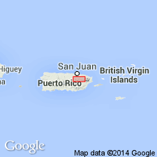
- Caribbean region
Summary:
The Santa Olaya Formation of Lidiak (1965) is here redefined at the Santa Olaya Lava and adopted. Consists of massive submarine basaltic and andesitic lava flows, lava breccia, and volcanic breccia with tuff in the upper part. Unconformably overlies the Cancel Breccia; interfingers with Camarones Sandstone; unconformably underlies the Rio de la Plata Sandstone or middle Tertiary rocks. Thickness is 2,600 m in east part of Naranjito quadrangle, but thins rapidly toward the west. Age is Late Cretaceous (no older than Cenomanian), possibly most of the Late Cretaceous.
Source: GNU records (USGS DDS-6; Reston GNULEX).

- Usage in publication:
-
- Santa Olaya Lava*
- Modifications:
-
- Overview
- AAPG geologic province:
-
- Caribbean region
Summary:
The Santa Olaya Lava occurs in eastern Puerto Rico and consists of basal pillowed, basaltic and andesitic lava flows, followed by hyaloclastite breccia, tuff, and volcaniclastic sandstone. Maximum estimated thickness is 2600 meters. The Santa Olaya is of Late(?) Cretaceous age.
Source: GNU records (USGS DDS-6; Reston GNULEX).
For more information, please contact Nancy Stamm, Geologic Names Committee Secretary.
Asterisk (*) indicates published by U.S. Geological Survey authors.
"No current usage" (†) implies that a name has been abandoned or has fallen into disuse. Former usage and, if known, replacement name given in parentheses ( ).
Slash (/) indicates name conflicts with nomenclatural guidelines (CSN, 1933; ACSN, 1961, 1970; NACSN, 1983, 2005, 2021). May be explained within brackets ([ ]).