

- Usage in publication:
-
- Santa Fe marls*
- Modifications:
-
- Original reference
- Dominant lithology:
-
- Sandstone
- Sand
- Marl
- AAPG geologic province:
-
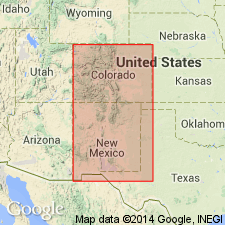
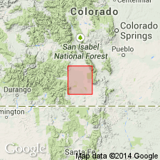
- Estancia basin
- San Juan basin
- San Luis basin
Summary:
Pg. 66, 90. Santa Fe marls. From Santa Fe to banks of Gallisteo Creek, 18 miles, we pass over the recent marls and sands which seem to occupy greater part of valley of Rio Grande above and below Santa Fe, which I have named Santa Fe marls. They are mostly of light cream color, sometimes rusty yellow, sometimes yellowish white, with layers of sandstone varying in texture from a very fine aggregate of quartz to a moderately coarse puddingstone. These marls and sands weather into unique forms north of Santa Fe like the "badlands" of Dakota. Are much younger than Gallisteo sand group. In Taos Valley they rest on metamorphic rocks. They are doubtless of Upper Tertiary age. Thickness 1,200 to 1,500 feet north of Santa Fe, in Rio Grande Valley. [According to C.B. Hunt the thickness of this formation in wells reaches 5,000 feet.]
Source: US geologic names lexicon (USGS Bull. 896, p. 1923).

- Usage in publication:
-
- Santa Fe formation*
- Modifications:
-
- Overview
Summary:
Santa Fe formation. Recognized in northern New Mexico and central southern Colorado [see C.E. Siebenthal, San Luis Valley, 1910a, Sci., n.s., v. 31, and 1910b, USGS Water-Supply Paper 240]. Age is late Miocene and Pliocene.
Source: US geologic names lexicon (USGS Bull. 896, p. 1923).
- Usage in publication:
-
- Santa Fe formation
- Modifications:
-
- Areal extent
- Dominant lithology:
-
- Sand
- Gravel
- Clay
- AAPG geologic province:
-
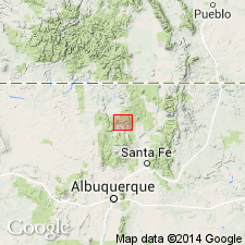
- Estancia basin
- San Juan basin
Summary:
Pg. 806-818. Santa Fe formation. Divided into (descending): (1) "Upper Buff" member, buff and gray sand and gravel with andesitic and other pebbles; (2) "Middle Red" member, salmon red and buff sand with some gray zones, concretions and concretionary layers, and a few red, brown and green clays, carries vertebrate fossils; and (3) "Lower Gray" member, white to gray sand and fine gravel, cemented layers and concretions. Unconformably overlies andesite and basalt tuff. Unconformably underlies soil, wind blown sand, caliche ["Albuquerque marl" of Herrick], and gravel. Exposures are discontinuous. Age is late Tertiary (Miocene or early Pliocene). Fossil evidence indicates same age as type Santa Fe marls of Hayden (1869) and Cope (1874).
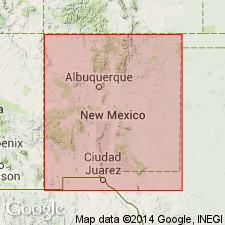
[Report area, the Ceja del Rio Puerco, in R. 1 E., T. 11, 12, 13, and 14 N., is a low escarpment along western edge of triangular highland known as Llano de Albuquerque, Albuquerque 30- x 60-min quadrangle, Sandoval and Bernalillo Cos., north-central NM.]
Source: Publication.
- Usage in publication:
-
- Santa Fe formation*
- Modifications:
-
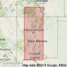
- Areal extent
- AAPG geologic province:
-
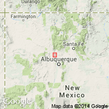
- Estancia basin
- Orogrande basin
- San Juan basin
- San Luis basin
Summary:
Areally extends Santa Fe formation in Rio Grande depression from north end of San Luis Valley, CO (San Luis basin) southward following course of Rio Grande (through San Juan, Estancia, and Orogrande basins, NM) to beyond El Paso, TX. Santa Fe was deposited in structural basins--through which the Pliocene Rio Grande flowed--of two types: 1) basins with through-flowing river; and 2) basins with enclosed drainage. First type has 3 kinds of deposits--2 sets of fan deposits and an axial zone of river deposits. Second type has a central or axial lake or playa. Common to both are gravel deposits near axis of basin indicating presence of a north-south-flowing river larger than the present-day Rio Grande; on its course the basins were strung like beads on a cord. Refers to "type locality" and "type area" as deposits exposed in deep gulches for a distance of 40 mi north of Santa Fe [the author states that these deposits are those to which Hayden (1869) originally applied the name Santa Fe marls, and the author and subsequent workers refers to this locality as the "type locality" or "type area"--even though Hayden did not formally designate it as such]. Volcanic rocks are interbedded with sedimentary strata of Santa Fe. Extensive post-Santa Fe deformation and faulting took place. Santa Fe is overlain by Quaternary rocks. Early Pliocene fauna (Frick, 1933) occurs in the formation, but it is not known where the fauna occurs position-wise in the formation.
Source: GNU records (USGS DDS-6; Denver GNULEX).
- Usage in publication:
-
- Santa Fe formation
- Modifications:
-
- Areal extent
- AAPG geologic province:
-
- San Juan basin
Summary:
Pg. 952-957; see also 1937 [abs.], GSA Proc. 1936, p. 103. Santa Fe formation. Described in Abiquiu quadrangle, [Arriba County], north-central New Mexico. Thickest and most typical exposures are in western slopes of Black Mesa. Here thickness is 990 feet. Base of exposed section lies undetermined distance (probably several hundred feet) above base of formation, and an unknown thickness has been eroded from top of section. Formation consists of alluvial deposits with some interbedded basalt flows. Where formation overlies Abiquiu tuff, there is a gradational transition extending over vertical range of 100 to 300 feet. [Age is middle(?) Miocene to Pleistocene(?).]
Source: US geologic names lexicon (USGS Bull. 1200, p. 3463-3465).
- Usage in publication:
-
- Santa Fe formation
- Modifications:
-
- Areal extent
- AAPG geologic province:
-
- Estancia basin
- Orogrande basin
- San Luis basin
Summary:
Pg. 78-79 (fig. 1), 82 (fig. 3), 84-99. Santa Fe formation. In San Acacia area, New Mexico, overlies Popotosa formation (new). Total thickness undetermined; structure section (fig. 3) assumes thickness of about 6,000 feet just east of Loma Pelada fault. Fossils suggest middle to upper Pliocene.
Type area noted (see C.S. Denny, 1938 [abs.], GSA Bull., 49, no. 12, pt. 2, p. 1877): region north of Santa Fe, New Mexico, between Sangre de Cristo and Jemez Mountains.
Source: US geologic names lexicon (USGS Bull. 1200, p. 3463-3465).
- Usage in publication:
-
- Santa Fe formation
- Modifications:
-
- Areal extent
- AAPG geologic province:
-
- Estancia basin
- San Juan basin
Summary:
Pg. 304 (fig. 2), 316-317. Santa Fe formation unconformably overlies Espinaso volcanics (new). Along base of Sangre de Cristo Mountains, Sante Fe formation unconformably overlies Precambrian granite gneiss. At north end of Sandia Mountains, formation overlies the Mesaverde with angular unconformity. Map legend shows Santa Fe formation below Cuerbio basalt (new). [Age is late Tertiary.]
Source: US geologic names lexicon (USGS Bull. 1200, p. 3463-3465); supplemental information from GNU records (USGS DDS-6; Denver GNULEX).
- Usage in publication:
-
- Santa Fe formation*
- Modifications:
-
- Revised
- AAPG geologic province:
-
- Estancia basin
Summary:
Pg. 12. Surface of Santa Fe Plateau is underlain by strata of late Tertiary or Quaternary age which have been called upper beds of Santa Fe formation, or more recently, the "Ancha formation" by Baldwin, Kottlowski, and Spiegel.
Source: GNU records (USGS DDS-6; Denver GNULEX).
- Usage in publication:
-
- Santa Fe group
- Modifications:
-
- Revised
- AAPG geologic province:
-
- Orogrande basin
Summary:
Pg. 144. Proposed that Santa Fe formation be raised to group status.
Source: US geologic names lexicon (USGS Bull. 1200, p. 3463-3465).
- Usage in publication:
-
- Santa Fe group
- Modifications:
-
- Overview
- Revised
- AAPG geologic province:
-
- Estancia basin
- San Juan basin
Summary:
Good overview of reports on Santa Fe group to date. Santa Fe group as revised and defined by author represents basin-filling sedimentary and volcanic rocks associated with the Rio Grande trough, and it ranges in age from middle Miocene? to Pleistocene?. In Santa Fe area, the lower limit of Santa Fe group is taken as the top of Espinaso volcanics and Cieneguilla limburgite, and as the base of Abiquiu? formation of Stearns (1953). Upper limit of Santa Fe is chosen to exclude only alluvium and terraces of present drainage, and thus the basalt flows west of Santa Fe are included in upper part of Santa Fe group. There are three main units in the report area--Albuquerque to Abiquiu, Bernalillo, Santa Fe, Sandoval, and Rio Arriba Cos, Estancia and San Juan basins--[loosely following Bryan and McCann's (1937) Lower Gray, Middle Red, and Upper Buff members]: 1) at base, lower part of Tesuque formation, with its Bishops Lodge member [first used; shown on chart only by Kottlowski, 1953] interbedded near base. Bishops Lodge used just north of Santa Fe instead of Picuris tuff (of Cabot, 1938); 2) bulk of Tesuque formation, the "typical Santa Fe"--a thick complex of alluvial fans, variable in sorting, source material, and cementation; and 3) Puye gravel, Tuerto gravel, and Ancha formation, all resting with angular unconformity on deformed beds of Tesuque. This addition of Puye and Tuerto gravels to the group constitutes revision of Santa Fe. Correlation chart.
Source: GNU records (USGS DDS-6; Denver GNULEX).
- Usage in publication:
-
- Santa Fe group
- Modifications:
-
- Revised
- AAPG geologic province:
-
- Estancia basin
Summary:
Pg. 5 (table 1), 26-29, pl. 1. Referred to as Santa Fe group in Cerrillos area. Near city of Santa Fe, strata originally placed in Santa Fe formation have been subdivided into three map units which comprise Santa Fe group. They are (ascending) Tesuque formation (with Bishops Lodge member) and Ancha formation. Terminology has been modified in Cerrillos area, where only strata similar to basal and upper units of group are found. Tuffaceous strata similar to Bishops Lodge member are placed in Abiquiu(?) formation. Name Ancha is used in both areas. Table 1 shows Santa Fe group younger than Cieneguilla limburgite and older than Cuerbio basalt. Age of group is middle Miocene(?) to early Pleistocene(?).
Source: US geologic names lexicon (USGS Bull. 1200, p. 3463-3465).
- Usage in publication:
-
- Santa Fe formation
- Modifications:
-
- Areal extent
- AAPG geologic province:
-
- Basin-and-Range province
- Orogrande basin
Summary:
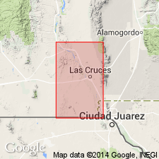
Pg. 10, 11-13, 17 (table 1), 36, 37, pl. 1. Santa Fe fanglomerates in Dwyer quadrangle are postvolcanic except for minor interbedded basalts. Name Gila formation may be as applicable to rocks of Dwyer quadrangle as name Santa Fe. Term Santa Fe is used in this report to include all consolidated valley-fill sediments younger than units grouped under informal term of Upper Volcanic series. In northern part of the quadrangle, formation is confined to eastern side of Mimbres fault, but, east and southeast of mouth of Tom Brown Canyon, it covers Mimbres fault zone and all other major structures. Thickness of fanglomerates may be as much as 1,000 feet. Overlies Swartz rhyolite (new) with angular unconformity. Stratigraphically above Pollack rhyolite (new).
Source: US geologic names lexicon (USGS Bull. 1200, p. 3463-3465).
- Usage in publication:
-
- Santa Fe formation
- Modifications:
-
- Areal extent
- AAPG geologic province:
-
- Basin-and-Range province
- Orogrande basin
Summary:
Pg. 18-20. Discussion of geology of Dog Springs quadrangle. Santa Fe formation consists of gravels and basalts. Summits of D Cross, Tres Hermanos, Table Mountain, and Blue Mesas are capped with basalt which is considered to be part of Santa Fe formation. The basalt truncates Mesaverde group, Baca formation, and Spears Ranch member of Datil formation. Old channels filled with Santa Fe gravel are present under basalt on Tres Hermanos Mesa and on Table Mountain Mesa. Lens of Santa Fe gravel present within basalt of Tres Hermanos Mesa. Age of formation and basalt not definitely known. Believed to be Pliocene-Pleistocene. Santa Fe beds in other parts of State may or may not be age equivalents of Santa Fe beds in area of this report.
[Misprint (US geologic names lexicon, USGS Bull. 1200, p. 3464): publication date should be 1957, not 1958.]
Source: US geologic names lexicon (USGS Bull. 1200, p. 3463-3465).
- Usage in publication:
-
- Santa Fe formation*
- Modifications:
-
- Areal extent
- AAPG geologic province:
-
- San Luis basin
Summary:
Pg. 18-19. Santa Fe formation. Discussion of ground-water resources of San Luis Valley, Colorado. Several outcrops of formation occur in valley, but they are small and do not fully reveal character of formation. Most reliable data are logs of artesian wells and deep oil tests. Thickness may be more than 5,000 feet. Underlies Alamosa formation. In this report, formation is considered to be largely of Pliocene age but in part of Miocene age.
Source: US geologic names lexicon (USGS Bull. 1200, p. 3463-3465).
- Usage in publication:
-
- Santa Fe formation
- Modifications:
-
- Revised
- AAPG geologic province:
-
- San Juan basin
Summary:
Pg. 83, 84. In Chama basin, Santa Fe formation includes Abiquiu tuff member. [Age is middle(?) Miocene to Pliocene(?).]
Source: US geologic names lexicon (USGS Bull. 1200, p. 3463-3465).
- Usage in publication:
-
- Santa Fe Formation
- Modifications:
-
- Revised
- AAPG geologic province:
-
- San Juan basin
Summary:
Santa Fe Formation revised in report area, Sandoval Co, NM in San Juan basin--lower contact changed. Unconformably overlies Chamisa Mesa Member of Zia Sand Formation; Zia Sand Formation consists of Chamisa Mesa Member at top and Piedra Parada Member at base (Zia and its members newly named, this report). Chamisa Mesa type section measured in Arroyo Pueblo in N1/4 sec 25, T16N, R2E, Sandoval Co, NM, San Juan basin. Base of member not exposed in Arroyo Pueblo but is cut off and buried on west by Arroyo Pueblo fault. However, about 300 ft of sediments are exposed below Blick Quarry. Jeep Quarry occurs about 275-300 ft stratigraphically above Blick Quarry; the limestone ledge that crops out 75 ft above Jeep Quarry horizon is here considered top of Chamisa Mesa Member. Beds that crop out along the Ceja del Rio Puerco in Canyada Navajo, Canyada Pilares, Canyada Moquino, and Canyada Benevides are here correlated as part of Chamisa Mesa. These beds were described by McCann (1937) as the "Lower Gray Member" of his three-fold division of Santa Fe. Renick (1931) described Chamisa Mesa beds as part of Santa Fe Formation; the beds he described are part of the type locality of Piedra Parada Member (new), lowermost member of Zia Sand Formation. Vertebrate fossils suggest a Hemingfordian (late Pliocene) age. Geologic map. Measured sections. Vertebrate fossils listed.
Source: GNU records (USGS DDS-6; Denver GNULEX).
- Usage in publication:
-
- Santa Fe Group
- Modifications:
-
- Revised
- Areal extent
- AAPG geologic province:
-
- Estancia basin
- San Juan basin
- San Luis basin
Summary:
Type area of Santa Fe Group restricted to north of Santa Fe, in the Rio Grande Valley (includes parts of northern Santa Fe Co (Estancia basin), southeastern Rio Arriba Co (San Juan basin), and southern Taos Co (San Luis basin). In this area, Santa Fe Group is revised--divided into Chamita Formation (new, at top) and Tesuque Formation (revised, at base), with its 5 newly named members (ascending): Nambe, Skull Ridge, Pojoaque, Chama-El Rito, and Ojo Caliente Sandstone. Bishop's Lodge Member (assigned to basal part of Tesuque Formation by Spiegel and Baldwin, 1963) is here reassigned to Picuris Tuff of Cabot (1938). Formations of Santa Fe Group have been divided in this report on basis of lithologic characteristics, stratigraphic sequence, and other rock-stratigraphic criteria; boundaries are not specifically differentiated on basis of fossil content. Santa Fe Group is overlain by several younger formations; nonconformably overlies crystalline rocks of the Sangre de Cristo Range. Age of Santa Fe ranges from Hemingfordian to Hemphillian (North American Land Mammal Ages). Geologic map. Measured sections.
Source: GNU records (USGS DDS-6; Denver GNULEX).

- Usage in publication:
-
- Santa Fe Group*
- Modifications:
-
- Geochronologic dating
- AAPG geologic province:
-
- Estancia basin
- San Juan basin
Summary:
As classified in previous USGS reports, Santa Fe Group in its type region (Espanola basin, north-central NM in San Juan and Estancia basins) is middle? Miocene to Pleistocene? in age. Tesuque Formation is Miocene to Pliocene, and is unconformably overlain by Ancha Formation near southeastern margin of Espanola basin, and by Puye Formation to west. In this report, new radiometric ages provide more precise dating for Tesuque, Puye, and Ancha Formations of Santa Fe Group. Ancha has been assigned a Pliocene or Pleistocene age--fission-track age of 2.7 +/-0.4 m.y. was obtained from zircons in pumice 15 m from top of Ancha type locality. Puye is Pliocene--zircon fission-track age of 2.9 +/-0.5 m.y. was obtained from a pumice bed directly overlying Totavi Lentil of Puye, 8 km north of type locality of Ancha (Santa Fe Co, NM in Estancia basin). These ages support the correlation of Puye and Ancha Formations and establish a minimum age for the Rio Grande [River] (Totavi Lentil of Puye) in Espanola basin. In northeastern part of Espanola basin, Ancha Formation was assigned a probable Pleistocene age, partly on basis of a "Pearlette-like" ash. Remapping has shown that this formation consists of two units: 1) a deposit that contains two pumice beds fission-track dated at 10.8 +/-1.6 m.y. and 12.7 +/-1.8 and, therefore, equivalent to a part of Tesuque Formation; and 2) discontinuous surface gravels that are late Pliocene to Pleistocene in age.
Source: GNU records (USGS DDS-6; Denver GNULEX).
- Usage in publication:
-
- Santa Fe Group*
- Modifications:
-
- Revised
- AAPG geologic province:
-
- San Juan basin
Summary:
Divided into an unnamed part (lower Miocene) and Tesuque Formation (middle Miocene). Tesuque separable into an unnamed eolian sand (base) and the Cejita Member (new). Report area is in Rio Arriba Co, NM in San Juan basin.
Source: GNU records (USGS DDS-6; Denver GNULEX).
- Usage in publication:
-
- Santa Fe Group*
- Modifications:
-
- Geochronologic dating
- AAPG geologic province:
-
- Estancia basin
- San Juan basin
Summary:
Santa Fe Group. In Rio Arriba County, north-central New Mexico, includes (ascending) Tesuque Formation, Chamita Formation, Puye Formation and Ancha Formation. Samples from tephra layers yielded fission-track ages from 12.7 +/-1.8 Ma to 2.7 +/-0.4 Ma (zircon). [See also entries under individual formations.]
Source: Modified from GNU records (USGS DDS-6; Denver GNULEX).
- Usage in publication:
-
- Santa Fe Group*
- Modifications:
-
- Revised
- AAPG geologic province:
-
- Orogrande basin
Summary:
As revised in the Orogrande basin includes middle Pleistocene to lower Pliocene Sierra Ladrones Formation, a newly named formation that was assigned to Santa Fe Formation by Denny in 1940 (at top), and Miocene Popotosa Formation, newly assigned as the lowest formation of Santa Fe Group.
Source: GNU records (USGS DDS-6; Denver GNULEX).
- Usage in publication:
-
- Santa Fe Group
- Modifications:
-
- Geochronologic dating
- AAPG geologic province:
-
- Estancia basin
- San Juan basin
Summary:
New K-Ar date of 25.1 +/-0.6 m.y. obtained from base of Santa Fe Group. Thus the base of the Santa Fe in Espinaso Ridge area is latest Oligocene following the Van Couvering (1978) time scale.
Source: GNU records (USGS DDS-6; Denver GNULEX).
- Usage in publication:
-
- Santa Fe Group
- Modifications:
-
- Revised
- AAPG geologic province:
-
- Orogrande basin
Summary:
Divided into Miocene Popotosa and Pliocene and Pleistocene Sierra Ladrones Formations in Socorro area, Socorro Co, NM, Orogrande basin. Two formations separated by recognition of first occurrence of main-stem river deposits which forecast the integration of drainage to form ancestral Rio Grande. Beyond the Rio Grande valley where main-stem deposits are not present contact of two formations is problematic, and is arbitrarily placed either at a mappable stratum or an unconformity below which strata are better indurated, have steeper dips, contain clasts mainly of volcanic rocks, and the rocks are usually redder. Volcanic units of limited areal extent interbedded with both formations are included in Santa Fe. All volcanic units are informally named. One of them is the newly named basalt of Socorro Canyon. Includes the Miocene Magdalena Peak Rhyolite on west flank of Magdalena Range.
Source: GNU records (USGS DDS-6; Denver GNULEX).
- Usage in publication:
-
- Santa Fe Group
- Modifications:
-
- Revised
- AAPG geologic province:
-
- Orogrande basin
Summary:
Palomas Formation of the area between towns of Derry (south) and San Marcial (north) in the Palomas, Engle, and San Marcial basins in southern part of Rio Grande rift, Sierra Co, NM in the Orogrande basin, assigned to the "upper Santa Fe Group." Palomas has an age range of about 5 Ma to 400,000 yrs. Measured sections; geologic map. Inclusion of Palomas in Santa Fe follows the general usage in area for the Santa Fe as an upper Cenozoic basin fill in the Rio Grande rift. [Older Santa Fe units not discussed.]
Source: GNU records (USGS DDS-6; Denver GNULEX).
- Usage in publication:
-
- Santa Fe Formation*
- Modifications:
-
- Mapped
- AAPG geologic province:
-
- Orogrande basin
Summary:
Name applied only to the reddish-gray, pale-brown and tan, slightly indurated, conglomeratic and sandy mudstone, calcareous mudstone, and sandstone that are in part tuffaceous. Is faulted, folded, and tilted to 30 to 50 deg dips. Mapped at very local areas along west side of Mud Springs Mountains, Sierra Co, NM in the Orogrande basin. Separated from the older quartz latite, and from the younger basalts and the Palomas Formation by unconformities. Assigned to the Miocene.
Source: GNU records (USGS DDS-6; Denver GNULEX).
- Usage in publication:
-
- Santa Fe Group
- Modifications:
-
- Revised
- AAPG geologic province:
-
- San Juan basin
Connell, S.D., Koning, D.J., and Cather, S.M., 1999, Revisions to the stratigraphic nomenclature of the Santa Fe Group, northwestern Albuquerque basin, New Mexico: New Mexico Geological Society Field Conference Guidebook, no. 50, p. 337-354.
Summary:
Santa Fe Group revised to include Arroyo Ojito Formation (new), uppermost formation. Underlies †Pantadeleon Formation (new) [later abandoned, see Connell, 2008]. Overlies Galisteo Formation and older rocks. Age is Miocene to earliest Pleistocene (Arikareean to earliest Blancan); Pliocene-Pleistocene boundary = 1.8 Ma.
Source: Publication.
- Usage in publication:
-
- Santa Fe Group*
- Modifications:
-
- Revised
- AAPG geologic province:
-
- Estancia basin
- San Juan basin
Summary:
Pg. 8-13 of pamphlet. Santa Fe Group. Includes, in descending order: (1) Ceja Formation, Pliocene; (2) unconformity, hiatus approx. = 6 to 4.5 Ma; (3) "Middle Red" formation, middle and upper Miocene, includes, in descending order, Loma Barbon (Atrisco), Navajo Draw, and Cerro Conejo Members; (4) unconformity, hiatus approx. = 16 to 14 Ma; and (5) Zia Formation, lower to middle Miocene, includes, in descending order, Canada Pilares, Chamisa Mesa, and Piedra Parada Members. Formations approx. = "Upper Buff," "Middle Red," and "Lower Gray" members, respectively, of Santa Fe Formation of Bryan and McCann (1937).
Source: Publication.
For more information, please contact Nancy Stamm, Geologic Names Committee Secretary.
Asterisk (*) indicates published by U.S. Geological Survey authors.
"No current usage" (†) implies that a name has been abandoned or has fallen into disuse. Former usage and, if known, replacement name given in parentheses ( ).
Slash (/) indicates name conflicts with nomenclatural guidelines (CSN, 1933; ACSN, 1961, 1970; NACSN, 1983, 2005, 2021). May be explained within brackets ([ ]).