

- Usage in publication:
-
- Santa Cruz Island Schist
- Modifications:
-
- Named
- Dominant lithology:
-
- Schist
- AAPG geologic province:
-
- Santa Maria basin
Summary:
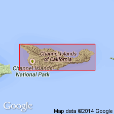
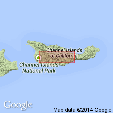
[Probably named for Santa Cruz Island] Type area designated as exposures in Santa Cruz Island off southern coast of CA. Composed of olive-green to gray-green metamorphosed chloritic schist and greenstones. Texture is fine and even grained. Schistosity is well developed. Is intruded by Alamos Tonalite [new]. Is in fault contact with Willows Diorite (new). Is Paleozoic or lower Mesozoic age based on stratigraphic relations with Willows Diorite with K-Ar age of 145 +/-5 Ma.
Source: GNU records (USGS DDS-6; Menlo GNULEX).
- Usage in publication:
-
- Santa Cruz Island Schist
- Modifications:
-
- Age modified
- AAPG geologic province:
-
- Santa Maria basin
Summary:
Consists chiefly of metavolcanic rocks and less abundant metasedimentary rocks and metamorphosed hypabyssal rocks. May be as much as 5000 ft thick. Formed during volcanism associated with intermittent sedimentation. Intruded by Willows pluton(s) and then by Alamos Pluton. Radiometric ages indicate that plutonic crystallization and metamorphism occurred during Late Jurassic time, and metamorphism may have continued into Cretaceous time.
Source: GNU records (USGS DDS-6; Menlo GNULEX).
- Usage in publication:
-
- Santa Cruz Island Schist
- Modifications:
-
- Overview
- AAPG geologic province:
-
- Santa Maria basin
Summary:
Unit is sliver of metavolcanic, metaplutonic, and metasedimentary basement rocks of approximately 2 by 15 km juxtaposed against Tertiary Santa Cruz Volcanics along Santa Cruz Island fault and against Willows Plutonic Complex along North Valley Anchorage fault. Intruded by Alamos Pluton which contains zircons yielding U-Pb age of 141 +/-3 Ma, probable lower limit for Santa Cruz Island Schist metamorphism. Detailed petrologic descriptions and comparison with Santa Monica Formation and Willows Plutonic Complex included in study.
Source: GNU records (USGS DDS-6; Menlo GNULEX).
For more information, please contact Nancy Stamm, Geologic Names Committee Secretary.
Asterisk (*) indicates published by U.S. Geological Survey authors.
"No current usage" (†) implies that a name has been abandoned or has fallen into disuse. Former usage and, if known, replacement name given in parentheses ( ).
Slash (/) indicates name conflicts with nomenclatural guidelines (CSN, 1933; ACSN, 1961, 1970; NACSN, 1983, 2005, 2021). May be explained within brackets ([ ]).