

- Usage in publication:
-
- Sankaty Sand*
- Modifications:
-
- Overview
- AAPG geologic province:
-
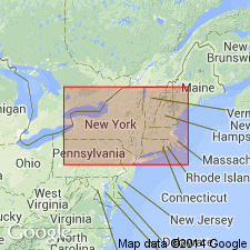
- Atlantic Coast basin
Summary:
The Sankaty Sand is abundantly fossiliferous and is made up of two units that contain distinct molluscan and ostracode faunas. A shell from the lower unit yielded a finite radiocarbon age of 31,99+/-730 yr B.P. This age, however, is considered unreliable because of recrystallization of the shell. A uranium-thorium age of 133,000+/-7,000 yrs B.P. on detrital coral from the upper unit is supported by AR age estimates of 120-140 ka for shells from both the upper and lower units of the Sankaty. Therefore, the Sankaty Sand appears to be Sangamonian in age and the lower till at Sankaty Head, which has been correlated with the Montauk Till Member of the Manhasset Formation in NY, is consequently Illinoian or older.
Source: GNU records (USGS DDS-6; Reston GNULEX).
For more information, please contact Nancy Stamm, Geologic Names Committee Secretary.
Asterisk (*) indicates published by U.S. Geological Survey authors.
"No current usage" (†) implies that a name has been abandoned or has fallen into disuse. Former usage and, if known, replacement name given in parentheses ( ).
Slash (/) indicates name conflicts with nomenclatural guidelines (CSN, 1933; ACSN, 1961, 1970; NACSN, 1983, 2005, 2021). May be explained within brackets ([ ]).