- Usage in publication:
-
- Sangamon Soil
- Modifications:
-
- Overview
- Dominant lithology:
-
- Soil
- AAPG geologic province:
-
- Illinois basin
Summary:
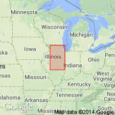
Named by Leverett (1898) on the basis of a description of a soil in a well in Sangamon Co. given by Worthen (1873). Several reference sections are designated here. In the Chapin section (Chapin, Morgan Co., IL) the Sangamon Soil is an in-situ profile developed in the till of the Hulick Till Member of the Glasford Formation. It is overlain by the Markham Silt Member of the Roxana Silt. In the Rochester Section (eastern Sangamon Co., IL) the Sangamon is an accretion-gley developed in the Berry Clay Member of the Glasford Formation. It is gray to blue-gray massive clay with some small pebbles and sand grains. Overlies the Vandalia Till Member and underlies the Peoria. Elsewhere developed in-situ in the Teneriffe Silt, Loveland Silt, and the Pearl Formation. Accretion-gley occurs on the Sterling, Hulick, Vandalia and the Kellerville Till Members of the Glasford Formation.
Source: GNU records (USGS DDS-6; Reston GNULEX).

- Usage in publication:
-
- Sangamon Geosol
- Modifications:
-
- Revised
- AAPG geologic province:
-
- Illinois basin
Summary:
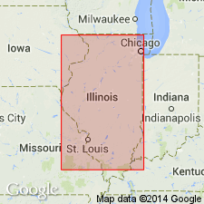
Authors quote the NACSN Code in stating that the "geosol is the fundamental unit of pedostratigraphy, defined as a mappable, stratiform body of material with soil characteristics formed on a previous land surface, with an upper surface that now constitutes both a material and stratigraphic boundary. A formalized geosol is defined at its type locality as a buried soil that contains catenal members." The Sangamon Geosol is most commonly formed in Illinoian glaciogenic sediments and Sangamonian colluvium and alluvium. Most distinctive aspect of the unit is the B horizon, which contains an abundance for fine clay. The geosol can be found developed in the Berry Clay (colluvium) in very poorly drained environments.
Source: GNU records (USGS DDS-6; Reston GNULEX).
- Usage in publication:
-
- Sangamon Geosol
GNU Staff, 1993, GNU Staff remark. Geosols.: U.S. Geological Survey Digital Data Series, DDS-6, 1 CD-ROM., release 3
Summary:
Sangamon Interglaciation is stage during which the Sangamon soil was formed. Soil overlies the Illinoian glacial till and underlies the main loess deposit. Until recently, soils were considered informal. Geosols, however, were defined by the 1983 Code as formal units, but only the State of Illinois has used this term.
Source: GNU records (USGS DDS-6; Reston GNULEX).
For more information, please contact Nancy Stamm, Geologic Names Committee Secretary.
Asterisk (*) indicates published by U.S. Geological Survey authors.
"No current usage" (†) implies that a name has been abandoned or has fallen into disuse. Former usage and, if known, replacement name given in parentheses ( ).
Slash (/) indicates name conflicts with nomenclatural guidelines (CSN, 1933; ACSN, 1961, 1970; NACSN, 1983, 2005, 2021). May be explained within brackets ([ ]).

