

- Usage in publication:
-
- Sandia series
- Modifications:
-
- First used
- Dominant lithology:
-
- Shale
- Sandstone
- Conglomerate
- Limestone
- AAPG geologic province:
-
- Estancia basin
- San Juan basin
- Orogrande basin
Summary:
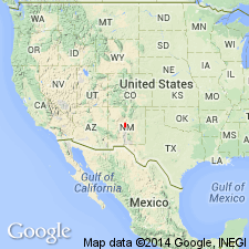
First use of name [together with 2 other reports by Herrick and Bendrat in The American Geologist, v. 25, and by Herrick in University of New Mexico Bulletin, v. 2, pt. 3. All three reports have similar information, and information from all three is combined and summarized here]. Intent to name not stated. Named for Sandia Mountains, NM. No type locality designated. Present in Sandia Mountains, Sandoval and Bernalillo Cos, NM, San Juan and Estancia basins; Manzano Mountains, Bernalillo and Torrance Cos, NM, Estancia basin; San Andreas Mountains, Socorro Co, Orogrande basin; and foothills of Sacramento Mountains, Otero Co, Orogrande basin. In these ranges conformably overlies quartzite of unknown age. Is a siliceous series of shales, sandstones, and conglomerates with occasional sandy limestone bands. Maximum thickness not more than 150 ft. Variability of lithologic details considerable but series retains prevailingly sandy nature in all exposures seen. Considerable fauna, including BELLEROPHON CARBONARIA, A PHILLIPSIA, SPIRIFER CAMERATA and other distinctively Carboniferous forms. Overlain by black carbonaceous limestone and shale not exceeding 150 ft thick, which is correlated with "Upper Coal Measures limestones" of OH. Above this horizon is Coyote sandstone (first used), which roughly marks transition to Permo-Carboniferous as generally developed in these mountains. Of Coal Measure age [Pennsylvanian and Permian, present usage].
Source: GNU records (USGS DDS-6; Denver GNULEX).
- Usage in publication:
-
- Sandia formation
- Modifications:
-
- Overview
- Age modified
- Areal extent
- AAPG geologic province:
-
- San Juan basin
Summary:
In the Sandia Mountains, Sandia formation as here interpreted corresponds in age to the lower part of type section of Armendaris group (new) of Des Moines series, measured in west end of Whiskey Canyon in north portion of Mud Springs Mountains, just west of westernmost box canyon, in southwest part of sec 1, T13S, R5W, Sierra Co, NM in Orogrande basin. Fauna in uppermost arenaceous beds of Sandia corresponds in age almost exactly with fauna in lower part of type section of Elephant Butte formation (new), lowest formation of Armendaris group. Sandia is about 127 ft thick in north end of Sandia Mountains, San Juan basin, and is composed largely of cross-bedded sandstone and arenaceous to highly calcareous shales and highly argillaceous and arenaceous dark-gray to black limestone. Unit is confined to general region of Sandia Mountains. South of Sandia Mountains, the sandstones and arenaceous beds change laterally into the lower limestones of Elephant Butte formation. Northward from Sandia Mountains, overlaps against the pre-Cambrian. Unit was previously assigned to lower part of the Pennsylvanian in the Sandia Mountains area. Is assigned a Pennsylvanian --Derry (named in this report) and Des Moines--age in this report.
Source: GNU records (USGS DDS-6; Denver GNULEX).
- Usage in publication:
-
- Sandia formation*
- Modifications:
-
- Revised
- Areal extent
- AAPG geologic province:
-
- San Juan basin
- Orogrande basin
Summary:
Sandia formation of Magdalena group revised in Lucero uplift area, Valencia and Socorro Cos, NM in San Juan and Orogrande basins; upper contact changed. Overlying Madera limestone of Magdalena group divided into three members (ascending): Gray Mesa, Atrasado, and Red Tanks members (all new). Sandia divided into upper, clastic member and lower limestone member in this report. Contact of upper clastic member of Sandia is with Gray Mesa member of Madera. Overlies pre-Cambrian rocks. Sandia areally extended into: Socorro Co, Orogrande basin, in northwest-trending hogback of the Ladron Mountains; and into Valencia Co, San Juan basin, at foot of Monte de Belen and in a small area at foot of Gray Mesa. Not exposed north of this point. Age of Gray Mesa and Sandia is Pennsylvanian. Measured sections, cross sections, and geologic map.
Source: GNU records (USGS DDS-6; Denver GNULEX).
- Usage in publication:
-
- Sandia formation*
- Modifications:
-
- Overview
- AAPG geologic province:
-
- San Juan basin
Summary:
As the lower formation of the Magdalena group, Sandia is divided into two mapped and informally designated members. The lower limestone member is a dark-gray, slightly siliceous limestone, discontinuous in areal extent, and fossiliferous (Morrow age fusulinids); could be pre-Pennsylvanian in age. The upper clastic member consists of dark-brown, brownish-gray, and brownish-green sandstone and impure arenaceous limestone. Thickness variations of the upper member are due to deposition on an irregular surface. Upper member, which is of Morrow and Lampasas age, has fossil crinoids, bryozoans, brachiopods, worm borings, and shark teeth. Extensive listing of fossils. Mapped in southeast part of area in Sandoval Co, NM in the San Juan basin. Is the oldest Paleozoic unit in mapped area. Is overlain by Pennsylvanian Madera limestone.
Source: GNU records (USGS DDS-6; Denver GNULEX).

- Usage in publication:
-
- Sandia formation
- Modifications:
-
- Revised
- AAPG geologic province:
-
- Orogrande basin
Summary:
Sandia formation revised; lower contact changed. In this report unconformably overlies Kinderhook (Early Mississippian) Caloso formation (revised) north of Rio Salado [just south of Ladron Mountains], Socorro Co, NM in Orogrande basin. To south of Rio Salado, Caloso is overlain unconformably by Kelly formation. North of Rio Salado, Kelly is eroded and disappears 3 mi north of Rio Salado; from this point northward, Caloso is unconformably overlain by Sandia formation. Sandia formation is of Pennsylvanian age. Measured sections, cross section.
Source: GNU records (USGS DDS-6; Denver GNULEX).
- Usage in publication:
-
- Sandia formation*
- Modifications:
-
- Revised
- AAPG geologic province:
-
- San Juan basin
Summary:
Overlies newly named Arroyo Penasco formation in Sandoval Co, NM in San Juan basin. Assigned a Pennsylvanian age.
Source: GNU records (USGS DDS-6; Denver GNULEX).
- Usage in publication:
-
- Sandia formation
- Modifications:
-
- Overview
- AAPG geologic province:
-
- San Juan basin
Summary:
Is a unit of northern NM, San Juan basin, that correlates with Deer Creek formation (new) of Huerfano Park and La Veta Pass, CO and with Belden formation of the Pando, Crested Butte, and Glenwood Springs areas. Correlation Chart. Assigned an Atokan [Middle] Pennsylvanian age.
Source: GNU records (USGS DDS-6; Denver GNULEX).
- Usage in publication:
-
- Sandia formation*
- Modifications:
-
- Revised
- Areal extent
- AAPG geologic province:
-
- Las Vegas-Raton basin
- San Luis basin
- Palo Duro basin
Summary:
Sandia formation revised in report area, Sangre de Cristo Mountains, in Taos, Mora, and San Miguel Cos, NM in San Luis, Las Vegas-Raton, and Palo Duro basins. The sandstone and coaly shale beds of the Sandia formation unconformably overlie (erosional unconformity) Cowles member of Tererro formation (both new); the Tererro is here named and divided into (ascending, all new): Macho, Manuelitas (dated by faunas as Early Mississippian in age), and Cowles members. Upper surface of Cowles member is irregular and undulatory, and, in places, channeled. Overlying Sandia beds contain residual chert and limestone pebbles derived from Cowles. In the southern part of the Sangre de Cristo Mountains, near the Paleozoic uplift, Cowles has been completely eroded and is overlapped by thick sandstone beds of Sandia. Karst topography not developed on the Cowles member--in this respect, Tererro-Sandia contact in Sangre de Cristo Mountains differs from the Leadville-Molas contact in southern CO and the Arroyo Penasco-Sandia contact in Nacimiento Mountains of NM in San Juan basin. The lower coaly beds of Sandia in this area are probably correlative with Molas formation of CO. Sandia is of Early Pennsylvanian age. Measured sections.
Source: GNU records (USGS DDS-6; Denver GNULEX).
- Usage in publication:
-
- Sandia Formation
- Modifications:
-
- Not used
Summary:
Sandia Formation could not be consistently delineated in the southern part of the report area--upper Pecos Valley area, including the Dalton Bluff exposure 6 mi north of Pecos, southern edge of Sangre de Cristo Mountains, San Miguel Co, NM in Palo Duro basin--consequently, name "Sandia" not used in this report. Pennsylvanian rocks in southernmost Sangre de Cristos here divided into (both new): 1) La Pasada Formation, 973 ft thick at Dalton Bluff, San Miguel Co, NM, Palo Duro basin, and equal there to Sandia Formation plus the lower gray limestone member of Madera Limestone (as used in this area by Brill, 1952); and 2) Alamitos Formation (about 1,275 ft thick in Alamitos and Pecos Valley areas, San Miguel Co, and equal to the upper arkosic limestone member of Madera Limestone (of Brill). Stratigraphic relations of these two new formations to the "Madera Limestone" of Sandia Mountains further to southwest is unknown--therefore, term "Madera" not used in report area. "Magdalena Group" not used either, because it is essentially synonymous with systemic term "Pennsylvanian". La Pasada Formation's northern equivalent is Flechado Formation (new); Flechado extends north of Jicarilla area, Rio Arriba Co, to Taos area, San Luis basin. Measured sections, geologic map, correlation chart.
Source: GNU records (USGS DDS-6; Denver GNULEX).
- Usage in publication:
-
- Sandia Formation*
- Modifications:
-
- Revised
- AAPG geologic province:
-
- San Juan basin
- Estancia basin
Summary:
Underlies Los Moyos Limestone (a new name) of Madera Group (raised in stratigraphic rank in Manzano Mountains) in San Juan and Estancia basins, NM. Is of Atokan, or Middle Pennsylvanian age.
Source: GNU records (USGS DDS-6; Denver GNULEX).
- Usage in publication:
-
- Sandia Formation
- Modifications:
-
- Revised
- AAPG geologic province:
-
- San Juan basin
Summary:
Sandia Formation revised in that it is now underlain by Osha Canyon Formation (newly named, this report). Name Osha Canyon Formation applied to rocks designated "unnamed carbonate rocks", a unit recognized by Armstrong (1966) and Armstrong, Mamet (1974) as resting unconformably on Log Springs Formation and as unconformably below a restricted Sandia Formation. The unnamed carbonate rocks and the [restricted] Sandia were the upper clastic member of the Sandia Formation of Wood. Northrop (1946). Osha Canyon occurs in several locations in southern Nacimiento and Jemez Mountains, including Pinos and Penasco Canyons and several places in and near Guadalupe Box (all in Sandoval Co, NM, San Juan basin); not observed outside this area. Osha Canyon overlies Log Springs Formation unconformably and underlies Sandia Formation unconformably at type section (at Guadalupe Box); in Pinos and Penasco Canyons overlies Log Springs with angular unconformity and underlies Madera Formation with sharp angular unconformity--Sandia Formation is absent here. Osha Canyon not reported in San Pedro or Sandia Mountains. The fossiliferous Osha Canyon is of Morrowan--probably late Morrowan (Early Pennsylvanian)--age, based on brachiopod fauna. Stratigraphic chart.
Source: GNU records (USGS DDS-6; Denver GNULEX).
- Usage in publication:
-
- Sandia Formation*
- Modifications:
-
- Overview
- AAPG geologic province:
-
- Las Vegas-Raton basin
Summary:
Is a complex (marine and nonmarine) sequence of shale, sandstone, conglomerate, and subordinate amounts of limestone that may vary from 10 ft (3 m) thick on the south part of the Tecolate uplift to 5,080 ft (1,548 m) thick 1 mi north of Mora River. Usually overlies Arroyo Penasco Group (locally Precambrian) and underlies Madera Group. Brachiopods of Morrowan age found on west part of Gallinas Creek. Fusulinids of late Atokan age found near top of formation on north side of Sanguijuela Creek. Is of Early and Middle Pennsylvanian age.
Source: GNU records (USGS DDS-6; Denver GNULEX).
- Usage in publication:
-
- Sandia Formation*
- Modifications:
-
- Areal extent
- AAPG geologic province:
-
- San Juan basin
- Black Mesa basin
- Paradox basin
Summary:
An isopach map shows thickness of Pinkerton Trail Formation (lower formation of Hermosa Group) and its correlative to the southeast, the Sandia Formation. The arbitrary geographic limit between the two formations is in northwest Sandoval and adjoining McKinley Co., NM where there is a constriction in the depositional sites. Sandia thickens to southeast to more than 80 ft thick. Pinkerton Trail thickens to northwest from the San Juan basin into the Black Mesa basin of AZ and the Paradox basin of southwest CO and southeast UT to more than 120 ft. Pinkerton Trail overlies Molas Formation and underlies Paradox Formation (of Hermosa Group). Sandia unconformably overlies Log Springs Formation and underlies Madera Limestone. Correlation chart. Of Pennsylvanian age.
Source: GNU records (USGS DDS-6; Denver GNULEX).
- Usage in publication:
-
- Sandia Formation*
- Modifications:
-
- Reference
- Dominant lithology:
-
- Shale
- Sandstone
- Conglomerate
- Limestone
- AAPG geologic province:
-
- Las Vegas-Raton basin
- Palo Duro basin
Summary:
Mapped in southeastern Sangre de Cristo Mountains, Mora and San Miguel Cos, NM, Las Vegas-Raton and Palo Duro basins. Absent in southeastern part of map area due to angular unconformity with overlying rocks. Also occurs in subsurface of adjacent part of Las Vegas basin. Principal composite reference section designated (section J1-J7, fig. 89) across hogback ridges; base of composite section (J1) beginning about 0.95 mi north of Mora River and 2.7 mi east of center of town of Mora. Consists of gray shale, carbonaceous shale, fine- to coarse-grained sandstone and conglomerate, and subordinate amounts of generally thin limestone; unit is vertically and laterally heterogeneous indicating complex marine and nonmarine depositional environment. Thickens to north; thickness is 33-245 ft in southwestern part of area; 1030 ft east of Rociada; and more than 5030 ft 1 mi north of Mora River (at principal composite reference section). Unconformably overlies Tererro Formation of Arroyo Penasco Group; conformably underlies Porvenir Formation of Madera Group; contact with Porvenir is near Atokan-Desmoinesian boundary. Chart compares previous nomenclature; isopach map; measured sections; detailed lithologic description; brachiopod and fusulinid fossil lists; zonation chart (fig. 54). At Mora River, late Atokan fusulinids present near top and Morrowan brachiopods occur in lower part. Assigned Early and Middle Pennsylvanian based on fossils.
Source: GNU records (USGS DDS-6; Denver GNULEX).
For more information, please contact Nancy Stamm, Geologic Names Committee Secretary.
Asterisk (*) indicates published by U.S. Geological Survey authors.
"No current usage" (†) implies that a name has been abandoned or has fallen into disuse. Former usage and, if known, replacement name given in parentheses ( ).
Slash (/) indicates name conflicts with nomenclatural guidelines (CSN, 1933; ACSN, 1961, 1970; NACSN, 1983, 2005, 2021). May be explained within brackets ([ ]).