

- Usage in publication:
-
- Sandholdt formation
- Modifications:
-
- Named
- Biostratigraphic dating
- Dominant lithology:
-
- Clay
- Siltstone
- Limestone
- Sandstone
- Shale
- AAPG geologic province:
-
- California Coast Ranges province
Summary:
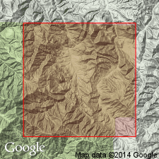
Named by author in abstract (1941, GSA Bull. v.52 no.12 pt.2 p.1958) [where type locality designated in upper Reliz Canyon, N/2 and SE/4 sec.14 NE/4 sec.15 T20S R6E, Junipero Serra 15' quad, Monterey Co, CA]. Divided into members (ascending): A, consisting of 125 feet of bluish-gray sandy clay and siltstone and interbedded yellowish-orange limestone beds; B, consisting of 75 feet of tan to dark-gray, medium-grained, biotitic, friable sandstone with several thin beds of dark-gray clay-shale; C, consisting of 750 feet of clay and calcareous shale with interbedded yellowish-orange arenaceous limestone beds. Conformably overlies Vaqueros formation; conformably underlies Monterey formation. Sandholdt formation contains Saucesian foraminifers in members A and C and Relizian foraminifers in upper part of member C. [According to Kleinpell (1938) these stages are early and middle Miocene age respectively].
Source: GNU records (USGS DDS-6; Menlo GNULEX).
- Usage in publication:
-
- Sandholdt shale*
- Modifications:
-
- Adopted
- Redescribed
- Areal extent
- AAPG geologic province:
-
- California Coast Ranges province
Summary:
Sandholdt formation of Thorup (1943) is adopted as Sandholdt shale. Has gradational contact with overlying Monterey formation. Attains thickness of 2000 ft in Horse Canyon near Arroyo Seco. Includes strata of Kleinpell's (1938) Relizian Stage, lower part of his Luisian Stage and in most areas, upper part of his Saucesian Stage. [Kleinpell's (1938) Saucesian Stage is early Miocene and his Relizian and Luisian Stages are middle Miocene age].
Source: GNU records (USGS DDS-6; Menlo GNULEX).
- Usage in publication:
-
- Sandholdt Member*
- Modifications:
-
- Revised
- Age modified
- Biostratigraphic dating
- AAPG geologic province:
-
- California Coast Ranges province
Summary:
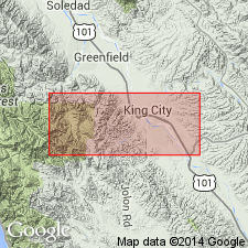
Sandholdt Shale is reduced in rank and assigned as basal member of Monterey Shale. Unit corresponds approximately to Sandholdt [Formation] of Thorup (1943) who named unit for exposures in sec.14 T20S R6E on old Sandholdt Ranch in Reliz Canyon. Crops out in almost continuous belt from northwest corner of Reliz Canyon 7.5' quad to southwest quarter of Thompson Canyon 7.5' quad. Upper contact placed at top of highest beds of calcareous shale or mudstone in Monterey Shale. "Upper contact of the member is near the base of the upper Miocene Mohnian Stage of Kleinpell, but most of the unit contains Foraminifera of the middle Miocene Relizian and Luisian Stages of Kleinpell (Patsy B. Smith, written commun., 1961)" p.Q16-Q17. In Reliz Canyon, Sandholdt contains UVIGERINELLA OBESA zone of Saucesian Stage (Kleinpell, 1938).
Source: GNU records (USGS DDS-6; Menlo GNULEX).
- Usage in publication:
-
- Sandholdt Member*
- Modifications:
-
- Age modified
- Biostratigraphic dating
- AAPG geologic province:
-
- California Coast Ranges province
Summary:
Sandholdt Member of Monterey Formation conformably underlies Hames Member (new) of Monterey Formation where both members occur. Extensive list of foraminifers from 16 representative localities included in report as identified by Patsy B. Smith. Other fossils include diatom frustules. Age of member is early and middle Miocene based on Kleinpell's foraminiferal Saucesian, Relizian, and Luisian Stages.
Source: GNU records (USGS DDS-6; Menlo GNULEX).
For more information, please contact Nancy Stamm, Geologic Names Committee Secretary.
Asterisk (*) indicates published by U.S. Geological Survey authors.
"No current usage" (†) implies that a name has been abandoned or has fallen into disuse. Former usage and, if known, replacement name given in parentheses ( ).
Slash (/) indicates name conflicts with nomenclatural guidelines (CSN, 1933; ACSN, 1961, 1970; NACSN, 1983, 2005, 2021). May be explained within brackets ([ ]).