

- Usage in publication:
-
- Sandersville limestone member*
- Modifications:
-
- Named
- Dominant lithology:
-
- Limestone
- AAPG geologic province:
-
- South Georgia sedimentary province
Summary:
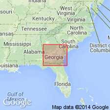
Limestone referred by Veatch and Stephenson (1911) to McBean formation and by Cooke and Shearer (1918: USGS Prof. Paper 120-C) to upper part of Barnwell is herein named Sandersville limestone member of Barnwell formation. Thickness probably not more than 40 ft. Thickness at type locality is 19 ft. Age is late Eocene.
Source: GNU records (USGS DDS-6; Reston GNULEX).
- Usage in publication:
-
- Sandersville limestone member
- Modifications:
-
- Overview
- AAPG geologic province:
-
- South Georgia sedimentary province
Summary:
Sandersville limestone member is believed to be equivalent in part to the Irwinton sand member (new), but it may represent in part a still younger bed of Jackson age.
Source: GNU records (USGS DDS-6; Reston GNULEX).
- Usage in publication:
-
- Sandersville Limestone
- Modifications:
-
- Revised
- AAPG geologic province:
-
- South Georgia sedimentary province
Summary:
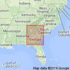
Sandersville used at formation rank on Georgia State map. Age shown as Eocene.
Source: GNU records (USGS DDS-6; Reston GNULEX).
- Usage in publication:
-
- Sandersville Limestone Member
- Modifications:
-
- Revised
- Areal extent
- AAPG geologic province:
-
- South Georgia sedimentary province
Summary:
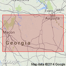
Sandersville is restricted to a relatively small area in central Washington Co., GA. Unit correlates with Ocmulgee Formation (new name) but is referred to Tobacco Road Sand because sandy sediments of formation occupy same stratigraphic position where member is absent. Unit grades laterally in all directions into Tobacco Road Sand. Overlies Irwinton Sand Member of Dry Branch Formation. Age is late Eocene.
Source: GNU records (USGS DDS-6; Reston GNULEX).
For more information, please contact Nancy Stamm, Geologic Names Committee Secretary.
Asterisk (*) indicates published by U.S. Geological Survey authors.
"No current usage" (†) implies that a name has been abandoned or has fallen into disuse. Former usage and, if known, replacement name given in parentheses ( ).
Slash (/) indicates name conflicts with nomenclatural guidelines (CSN, 1933; ACSN, 1961, 1970; NACSN, 1983, 2005, 2021). May be explained within brackets ([ ]).