

- Usage in publication:
-
- Sand Canyon member
- Modifications:
-
- Original reference
- Dominant lithology:
-
- Sand
- AAPG geologic province:
-
- Chadron arch
Summary:
Pg. 128, 129-131. Sand Canyon member of Sheep Creek Formation of Hemingford Group. Name applied to middle member of formation. The whole exposed section (type) which is about 145 feet, is made up largely of fine-grained sand, grayish in lower half and greenish in upper half; about 30 feet above base is a 3- to 4-foot bed of dark-gray volcanic ash. The fine sand below the ash bed has several zones of concretionary type of cementation and contains bones of mammals (this is zone of remains of MERYCHIPPUS and PRONOMOTHERIUM). Basal 10 feet is somewhat stratified by development of interbedded streaks of white fine sandy silt and contains a bed of white marl. The fine sand above the bed of the dark-gray volcanic ash is partially cemented into harder ledges, which approach in appearance the "mortar beds" of the Ogallala. Overlies Spottedtail member (new); underlies Box Butte member. Age is early Miocene (Hemingford).
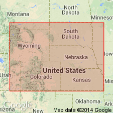
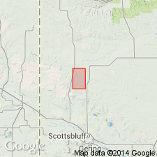
Type locality: Sand Canyon, 13 mi south and 5 mi west of Hay Springs; [Sand Canyon in T. 29 and 30 N., R. 47 W., Sand Canyon East and Box Butte NE 7.5-min quadrangles, Dawes Co., northwestern NE].
Type section: on southwest side of canyon at and around junction of secs. 11, 13, and 14, T. 29 N., R. 47 W., [Box Butte 7.5-min quadrangle], Dawes Co., northwestern NE.
Source: US geologic names lexicon (USGS Bull. 1200, p. 3432).
- Usage in publication:
-
- Sand Canyon Member
- Modifications:
-
- Not used
- AAPG geologic province:
-
- Denver basin
Summary:
Pg. 288-289 (table 3), 295-296, fig. 13. Sand Canyon Member of Sheep Creek Formation of Hemingford Group. Not used in type area of Sheep Creek Formation, Sioux County, Nebraska; considered unrelated. Authors do not accept Elias' (1942) correlation of type Sand Canyon sediments 50+ miles to the east with the upper 20 feet of the type Sheep Creek; his correlation was based on color of ash and presence of fossil grass seeds (STIPIDIUM DAWSENSE ALPHA, mut.). Sand Canyon beds are younger than Sheep Creek and age equivalent of "Lower Snake Creek" beds (Galusha, 1975).
Source: Publication.
For more information, please contact Nancy Stamm, Geologic Names Committee Secretary.
Asterisk (*) indicates published by U.S. Geological Survey authors.
"No current usage" (†) implies that a name has been abandoned or has fallen into disuse. Former usage and, if known, replacement name given in parentheses ( ).
Slash (/) indicates name conflicts with nomenclatural guidelines (CSN, 1933; ACSN, 1961, 1970; NACSN, 1983, 2005, 2021). May be explained within brackets ([ ]).