

- Usage in publication:
-
- Sand Butte Bed*
- Modifications:
-
- Named
- Dominant lithology:
-
- Sandstone
- Siltstone
- Limestone
- Shale
- AAPG geologic province:
-
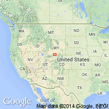
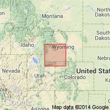
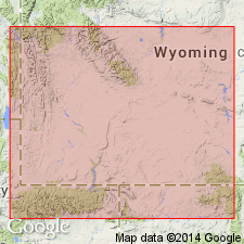
- Green River basin
Summary:
Named for Sand Butte as a middle bed (of three named beds) of Laney Member of Green River Formation for exposures on Sand Butte, T16N, R100W in Sweetwater Co, WY in Washakie basin of Greater Green River basin. Type section measured in NE1/4 sec 19, N1/2 sec 20, and NW1/4 sec 21, T14N, R99W. Composed of gray to brown tuffaceous sandstone and siltstone (about 90%) and thin beds of gray coquinal siltstone and coquinal sandstone, gray, partly coquinal limestone, tan and gray algal limestone, light-gray to tan-gray tuff, gray to brown shale, brown oil shale, and gray and green mudstone. Has maximum thickness of 900 ft along Antelope Creek; thins and wedges out east across basin. Unconformably above LaClede Bed (new name); intertongues and underlies Hartt Cabin Bed (new name). Is of middle Eocene age.
Source: GNU records (USGS DDS-6; Denver GNULEX).
- Usage in publication:
-
- Sand Butte Bed*
- Modifications:
-
- Areal extent
- Overview
- AAPG geologic province:
-
- Green River basin
Summary:
Isopach map (fig 30) shows areal extent within Greater Green River basin, WY and CO. Sand Butte (Laney Member of Green River Formation) is restricted to flanks of Rock Springs uplift and parts of adjacent basins (Green River, Great Divide, Washakie, and Sand Wash). Thickness is variable because: 1) it was mostly deposited on erosional surface of Rock Springs uplift, 2) composed largely of reworked volcanic ash that sporadically entered Greater Green River basin from Absaroka volcanic field in northwest WY, and 3) it intertongues with or wedges out in laterally equivalent Hartt Cabin and LaClede Beds of Laney. Thickness ranges from 0-850 ft. Stratigraphic chart; cross sections. Eocene age.
Source: GNU records (USGS DDS-6; Denver GNULEX).
- Usage in publication:
-
- Sand Butte Bed*
- Modifications:
-
- Overview
- AAPG geologic province:
-
- Green River basin
Summary:
Paleogeographic map (fig. 83) of this bed of Laney Member of Green River Formation showing depositional environments in Greater Green River basin. Sand Butte occupied an area of 3,500 sq mi of Lake Gosiute in central part of basin. Sediments of Sand Butte are composed mostly of very tuffaceous siltstone and sandstone and interbedded tuff; these were deposited following an uplift of Rock Springs anticline which caused lake to contract and retreat southward and resulted in erosion of as much as 700 ft of underlying LaClede Bed of Laney. Erosion surface on which Sand Butte was deposited is called Tower unconformity. Thickness of Sand Butte ranges up to 900 ft. Sand Butte is fluvial in northern two-thirds of Rock Springs uplift area and is lacustrine in southern one-third of uplift area. Lake margin deposits are mostly fluvial sandstone and mudstone with thinly interbedded lacustrine limestone and sandstone of lower part of Hartt Cabin Bed of Laney Member. Several sand fan deltas formed along northern shore of Lake Gosiute during deposition of Sand Butte. In northern part of basin, Sand Butte intertongues with Bridger Formation and Hartt Cabin; in southern part of basin bed intertongues with LaClede. Generalized stratigraphic correlation chart (fig. 41). Eocene age.
Source: GNU records (USGS DDS-6; Denver GNULEX).
For more information, please contact Nancy Stamm, Geologic Names Committee Secretary.
Asterisk (*) indicates published by U.S. Geological Survey authors.
"No current usage" (†) implies that a name has been abandoned or has fallen into disuse. Former usage and, if known, replacement name given in parentheses ( ).
Slash (/) indicates name conflicts with nomenclatural guidelines (CSN, 1933; ACSN, 1961, 1970; NACSN, 1983, 2005, 2021). May be explained within brackets ([ ]).