

- Usage in publication:
-
- Sandbridge Formation
- Modifications:
-
- Named
- Dominant lithology:
-
- Sand
- Clay
- AAPG geologic province:
-
- Atlantic Coast basin
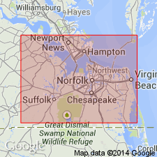
Summary:
Sandbridge Formation, here named in southeastern VA, consists of dune and beach sand in east; lagoon clay and clayey sand in west. Maximum thickness is 20 ft. Overlies Londonbridge Formation (new name); underlies Dismal Swamp peat (new name). Radiocarbon age about 40,000 (late Pleistocene).
Source: GNU records (USGS DDS-6; Reston GNULEX).
- Usage in publication:
-
- Sand Bridge Formation
- Modifications:
-
- Revised
- Reference
- AAPG geologic province:
-
- Atlantic Coast basin
Summary:
Sand Bridge Formation divided into a homogeneous lower member and an upper member composed of several different mappable facies (Oaks, 1965, unpub. thesis, described type sections of upper and lower members of formation at boring PA-26.) Reference sections in Inner Coastal Plain herein designated. Lower member occurs as thin layer, 3 to 6 ft thick, beneath Churchland Flat, where it overlies Norfolk Formation, except where it has been lost through erosion during deposition of clay-sand facies of upper member. Age is Wisconsinan. [BGN prefers double name rather than single name as used by Oaks and Coch (1963).]
Source: GNU records (USGS DDS-6; Reston GNULEX).

- Usage in publication:
-
- Sand Bridge Member
- Modifications:
-
- Revised
- AAPG geologic province:
-
- Atlantic Coast basin
Summary:
Sand Bridge (at top) and Londonbridge Formations reduced to member rank and assigned to newly named Powells Crossroads Formation at Virginia Beach. Gray silty sands in lower part of Sand Bridge indicate open marine environment (5 to 30 m depths) and grade upward into coarser cross-bedded sands deposited in an intertidal and very nearshore environment.
Source: GNU records (USGS DDS-6; Reston GNULEX).
For more information, please contact Nancy Stamm, Geologic Names Committee Secretary.
Asterisk (*) indicates published by U.S. Geological Survey authors.
"No current usage" (†) implies that a name has been abandoned or has fallen into disuse. Former usage and, if known, replacement name given in parentheses ( ).
Slash (/) indicates name conflicts with nomenclatural guidelines (CSN, 1933; ACSN, 1961, 1970; NACSN, 1983, 2005, 2021). May be explained within brackets ([ ]).