

- Usage in publication:
-
- Sanborn formation*
- Modifications:
-
- Original reference
- Dominant lithology:
-
- Loess
Summary:
Pg. 163+. The name Sanborn formation is proposed for the Pleistocene loess, with some gravel and sand at base, which is widely distributed on divides in western Kansas. Major part of formation is loess. It seems to writer that only the loess that covers the divides can be considered to be Pleistocene, the loess of the valley slopes and bottoms being largely if not wholly redeposited from the divides, the redeposition having taken place probably for the most part in late Pleistocene and Recent times. The name Sanborn formation is intended as a substitute for the old terms "Tertiary marl" or "Plains marl", introduced for this formation by Robert Hay. The new name derived from Sanborn, Nebraska, which is nearest town to a locality of the formation in northwest corner of Cheyenne County, Kansas, where the loess is 180 feet thick, is exposed in steep bluffs of numerous canyons on south side of Arikaree River, and is underlain by a few feet of Ogallala and by Pierre shale. In other parts of the county the loess on the divides is 20 to 60 feet thick. Basal part of formation is always sandy, and in many places coarse gravel was seen at its base, chiefly in northern half of Wallace County]. [Gravel has average diameter of 1 to 6 inches. Some boulders 1.5+ ft in diameter. The large blocks are medium- to coarse-grained arkose cemented by secondary silica. The round stones are of granite, porphyry, basalt, quartz, flint, jasper, quartzite. Almost all the medium size are gray porphyry. These gravels thought to have been transported by ice. Overlies the Tertiary Ogallala beds.] Age is Pleistocene.
Named from town of Sanborn, Dundy Co., NE. Recognized in Cheyenne and Wallace Cos., northwestern KS, on Las Animas arch and in Anadarko basin.
[Misprint: Univ. Kansas Bull., v. 32, no. 7 is cited in lexicon (USGS Bull. 896, p. 1904). Should be Bull. no. 18.]
Source: US geologic names lexicon (USGS Bull. 896, p. 1904); supplemental information from GNU records (USGS DDS-6; Denver GNULEX).
- Usage in publication:
-
- "Sanborn formation"
- Modifications:
-
- Not used
Summary:
Pg. 355. "Sanborn formation" (Elias, 1931) of western Kansas is a composite of sand, gravel, and loess, ranging in age from early Pleistocene (Kansan or perhaps older) to Peorian or younger (the "yellow dirt"). The separate parts of "Sanborn formation," especially the loess, are differentiated in Nebraska and should not have been grouped together as a formation; at least a new formation name should not have been assigned.
Source: US geologic names lexicon (USGS Bull. 896, p. 1904).
- Usage in publication:
-
- Sanborn formation
- Modifications:
-
- Biostratigraphic dating
Summary:
Stratigraphic position of these deposits [Sanborn formation] unconformably above middle Pliocene Ogallala beds, and the snails which contain conclusively demonstrate a Pleistocene age.
Source: US geologic names lexicon (USGS Bull. 1200, p. 3428-3429).
- Usage in publication:
-
- Sanborn formation
- Modifications:
-
- Revised
Summary:
Pg. 3-26. Elias' term Sanborn is used in this paper to refer to essentially the entire Pleistocene section exposed in north-central and northwestern Kansas, although some distinct terrace beds of local extent have not been included within it. Term is used despite the fact that in some localities beds have been studied that are probably stratigraphic equivalents of the Peorian and Loveland as described by Lugn in southern Nebraska. Beds herein assigned to Sanborn formation have been observed from western Jewell County westward for more than 200 miles to Yuma County, Colorado. Formation mantles upland much of north-central part of state. Consists of an upper gray silt bed which is persistent over entire area, and an underlying soil zone that occurs only north-central Kansas, and pre-soil zone deposits consisting of a wide variety of lithologic types.
Source: US geologic names lexicon (USGS Bull. 1200, p. 3428-3429).

- Usage in publication:
-
- Sanborn formation
- Modifications:
-
- Principal reference
- Revised
Summary:
Pg. 40-41. Proposed that late Pleistocene loesses, associated deposits, and lateral facies generally occurring in northern and central Kansas, be classed as Sanborn formation and the Loveland silt, Peoria silt, and Bignell silt and their lateral coarse-textured facies be assigned rank as members. Type section designated.
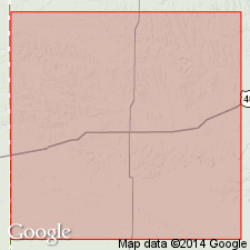
Type area: exposures in canyons extending from the NW/4 sec. 20, T. 1 S., R. 41 W. into the adjacent SW/4 SE/4 sec. 17, T. 1 S., R. 41 W., Cheyenne Co., KS.
Type section: measured in canyon on south side of Arikaree River, in SW/4 SE/4 sec. 17, T. 1 S., R. 41 W., Cheyenne Co., KS.
Source: US geologic names lexicon (USGS Bull. 1200, p. 3428-3429).

- Usage in publication:
-
- Sanborn formation
- Modifications:
-
- Overview
Summary:
Pg. 12 (fig. 5), 14, 16 (fig. 6). Sanborn formation. Massive silt, soil, sand, and gravel; widely distributed in northern and western Kansas. Sand and gravel are stream deposits, and widespread loess mantles extensive upland areas. Locally 200 feet thick, commonly 40 feet. Includes (descending) Bignell silt member, Peoria silt member (with Brady soil at top), Loveland silt member (with Sangamon soil at top), and Crete sand and gravel member. Age is late Pleistocene (Wisconsinan, Sangamonian, and Illinoian). Includes measured sections (fig. 6).
Source: Publication.

- Usage in publication:
-
- Sanborn formation
- Modifications:
-
- Overview
Summary:
Pg. 106-110. Sanborn formation, unlike other stratigraphic units of formational rank in Kansas Pleistocene, includes deposits of two stages (Illinoian and Wisconsinan) and the several substages of the Wisconsinan. Includes two unconformities, defined by the Sangamon and Brady buried soils, and represents three distinct cycles of deposition. As classified by Kansas Geological Survey, includes (ascending) Crete sand and gravel member; Loveland silt member, commonly containing Sangamon buried soil at top; unnamed early Wisconsinan alluvial deposits; Peoria silt member, commonly containing Brady buried soil; unnamed Wisconsinan alluvial deposits; and Bignell silt member. Thickness 130 feet at type locality. Among units that consist in part or entirely of deposits known to be of Illinoian or younger age and which are properly classed at least in part as Sanborn are Kingsdown marl or formation, Odee formation, and Vanhem formation.
Source: US geologic names lexicon (USGS Bull. 1200, p. 3428-3429).
- Usage in publication:
-
- Sanborn group*
- Modifications:
-
- Revised
- AAPG geologic province:
-
- Anadarko basin
Summary:
Pg. 55 (fig. 1). Sanborn group. Rank raised to group. In southwestern Kansas, includes Kingsdown formation below and Vanhem formation above, [as well as isolated basin fillings called the Odee formation, citing Hibbard, 1949]. For other parts of Kansas, includes (ascending) Crete formation, Loveland formation, early Wisconsinan terrace deposits, Peoria formation, terrace deposits, and Bignell formation. Overlies Meade group. Classification used in this report is in accord with agreement at Pleistocene conference at Lawrence, Kansas, June 28-29, 1956. [Age is Pleistocene.]
Source: US geologic names lexicon (USGS Bull. 1200, p. 3428-3429); supplemental information from GNU records (USGS DDS-6; Denver GNULEX).

- Usage in publication:
-
- Sanborn formation
- Sanborn group
- Modifications:
-
- Not used
Summary:
Sanborn formation (Sanborn group) not included in the Classification of rocks in Kansas. Included are (ascending): [Illinoian age] Crete formation; [Illinoian] and Sangamonian age Loveland formation; Sangamonian age Sangamon soil; and Wisconsinan age unnamed terrace deposits, Peoria formation, Brady soil, unnamed terrace deposits, and Bignell formation.
Source: Publication.

- Usage in publication:
-
- Sanborn Formation
- Sanborn Group
- Modifications:
-
- Not used
Summary:
(Cenozoic Era; Quaternary System by C.K. Bayne and H.G. O'Connor, p. 59-68.) Sanborn Formation, or Sanborn Group, not used. [Illinoian age] Crete and Loveland Formations; Sangamonian age Sangamon Soil; and Wisconsinan age Gilman Canyon Formation, unnamed fluvial deposits, Peoria Formation, Brady Soil, unnamed fluvial deposits, and Bignell Formation are used (see Table 3, p. 60, and discussion, p. 64, 65, 66, 67).
Source: Publication.
For more information, please contact Nancy Stamm, Geologic Names Committee Secretary.
Asterisk (*) indicates published by U.S. Geological Survey authors.
"No current usage" (†) implies that a name has been abandoned or has fallen into disuse. Former usage and, if known, replacement name given in parentheses ( ).
Slash (/) indicates name conflicts with nomenclatural guidelines (CSN, 1933; ACSN, 1961, 1970; NACSN, 1983, 2005, 2021). May be explained within brackets ([ ]).