

- Usage in publication:
-
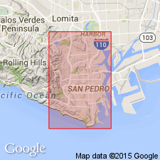
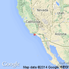
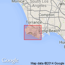
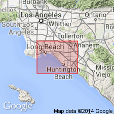
- San Pedro beds
- Modifications:
-
- Original reference
- Dominant lithology:
-
- Sand
- AAPG geologic province:
-
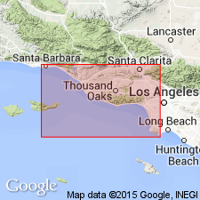
- Los Angeles basin
Summary:
Pg. 335; first published in 1897 as House Doc. 5, 55th Cong., 2nd sess. San Pedro beds. Extensive beds of unconsolidated Pleistocene sand replete with molluscan shells in very perfect condition, best exhibited at Harbor Hill, at head of San Pedro Harbor, Los Angeles County, southern California. Assigned to Pleistocene. Same horizon is recognizable above the Pliocene of Pacific Beach, San Diego; at various points on Coronado Beach peninsula opposite San Diego, especially at a cove called Spanish Bight; and also at Santa Barbara and elsewhere. Unconformably overlies Merced group.
Source: US geologic names lexicon (USGS Bull. 896, p. 1918).
- Usage in publication:
-
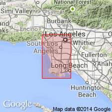
- San Pedro formation
- Modifications:
-
- Areal extent
- AAPG geologic province:
-
- Los Angeles basin
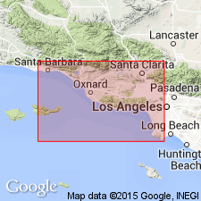
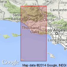
- Ventura basin
Summary:
Pg. 420. San Pedro formation (Pleistocene). This series of beds, which is typically developed in vicinity of San Pedro, has been described in detail by Ralph Arnold (California Acad. Sci. Mem., v. 3, 1903), who has divided it into two members, separated by an unconformity. The San Pedro occurs at many places in Los Angeles basin, resting unconformably on Saugus formation or upon beds of San Diego age.
Source: US geologic names lexicon (USGS Bull. 896, p. 1918).
- Usage in publication:
-
- San Pedro sand*
- Modifications:
-
- Revised
- Adopted
- AAPG geologic province:
-
- Los Angeles basin
Summary:
Pg. 502-512. San Pedro sand. Applied Palos Verdes sands to upper member of typical San Pedro, and restricted San Pedro to lower member of Arnold's San Pedro. He stated these changes were made upon suggestion of W.S.W. Kew. This is present approved definition of the USGS [ca. 1938].
Source: US geologic names lexicon (USGS Bull. 896, p. 1918).
- Usage in publication:
-
- San Pedro formation
- Modifications:
-
- Revised
- AAPG geologic province:
-
- Ventura basin
Summary:
Pg. 123-125. Restricted San Pedro formation to lower part of San Pedro and named the unconformable upper part in Ventura basin, Hall Canyon formation, which he stated is older than Palos Verdes formation. (See 1928 entry under Hall Canyon formation.)
Source: US geologic names lexicon (USGS Bull. 896, p. 1918).
- Usage in publication:
-
- San Pedro formation
- San Pedro group
- Modifications:
-
- Biostratigraphic dating
- AAPG geologic province:
-
- Los Angeles basin
- Ventura basin
Summary:
Pg. 37. In the Pleistocene, San Pedro formation (or group) there can be recognized the lower or Las Posas zone, the middle Deadman Island "Pliocene," or Timms Point zone, as it might be called, and the upper or typical San Pedro zone.
Source: US geologic names lexicon (USGS Bull. 896, p. 1918).
- Usage in publication:
-
- San Pedro sand
- Modifications:
-
- Revised
- AAPG geologic province:
-
- Los Angeles basin
Summary:
Pl. 2. Showed typical San Pedro sand (restricted) of San Pedro Hills as younger than Saugus formation and unconformably overlain by older terrace deposits, which in turn underlie Palos Verdes sand. [Age is Pleistocene.]
Source: US geologic names lexicon (USGS Bull. 896, p. 1918).
- Usage in publication:
-
- San Pedro formation
- Modifications:
-
- Areal extent
- AAPG geologic province:
-
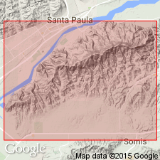
- Ventura basin
Summary:
Pg. 490-492. San Pedro formation consists of 3,000 to 3,500 feet of poorly consolidated light-gray to buff fine to coarse sands and gravels, buff-weathering sandy silts, and greenish-gray, drab-gray, and locally, grayish-maroon clays and silty clays; over 75 percent of it is sands and pebble to cobble gravels. It has been called Saugus by Kew, Cartright, Waterfall, and Driver, and most of it has been called Las Posas by Pressler, Grant, and Gale. Eaton (1928) [report cited above] has arbitrarily divided it into 3 so-called formations --Hall Canyon, San Pedro, and Saugus-- which cannot be consistently separated or recognized for any distance, either paleontologically or lithologically. Because of large number of confusing local names for the southern California Pleistocene, writer prefers to use Arnold's original name San Pedro, even though type San Pedro probably comprises only a meager remnant of the Ventura San Pedro. Overlies Santa Barbara formation.
Source: US geologic names lexicon (USGS Bull. 896, p. 1918).
- Usage in publication:
-
- San Pedro formation
- Modifications:
-
- Biostratigraphic dating
- AAPG geologic province:
-
- Los Angeles basin
Summary:
Pg. 73-74. Gave following as succession of marine Pleistocene formations at San Pedro: Palos Verdes formation, San Pedro formation, Timms Point formation, and Lomita formation, and listed fossils from each formation.
Source: US geologic names lexicon (USGS Bull. 896, p. 1918).
- Usage in publication:
-
- San Pedro formation
- Modifications:
-
- Areal extent
- AAPG geologic province:
-
- Los Angeles basin
Summary:
Pg. 1557. San Pedro formation. Described in Santa Barbara County, southern California. San Pedro formation, as defined here, is synonymous with Pressler's (1929) Las Posas except that his so-called Kalorama member (near Ventura) which contains a typical Santa Barbara fauna, is retained in the Santa Barbara; it is also approximately equivalent to the combined Hall Canyon and Saugus formations of Eaton (1928). Saugus, Las Posas, and Hall Canyon are abandoned.
Source: US geologic names lexicon (USGS Bull. 1200, p. 3454-3455).
- Usage in publication:
-
- San Pedro sand*
- Modifications:
-
- Principal reference
- AAPG geologic province:
-
- Los Angeles basin
Summary:
Pg. 42-53, pls. 1, 13, 14. San Pedro sand. Described in Palos Verdes Hills area, southern California, as San Pedro sand. Rests directly on the Miocene or Pliocene or overlies the Lomita marl or Timms Point silt. Maximum exposed thickness about 170 feet. Age is Early Pleistocene. Type region designated.
Type region: localities along San Pedro waterfront, Los Angeles Co., southern CA.
Source: US geologic names lexicon (USGS Bull. 1200, p. 3454-3455).
- Usage in publication:
-
- San Pedro formation
- Modifications:
-
- Revised
- AAPG geologic province:
-
- Ventura basin
Summary:
Pg. B-103-B-104, pls. B-1C, B-2. San Pedro formation. In Ventura County, southern California, includes basal Fox Canyon member (new) and Epworth gravel member (new) near top. Age is early Pleistocene.
Source: US geologic names lexicon (USGS Bull. 1200, p. 3454-3455).
- Usage in publication:
-
- San Pedro formation
- Modifications:
-
- Areal extent
Summary:
Pg. 1. San Pedro formation. South of South Mountain, lower 200 to 500 feet of San Pedro formation is Fox Canyon Member. San Pedro conformably overlies Santa Barbara formation and is between 1,000 to 3,500 feet thick. [Age is early Pleistocene.]
Source: US geologic names lexicon (USGS Bull. 1200, p. 3454-3455).
- Usage in publication:
-
- San Pedro formation*
- Modifications:
-
- Revised
- AAPG geologic province:
-
- Los Angeles basin
Summary:
Pg. 38 (table), 60-86, pl. 3. San Pedro formation. Described in Long Beach-Santa Ana area as a formation. Expanded to include Timms Point silt and Lomita marl as basal members. Full stratigraphic sequence underlies unnamed upper Pleistocene deposits and overlies Pico formation. Thickness as much as 1,350 feet. [Age is early Pleistocene.]
Source: US geologic names lexicon (USGS Bull. 1200, p. 3454-3455).
- Usage in publication:
-
- San Pedro formation*
- Modifications:
-
- Revised
Summary:
Pg. 39-57, pls. San Pedro formation. In this report [Torrance-Santa Monica area], the San Pedro is considered to be essentially correlative with (but much thicker and more heterogeneous) the type San Pedro sand, Timms Point silt, and Lomita marl as defined by Woodring and others (1946). However, it doubtless includes some younger strata and may include some which are older than any exposed in type section. Nonlithologic designation San Pedro formation is preferred to term San Pedro sand. Timms Point silt and Lomita marl are treated as basal members of the formation. As here defined, formation embraces all strata of early Pleistocene age. In most of area, formation occurs between unnamed upper Pleistocene deposits above and Pico formaiton below. Thickness as much as 1,000 feet.
Source: US geologic names lexicon (USGS Bull. 1200, p. 3454-3455).
For more information, please contact Nancy Stamm, Geologic Names Committee Secretary.
Asterisk (*) indicates published by U.S. Geological Survey authors.
"No current usage" (†) implies that a name has been abandoned or has fallen into disuse. Former usage and, if known, replacement name given in parentheses ( ).
Slash (/) indicates name conflicts with nomenclatural guidelines (CSN, 1933; ACSN, 1961, 1970; NACSN, 1983, 2005, 2021). May be explained within brackets ([ ]).