The National Geologic Map Database is migrating to a new infrastructure. We apologize for any service disruptions during this process.
|
|---|


- Usage in publication:
-
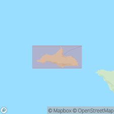
- San Miguel volcanics
- Modifications:
-
- Named
- Dominant lithology:
-
- Sandstone
- Siltstone
- Ash
- Tuff
- Basalt
- Porphyry
- AAPG geologic province:
-
- Santa Maria basin
Summary:
Named for occurrence on eastern San Miguel Island, Channel Islands, southwestern CA. Extends as far east as Santa Rosa Island. Mapped by Bremner (1933) as basalt member of his Temblor Formation. Consists of dark colored volcanic sandstone, siltstone, basaltic ash, tuff, thin flows of basalt, and dacite porphyry. Divided into lower and upper members on map of San Miguel Islands. Is at least 1520 ft thick. Gradationally overlies Rincon Formation. Underlies Monterey Formation. Oligocene and Miocene foraminifers are listed. Age given as Oligocene on map legend.
Source: GNU records (USGS DDS-6; Menlo GNULEX).
- Usage in publication:
-
- San Miguel Volcanics*
- Modifications:
-
- Age modified
- AAPG geologic province:
-
- Santa Maria basin
Summary:
San Miguel Volcanics of Weaver and Doerner (1969) listed as middle Miocene age in generalized stratigraphic column of San Miguel Island.
Source: GNU records (USGS DDS-6; Menlo GNULEX).
For more information, please contact Nancy Stamm, Geologic Names Committee Secretary.
Asterisk (*) indicates published by U.S. Geological Survey authors.
"No current usage" (†) implies that a name has been abandoned or has fallen into disuse. Former usage and, if known, replacement name given in parentheses ( ).
Slash (/) indicates name conflicts with nomenclatural guidelines (CSN, 1933; ACSN, 1961, 1970; NACSN, 1983, 2005, 2021). May be explained within brackets ([ ]).