

- Usage in publication:
-
- San Juan formation*
- Modifications:
-
- Original reference
- Dominant lithology:
-
- Tuff
- Breccia
- AAPG geologic province:
-
- Paradox basin
- San Juan Mountains province
Summary:
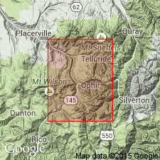
Pg. 225-228. San Juan formation. Stratified and water-laid andesitic tuffs and breccia, forming lower member of volcanic complex of Telluride district, [San Miguel, San Juan, and Ouray Counties], southwestern Colorado. Plays important part in composition of large part ot San Juan Mountains. Texture varies from thin-bedded fine-grained tuff containing no large fragments to a tuff brecda consisting of large subangular blocks embedded in a finer-grained matrix. Upper limit not always clearly definable, but in mountains about Marshall basin it is very sharply defined by appearance of first massive lava flow ot augite andesite. Thickness 1,000 to 2,600 feet. Rests conformably [unconformably reported in some areas] on San Miguel conglomerate, [preoccupied, and later replaced with Telluride conglomerate].
Source: US geologic names lexicon (USGS Bull. 896, p. 1912-1913).
- Usage in publication:
-
- San Juan tuff*
- Modifications:
-
- Areal extent
- AAPG geologic province:
-
- San Juan Mountains province
- Paradox basin
Summary:
and 1907 (USGS Geol. Atlas of the US, Ouray folio, no. 153). San Juan tuff unconformably underlies Silverton volcanic series and unconformably overlies Telluride conglomerate. Thickness 100 to 3,000 feet. [Age is late(?) Tertiary (Miocene?).]
Source: US geologic names lexicon (USGS Bull. 896, p. 1912-1913).
- Usage in publication:
-
- San Juan Tuff*
- Modifications:
-
- Mapped 1:24k
- AAPG geologic province:
-
- San Juan Mountains province
Summary:
Forms steep rounded slopes and cliffs. Thickness varies throughout area because of erosion. Is more than 3,000 ft thick at the Amphitheater. Consists of chaotic accumulation of moderately indurated volcanic debris ranging from microscopic size to blocks 10 ft across. Is actually a tuff breccia, rather than a tuff, with sandy tuffs and tuff conglomerates in lower part and flow breccias and a flow in upper part. Is usually gray or greenish-gray with shades of red, purple, and blue locally. Volcanic fragments range from andesite to quartz latite. They are finely porphyritic with phenocrysts of plagioclase and mafic minerals averaging 1 mm in size in an aphanitic groundmass. Groundmass is cryptocrystalline, fine grained or filled, and is of quartz, potassic feldspar or sodic plagioclase, apatite, and specks of iron ore. Its two members--Canyon Creek and Sneffels--recognized along Canyon Creek southwest of quad cannot be extended into Ouray quad with great certainty. Mostly a mud flow, lava flow, and air fall deposit. Source lay to the south. Miocene? age.
Source: GNU records (USGS DDS-6; Denver GNULEX).
- Usage in publication:
-
- San Juan Formation*
- Modifications:
-
- Redescribed
- Dominant lithology:
-
- Breccia
- Lava
- Tuff
- AAPG geologic province:
-
- San Juan Mountains province
Summary:
Name changed from San Juan Tuff to San Juan Formation, its original name (Cross and Purington, 1899). Consists of: rhyodacite tuff breccia with minor volcanic conglomerates and air-fall tuffs; rhyobasaltic and rhyodacitic lava flows and flow breccias; and rhyodacitic to quartz latitic welded ash-flow tuffs. Lower few hundred ft contain erratically distributed fragments derived from prevolcanic terrane. Has maximum thickness of 3,000+ ft. Was deposited over 2,400 sq mi. Had a volume of about 600 cubic mi. The source was a cluster of volcanoes in headwaters of Uncompahgre and Animas Rivers, and in Lake Fork of Gunnison River. Is a unit of middle and late Tertiary age in the San Juan Mountain province, CO.
Source: GNU records (USGS DDS-6; Denver GNULEX).
- Usage in publication:
-
- San Juan Formation*
- Modifications:
-
- Mapped 1:24k (Hinsdale and Ouray Cos, CO)
- Dominant lithology:
-
- Breccia
- Tuff
- Lava
- AAPG geologic province:
-
- San Juan Mountains province
Summary:
Is Oligocene and older(?) formation mapped throughout the quadrangle in southeast Ouray and western Hinsdale Cos, CO (San Juan Mountain province). Overlies Telluride Conglomerate (Eocene); overlain by Potosi Volcanic Group (Oligocene). Map unit described as gray and greenish-gray with shades of red and purple; massive indistinctly bedded; predominantly rhyodacitic tuff breccia increasing upward in amounts of tuffs and dark andesitic to dacitic lava flows (various latite intrusive sheets of Cross and others, 1907); forms steep slopes and cliffs; maximum thickness in quadrangle about 4,700 ft; locally absent in map area owing in part to nondeposition and in part to erosion.
Source: GNU records (USGS DDS-6; Denver GNULEX).
For more information, please contact Nancy Stamm, Geologic Names Committee Secretary.
Asterisk (*) indicates published by U.S. Geological Survey authors.
"No current usage" (†) implies that a name has been abandoned or has fallen into disuse. Former usage and, if known, replacement name given in parentheses ( ).
Slash (/) indicates name conflicts with nomenclatural guidelines (CSN, 1933; ACSN, 1961, 1970; NACSN, 1983, 2005, 2021). May be explained within brackets ([ ]).