

- Usage in publication:
-
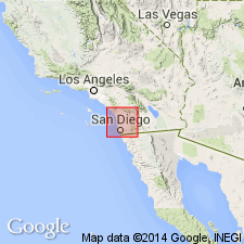
- San Diego beds
- Modifications:
-
- Original reference
- Dominant lithology:
-
- Marl
- AAPG geologic province:
-
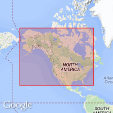
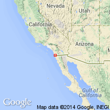
- Capistrano basin
Summary:
Pg. 337. San Diego beds. Pliocene sandy marls exhibited in well explored by Hemphill in city park; below Pleistocene at Pacific Beach, San Diego, on shores of False Bay near by; and on Coronado Peninsula, opposite San Diego, [San Diego County, southern California]. Same horizon crops out in various places northward, expecially at Dead Mans Island and Harbor Hill, San Pedro, and on coast of Todos Santos Bay, Lower California. [Age is middle Pliocene.]
Source: US geologic names lexicon (USGS Bull. 896, p. 1907).
- Usage in publication:
-
- San Diego formation*
- Modifications:
-
- Revised
- AAPG geologic province:
-
- Capistrano basin
Summary:
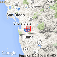
San Diego formation. An extension of Dall's use of the name. Consists of lenticular deposits of conglomerate, sandy marls, sand, and clay, with rare lenses of limestone. The sandy marls which are exposed around Mission Bay and in Mission Valley and underlying the conglomerates east of San Diego have been referred to in the literature as San Diego beds. Fossil collections obtained from them have been classified as Pliocene. Orcutt has assembled data in regard to fossil collections obtained from these deposits in a well boring in city of San Diego. The beds described by Orcutt are near base of later Tertiary section. They are best developed in immediate environs of city of San Diego, but have been recognized by their lithologic character as far south as Otay, and in northern part of the area in vicinity of Oceanside. They seem to be integral parts of a simple formation and chronologically inseparable from the other lenticular strata with which they are interbedded. On this ground it is proposed to include all of the later Tertiary marine deposits in this area under the name San Diego formation. It is essentially a shallow-water deposit. Rests on Eocene beds and is overlain by San Pedro formation. Thickness 500 feet.
[GNC remark (ca. 1936, US geologic names lexicon, USGS Bull. 896, p. 1907): To north the San Diego becomes a member of Pico formation. (See W.P. Woodring 1932 (16th Intl. Geol. Cong. Gdbk. 15, pl. 2, etc.)]
Source: US geologic names lexicon (USGS Bull. 896, p. 1907).
- Usage in publication:
-
- San Diego formation*
- Modifications:
-
- Areal extent
- AAPG geologic province:
-
- Capistrano basin
Summary:
Pg. 63 (fig. 4), 68-71. San Diego formation. Described in San Diego quadrangle as soft yellowish and gray sands, occasionally micaceous or marly, fossiliferous; minor amounts of conglomerate. Thickness 1,250 feet. Rests with angular unconformity upon Rose Canyon shale member of the La Jolla, or on Poway formation, or overlaps them and rests with marked unconformity upon Black Mountain volcanics; unconformably underlies Sweitzer formation. Age is Pliocene.
[Includes deposits later assigned to Miocene Sweetwater and Rosarito Beach Formations. (See Demere, 1983, IN Larue and Steel, eds., SEPM Pac. Sec., p. 187-195.)]
Source: US geologic names lexicon (USGS Bull. 1200, p. 3438).
- Usage in publication:
-
- San Diego formation
- Modifications:
-
- Age modified
- AAPG geologic province:
-
- Capistrano basin
Summary:
Pg. 7-9, pl. 1. San Diego formation. Age is middle or late Pliocene.
Source: US geologic names lexicon (USGS Bull. 1200, p. 3438).
- Usage in publication:
-
- San Diego Formation
- Modifications:
-
- Overview
- AAPG geologic province:
-
- Capistrano basin
Summary:
San Diego Formation. Informally subdivided into (descending): (1) upper member, interbedded fine- and coarse-grained friable sandstone with thick conglomerate layers, becomes nonmarine upsection; (2) lower member, massive fine-grained friable sandstone with occasional thin conglomerate layers. Thickness 74 m. Underlies, in places unconformably, Lindavista Formation (=Sweitzer Formation of Hertlein, 1929). Unconformably overlies middle Eocene Mount Soledad Formation. Fossils. Age is considered late Pliocene to early Pleistocene; in Deep Sea Drilling Project usage, no older than late Pliocene (N21, about 3.0 Ma) and as young as early Pleistocene (EMILIANIA ANNULA subzone, about 1.5 Ma).
Type section considered to be Pacific Beach (citing Arnold, 1906, USGS Prof. Paper 47). Recognized in San Diego basin, southern CA and northern Mexico.
Source: Publication.
For more information, please contact Nancy Stamm, Geologic Names Committee Secretary.
Asterisk (*) indicates published by U.S. Geological Survey authors.
"No current usage" (†) implies that a name has been abandoned or has fallen into disuse. Former usage and, if known, replacement name given in parentheses ( ).
Slash (/) indicates name conflicts with nomenclatural guidelines (CSN, 1933; ACSN, 1961, 1970; NACSN, 1983, 2005, 2021). May be explained within brackets ([ ]).