

- Usage in publication:
-
- San Antonio formation*
- Modifications:
-
- Named
- Dominant lithology:
-
- Alluvium
- Gravel
- AAPG geologic province:
-
- California Coast Ranges province
Summary:
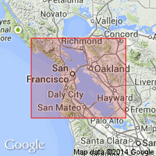
Named for development in San Antonio Township, Alameda Co, CA. Is great series of alluvial fans at foot of steep face of Berkeley Hills between East Oakland and Berkeley, built by streams that emerged from the hills. Is divisible into an older gravel which consists of rock fragments derived from front of hills and does not contain any chert and later or upper part called chert-gravel member because it contains abundant chert fragments. Has been dissected and terraced. Contains extinct vertebrate bones [listed]. Unconformably overlies Alameda formation (new); unconformably underlies Merritt sand (new). Age is given as Pleistocene.
Source: GNU records (USGS DDS-6; Menlo GNULEX).
- Usage in publication:
-
- San Antonio formation*
- Modifications:
-
- Areal extent
- AAPG geologic province:
-
- California Coast Ranges province
Summary:
San Antonio formation is described as it occurs in San Francisco Bay. Lower part (0 to 50 ft thick) in many places is greenish gray clay with persistent layer of plant fragments in lowermost part. Middle part is moderately firm silty clay (0 to 40 ft thick) in places containing thin lenses of fine gravel of Franciscan pebbles up to one inch in diameter. Persistent zone in upper part (0 to 40 ft thick) contains shells and sand. Unconformably overlies Alameda formation. Unconformably underlies Posey formation (new).
Source: GNU records (USGS DDS-6; Menlo GNULEX).
- Usage in publication:
-
- San Antonio formation*
- Modifications:
-
- Revised
- AAPG geologic province:
-
- California Coast Ranges province
Summary:
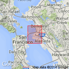
In Oakland West 7.5' quad writer considers the chert-gravel member of San Antonio formation and Temescal formation to be same unit. Temescal formation is used in this area for all Pleistocene gravelly alluvium overlying Alameda formation.
Source: GNU records (USGS DDS-6; Menlo GNULEX).
- Usage in publication:
-
- San Antonio Formation*
- Modifications:
-
- Age modified
- AAPG geologic province:
-
- California Coast Ranges province
Summary:
Age of San Antonio Formation is late Pleistocene (Sangamon) on basis of correlation.
Source: GNU records (USGS DDS-6; Menlo GNULEX).
For more information, please contact Nancy Stamm, Geologic Names Committee Secretary.
Asterisk (*) indicates published by U.S. Geological Survey authors.
"No current usage" (†) implies that a name has been abandoned or has fallen into disuse. Former usage and, if known, replacement name given in parentheses ( ).
Slash (/) indicates name conflicts with nomenclatural guidelines (CSN, 1933; ACSN, 1961, 1970; NACSN, 1983, 2005, 2021). May be explained within brackets ([ ]).