

- Usage in publication:
-
- San Andreas limestone*
- Modifications:
-
- Original reference
- Dominant lithology:
-
- Limestone
- AAPG geologic province:
-
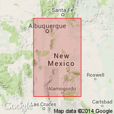
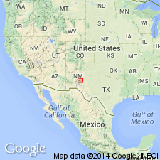
- Orogrande basin
Summary:
San Andreas limestone. Essentially massive limestone, often cherty and poorly fossiliferous, although at several localities fossils were abundant. Thickness 500 feet. This limestone was not included by Herrick in Manzano group, but he refers to it, in his description of region east of Socorro, as an unfossiliferous limestone, overlying Manzano red beds, and includes it in the illustration of his section. The writer, however, found in it fossils which are said to be unquestionably of Pennsylvanian [Permian now] age, and which prove that San Andreas limestone should be included in Manzano group. So far as known at present the San Andreas limestone is uppermost member of Manzano group. Typically developed at north end of San Andreas Mountains. Until further information is available the San Andreas limestone cannot be definitely separated from Yeso formation, except in its type locality in San Andreas Mountains, where it is 500 feet or more thick and clearly separable from underlying beds. In Caballos and Fra Cristobal Mountains, to the west, and at Carthage, to the north, the uppermost limestone of the sections is correlated with some confidence on lithologic evidence with San Andreas limestone; but since the San Andreas fauna is apparently not sufficiently characteristic for purposes of correlation, it is not known whether the capping limestone shown in the sections from other localities is the San Andreas or one of the limestones within Yeso formation. The large coiled shells of the genus EUOMPHALUS, the long pencil-shaped scaphopods PLAGIOGLYPIA CANNA and DENTALIUM MEXICANUM, and the genus AVICULIPINNA are conspicuous in uppermost limestones provisionally correlated with the San Andreas, but are not entirely absent from the lower ones. The San Andreas limestone differs from the older formations of Manzano group in having a more restricted geographic range. The beds provisionally correlated with it are well developed in southern part, but become less prominent northward and are not represented in northern part of region described.
Type locality: at north end of San Andreas Mountains.
Source: US geologic names lexicon (USGS Bull. 896, p. 1902).
- Usage in publication:
-
- San Andreas limestone member*
- Modifications:
-
- Revised
- AAPG geologic province:
-
- Orogrande basin
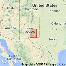
- San Juan basin
Summary:
Pg. 176-182. San Andreas [San Andres] limestone member of Chupadera formation of Manzano group. [The name Chupadera formation was adopted by the USGS for this report in July 1919, but report was not published unitl March 31, 1922.] The name Chupadera formation is here introduced for upper part of Manzano group, which Lee divided into Yeso formation and San Andreas [San Andres] limestone. In mapping these deposits it was found that while Lee's subdivisions were discernible in places, it was impracticable to separate them generally. Although limestone is conspicuous feature of San Andres limestone much of that subdivision consists of thick beds of gypsum and sandstone which are not well exposed in the type localities. In future, wherever Lee's subdivisions can be recognized they will be treated as members of Chupadera formation, instead of as distinct formations.
Source: US geologic names lexicon (USGS Bull. 896, p. 1902, Chupadera entry p. 442).
- Usage in publication:
-
- San Andres limestone member
- Modifications:
-
- Revised
- AAPG geologic province:
-
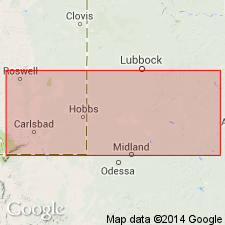
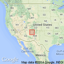
- Permian basin
Summary:
San Andres limestone member of Chupadera formation is here applied to the rocks in Pecos Valley of New Mexico that were named Picacho limestone in 1933; and Hondo sandstone member of Chupadera formation (above) and Yeso member of Chupadera formation (below) are here applied to the rocks designated as Nogal formation in 1933. Picacho limestone and Nogal formation are both abandoned. [The recognition of Hondo sandstone involves a slight redefinition of both Yeso and San Andres.]
Source: US geologic names lexicon (USGS Bull. 896, p. 1902).
- Usage in publication:
-
- San Andres [formation]
- Modifications:
-
- Revised
- Areal extent
- AAPG geologic province:
-
- Permian basin
Summary:
Pg. 42-44. Report gives geologic section from Fisher County through Andrews County, Texas, to Eddy County, New Mexico. The "Blaine of Texas" is herein called the San Andres because it is believed that unconformity at top of Dog Creek shale on east side of basin can be tied into top of San Andres on west side of basin by means of well logs. San Andres on east side can be divided into (descending) Dog Creek shale, Blaine gypsum, and Flowerpot [Flower-pot] shale [members], a division known in Oklahoma for some time. Top of Dog Creek shale is there called top of El Reno group. Term San Andres as used on west side of basin at present time includes beds between base of Whitehorse group (revised) and top of Yeso. In Guadalupes, San Andres is about 1,250 feet thick, and in wells in basin is about 1,460 feet. It has been assumed that this entire thickness is San Andres in age. At type locality in San Andres Mountains, formation is 500 feet thick and contains fossils which suggest its correlation with the Leonard of Glass Mountains of Texas. At type locality, base of formation is exposed, but top passes under alluvium of the Jornado del Muerto. There is evidence that the increased thickness of the so-called San Andres in the Guadalupes and in subsurface is due to the fact that additional section is younger than San Andres of type locality. This implies a division within the so-called San Andres dividing that part of section which is Leonard in age and which corresponds to San Andres as originally defined from younger beds which are probably middle Delaware Mountain in age. (Geologic section compiled from well logs in Eddy and Lea Counties, New Mexico, and Andrews, Martin, Dawson, Scurry, and Fisher Counties, Texas. This correlation was suggested by Willis and others, 1929).
Source: US geologic names lexicon (USGS Bull. 1200, p. 3424-3425); supplemental information from GNU records (USGS DDS-6; Denver GNULEX).
- Usage in publication:
-
- San Andres group
- Modifications:
-
- Revised
- AAPG geologic province:
-
- Permian basin
Summary:
San Andres problem discussed. San Andres group believed to be time equivalent of Word formation, lower two divisions of Delaware Mountain group, and El Reno group, each of which is separable into an upper and lower division over wide area in south Permian basin. Evidence indicates San Andres group should be placed in Guadalupe series.
Source: US geologic names lexicon (USGS Bull. 1200, p. 3424-3425).
- Usage in publication:
-
- San Andres formation
- Modifications:
-
- Revised
- AAPG geologic province:
-
- Permian basin
Summary:
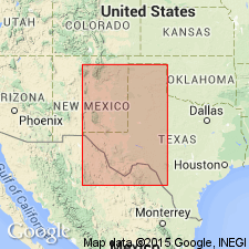
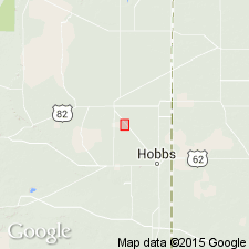
Pg. 269-271. San Andres formation. In subsurface of central Lea County, 10 miles northwest of Hobbs, New Mexico, includes Lovington sandstone member (new). Age is Early Permian (Leonard).
Source: Publication; US geologic names lexicon (USGS Bull. 1200, p. 3424-3425).
- Usage in publication:
-
- San Andres formation*
- Modifications:
-
- Revised
- AAPG geologic province:
-
- Orogrande basin
- Palo Duro basin
- Las Vegas-Raton basin
Summary:
Pg. 542, 687-694, 701-703, pl. 2. San Andres formation of Manzano group. Rank raised to formation; term Chupadera abandoned. In northern shelf area, upper part mostly limestone in outcrop; anhydrite and red beds interbedded to northeast; in lower part, sandstone beds replace limestone forming Glorieta sandstone member of northern New Mexico, Hondo sandstone member in Sacramento Mountains [Otero County]. Occurs above Yeso formation. In San Andres and other ranges of central New Mexico, formation is overlain unconformably by Mesozoic rocks, no higher Permian beds exposed; in Pecos Valley, overlain by Chalk Bluff formation. Included in Manzano group. Age is Early Permian (Leonard).
Source: US geologic names lexicon (USGS Bull. 1200, p. 3424-3425); supplemental information from GNU records (USGS DDS-6; Denver GNULEX).
- Usage in publication:
-
- San Andres formation
- Modifications:
-
- Principal reference
- Revised
- Dominant lithology:
-
- Limestone
- AAPG geologic province:
-
- Permian basin
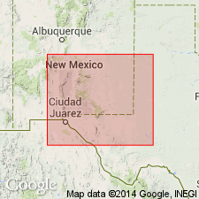
- Orogrande basin
- San Juan basin
Summary:
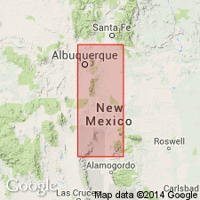
Pg. 1662, 1668 (fig. 2), 1664-1666. San Andres formation of Manzano group. Lee (1909) gave no detailed section. At new type section, herein designated, consists mainly of gray limestone with minor amounts of sandstone. Thickness 593.5 feet at type section; 110 feet, Bluewater Canyon in Zuni Mountains; 15 feet, Glorieta Mesa. Overlies Glorieta sandstone herein given formation status; underlies Permian and other beds. [Fossiliferous. Age is Early Permian (late Leonard).]
Type section: south wall of Rhodes Canyon 2 mi west of road fork at top of Rhodes Pass and 14.6 mi by road east of Continental Airlines beacon near Engle. Canyon extends from near middle of north line of sec. 29, T. 12 S., R. 2 E., Sierra Co., NM. Inquiry established that canyon referred to by Lee is one now known as Rhodes Canyon, San Andres Mountains, Socorro Co., central NM.
Source: US geologic names lexicon (USGS Bull. 1200, p. 3424-3425); supplemental information from GNU records (USGS DDS-6; Denver GNULEX).
- Usage in publication:
-
- San Andres formation*
- Modifications:
-
- Mapped
- AAPG geologic province:
-
- Estancia basin
- Palo Duro basin
Summary:
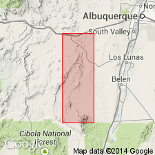
San Andres formation. In upper Pecos River and Rio Galisteo region, Santa Fe and San Miguel Counties, central New Mexico, formation consists of (ascending) Glorieta sandstone member (100 to 250 feet); light-gray thick-bedded cavernous-weathering limestone member (1 to 20 feet); and upper member (0 to 80 feet) of light-terra-cotta to orange gypsiferous siltstone and fine-grained sandstone. Overlies Yeso formation; underlies Dockum formation. Age is Permian.
Source: US geologic names lexicon (USGS Bull. 1200, p. 3424-3425).
- Usage in publication:
-
- San Andres formation*
- Modifications:
-
- Mapped
- AAPG geologic province:
-
- San Juan basin
- Orogrande basin
Summary:
San Andres formation. Most prominent and complete exposures are in Sierra Lucero, Valencia County, New Mexico. Includes (ascending) Glorieta sandstone member, middle evaporite member, and upper limestone member. Overlies Los Vallos member (new) of Yeso formation; underlies Shinarump conglomerate. Age is Permian.
Source: Modified from GNU records (USGS DDS-6; Denver GNULEX).
- Usage in publication:
-
- San Andres formation*
- Modifications:
-
- Revised
- AAPG geologic province:
-
- Las Vegas-Raton basin
Summary:
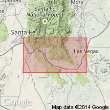
San Andres formation. In northwest Mora County, restricted to exclude upper clastic member which is here named Bernal formation. Includes Glorieta sandstone member at base. Middle limestone member, recognized in other areas, not present in mapped area of this report. Overlies Yeso formation or Sangre de Cristo formation. Age is Permian.
Source: US geologic names lexicon (USGS Bull. 1200, p. 3424-3425).
- Usage in publication:
-
- San Andres group
- Modifications:
-
- Revised
- AAPG geologic province:
-
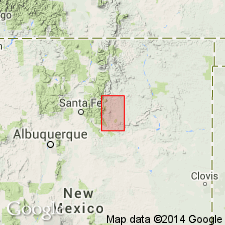
- Estancia basin
Summary:
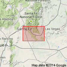
Pg. 307-308. San Andres group. Between Las Vegas and Santa Fe includes (ascending) Glorieta sandstone, Lagunita formation (new), and Bernal formation. Age is Permian.
Source: US geologic names lexicon (USGS Bull. 1200, p. 3424-3425).
- Usage in publication:
-
- San Andres Limestone*
- Modifications:
-
- Areal extent
- AAPG geologic province:
-
- Orogrande basin
Summary:
The Permian Hondo Sandstone Member of the San Andres Limestone and the Glorieta Sandstone in Otero, Lincoln, and Socorro Cos., Orogrande basin, NM have been thought to be identical units. Both are even bedded, have small scale cross laminations, and are gray. The Hondo has clear quartz, sparse rose quartz, smoky quartz, and is slightly coarser grained than the Glorieta. Both are present between Lone Mountain in sec. 22, T 6 S, R 11 E and Riverside in sec. 21, T 11 S, R 19 E on Rio Hondo. Cross sections. Block diagrams. The two sandstones are recognized in this report as two different units separated by an unnamed limestone of the San Andres. Hondo, the younger sandstone, overlies the unnamed limestone, and Glorieta underlies the unnamed limestone. The two sandstones may merge to the north but no proof exists. Hondo thickens toward southeast NM, whereas Glorieta wedges out to the southeast. In many areas, only one sandstone is present. The unnamed limestone thins northward. Glorieta and San Andres were deposited in a marine environment.
Source: GNU records (USGS DDS-6; Denver GNULEX).
- Usage in publication:
-
- San Andres Formation
- Modifications:
-
- Revised
- AAPG geologic province:
-
- Permian basin
- Orogrande basin
Summary:
San Andres Formation, which has previously not been subdivided, is here divided into (ascending): Rio Bonito, Bonney Canyon, and Fourmile Draw Members (all new, this report). Thus, San Andres includes all the beds between the top of Yeso Formation and the base of Artesia Group as defined by the base of the Grayburg Formation (lowest formation of Artesia Group). Pieced-together surface sections for the northern Guadalupe Mountains region (Otero Co, in Orogrande basin) total 1,208 ft thick. Farther north, complete surface sections to top are difficult to determine. For area as a whole, two general isopachous changes noted: 1) in western outcrop are, from 700 ft in north to 1,300 ft in south, and 2) in eastern subsurface area from about 900 ft in north to as much as 1,700 ft in south. Dolomite increases from south to north at expense of limestone, and color lightens from dark to light gray in same direction. Geologic map. Age is Early Permian (Leonardian).
Source: GNU records (USGS DDS-6; Denver GNULEX).
- Usage in publication:
-
- San Andres Limestone*
- Modifications:
-
- Areal extent
- AAPG geologic province:
-
- San Juan basin
Summary:
Is the youngest Permian unit in central and southern part of San Juan basin, NM. Overlies Glorietta Sandstone. Unconformably underlies Triassic rocks. Passes laterally into red beds in the southern Nacimiento Mountains of the Bernal Formation Isopach map; pinches out in northern San Juan Co., increases in thickness south; is 195 ft thick in Sandoval Co. Nomenclature chart.
Source: GNU records (USGS DDS-6; Denver GNULEX).
- Usage in publication:
-
- San Andres Limestone*
- Modifications:
-
- Areal extent
- AAPG geologic province:
-
- Palo Duro basin
Summary:
Mapped (plate 1) in southeast part of study area in San Miguel Co, NM, Palo Duro basin. Consists of limestone (8-20 ft thick) in upper part and clay and sandstone (0-20 ft thick) in lower part; total thickness near Chapelle is 40 ft thinning to 20 ft at Montezuma. Conformably overlies Glorieta Sandstone; conformably underlies Bernal Formation. Early Permian (Leonardian) age.
Source: GNU records (USGS DDS-6; Denver GNULEX).
For more information, please contact Nancy Stamm, Geologic Names Committee Secretary.
Asterisk (*) indicates published by U.S. Geological Survey authors.
"No current usage" (†) implies that a name has been abandoned or has fallen into disuse. Former usage and, if known, replacement name given in parentheses ( ).
Slash (/) indicates name conflicts with nomenclatural guidelines (CSN, 1933; ACSN, 1961, 1970; NACSN, 1983, 2005, 2021). May be explained within brackets ([ ]).