The National Geologic Map Database is migrating to a new infrastructure. We apologize for any service disruptions during this process.
|
|---|


- Usage in publication:
-
- Sample sandstone member
- Modifications:
-
- Named
- Dominant lithology:
-
- Sandstone
- Shale
- AAPG geologic province:
-
- Illinois basin
Summary:
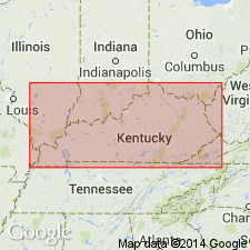
Named Sample sandstone member of Gasper oolite. Occurs in middle part of Gasper. Composed of sandstone, cross-bedded in part, and shale. Maximum thickness is 40 ft. Crops out in Breckinridge, Meade, Harden, and Grayson Cos, and perhaps Hart Co, KY. Age is Mississippian.
Source: GNU records (USGS DDS-6; Reston GNULEX).
- Usage in publication:
-
- Sample sandstone
- Modifications:
-
- Revised
- AAPG geologic province:
-
- Illinois basin
Summary:
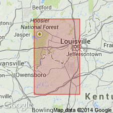
Raised to formation rank from Sample sandstone member of Gasper oolite to Sample sandstone. Composed of sandstone, sandy shale, and shale. Composition changes erratically over short distances. Thickness is 30 to 35 ft. Occurs in north-central Kentucky. Underlain by Beaver Bend limestone; overlain by Reelsville limestone.
Source: GNU records (USGS DDS-6; Reston GNULEX).
- Usage in publication:
-
- Sample formation
- Modifications:
-
- Revised
- AAPG geologic province:
-
- Illinois basin
Summary:
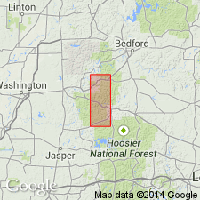
Designated Sample Formation and assigned to West Baden Group. Approximately 60 percent of formation consists of varicolored shales , siltstones, and mudstones; remainder is mostly thin-bedded and cross-bedded sandstone. Thickness ranges from 22 to 36 ft. Conformably underlain by Beaver Bend Limestone; conformably overlain by Reelsville Limestone.
Source: GNU records (USGS DDS-6; Reston GNULEX).
- Usage in publication:
-
- Sample Sandstone*
- Modifications:
-
- Overview
- AAPG geologic province:
-
- Illinois basin
Summary:
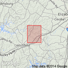
Representative of many U.S. Geological Survey Geologic Quadrangle Maps that were mapped in north-central and include the Sample Sandstone. Sample is "Sandstone and clay shale: Sandstone is thin bedded to massive, yellow to medium brown, well sorted, fine grained; weathers dark brown; rarely fossiliferous; locally cross-bedded; clay galls common along bedding planes in lower 10 to 15 feet. Shale less abundant than sandstone but locally is much as 30 feet thick. Formation rarely contains thin sandy limestone lenses as much as 1 foot thick. Lower contact [with Beaver Bend Limestone] is abrupt change to limestone at erosional surface or, less commonly, gradational change to limestone through calcareous sandstone and sandy limestone." Thickness ranges from 4 to 65 ft. Overlain conformably by Reelsville Limestone. Age is Late Mississippian.
Source: GNU records (USGS DDS-6; Reston GNULEX).

- Usage in publication:
-
- Sample Sandstone Member
- Modifications:
-
- Overview
- AAPG geologic province:
-
- Illinois basin
Summary:
Designated Sample Sandstone Member of Ridenhower Formation of West Baden Group by Illinois Geological Survey. Occurs locally in southeast Illinois. Dominantly sandstone and shale. Underlain by Beaver Bend Limestone Member and overlain by Reelsville Limestone Member, both of Ridenhower Formation.
Source: GNU records (USGS DDS-6; Reston GNULEX).

- Usage in publication:
-
- Sample Formation
- Modifications:
-
- Overview
- AAPG geologic province:
-
- Illinois basin
Summary:
Approved usage of Indiana Geological Survey is Sample Formation of West Baden Group. Is middle formation of 5. Consists of varicolored shale and thin-bedded and cross-bedded sandstone. Thickness ranges from 15 to 50 ft. Crops out in Indiana from Ohio River northward to Putnam Co in west-central Indiana. Present westward in subsurface but indistinguishable from other Chester sandstones in much of area because intervening limestones are missing. Conformably underlain by Beaver Bend Limestone; conformably overlain by Reelsville Limestone. Age is Mississippian, Chester Series.
Source: GNU records (USGS DDS-6; Reston GNULEX).
For more information, please contact Nancy Stamm, Geologic Names Committee Secretary.
Asterisk (*) indicates published by U.S. Geological Survey authors.
"No current usage" (†) implies that a name has been abandoned or has fallen into disuse. Former usage and, if known, replacement name given in parentheses ( ).
Slash (/) indicates name conflicts with nomenclatural guidelines (CSN, 1933; ACSN, 1961, 1970; NACSN, 1983, 2005, 2021). May be explained within brackets ([ ]).