The National Geologic Map Database is migrating to a new infrastructure. We apologize for any service disruptions during this process.
|
|---|


- Usage in publication:
-
- Sam Creek limestone member*
- Modifications:
-
- Named
- Dominant lithology:
-
- Sandstone
- AAPG geologic province:
-
- Arkoma basin
- Chautauqua platform
Summary:
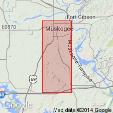
Named as a member (1 of 6 named members) of Savanna sandstone. Savanna is 1 of 5 formation names applied to rocks formerly assigned to Winslow formation. [Preferred usage for Winslow as a result of this study not clearly stated.] Named for exposure along Sam Creek in sec 15, T14N, R18E, Muskogee Co, OK on the Chautauqua platform. No type locality designated. Area of this report is in Muskogee Co. In a composite section of the Savanna sandstone in the northern part of Muskogee Co, Sam Creek shown as consisting of (ascending): gray limestone with layers of gray shale, 3 ft 8 inches thick; alternation of gray limestone and gray, fossiliferous shale, the former essentially a reef composed of CAMPOPHYLLUM TORQUIUM, 11 inches thick; gray, fossiliferous shale, 3 1/2 ft thick; gray limestone which weathers brown and contains so many MARGINIFERA MURICATA that it is almost coquina, 6 inches thick. Separated from underlying Spaniard limestone member of Savanna by 40 ft of unnamed shale. Separated from overlying Spiro sandstone member (new) of Savanna by 3 ft of unnamed buff shale. Both unnamed shales are part of the Savanna. Columnar section. Stratigraphic chart. Geologic map. Of Early Pennsylvanian age.
Source: GNU records (USGS DDS-6; Denver GNULEX).
For more information, please contact Nancy Stamm, Geologic Names Committee Secretary.
Asterisk (*) indicates published by U.S. Geological Survey authors.
"No current usage" (†) implies that a name has been abandoned or has fallen into disuse. Former usage and, if known, replacement name given in parentheses ( ).
Slash (/) indicates name conflicts with nomenclatural guidelines (CSN, 1933; ACSN, 1961, 1970; NACSN, 1983, 2005, 2021). May be explained within brackets ([ ]).