

- Usage in publication:
-
- Salyer Formation*
- Modifications:
-
- Named
- Dominant lithology:
-
- Claystone
- Breccia
- Tuff
- Sandstone
- Siltstone
- AAPG geologic province:
-
- Great Basin province
Summary:
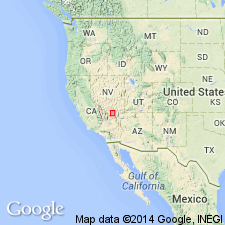
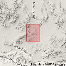
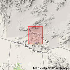
Named for Mount Salyer (its type area), Cane Spring quad, Nye Co, Nevada Test Site, NV in the Great Basin province. Its type section is a composite of (ascending): units 1 to 3--435 ft thick of orange to purplish tuffaceous claystone with pebbles of pre-Cenozoic rocks at base overlain in sequence by purplish to brownish breccia, and pink, brown, gray, red interbedded tuff, sandstone and breccia measured near head of Mara Wash about 1 1/4 mi south of Cane Spring; unit 4--breccia flows 1,000 ft thick that grade from purple and red (lower) to pale red, purple yellow (upper) and unit 5--interbedded tuff, sandstone, siltstone, claystone, 150 ft thick whose colors range from green, yellow, red, brown to gray measured on ridge half a mi east of Cane Spring; unit 6 --gray, pink, orange tuff (middle tuff as thin stratified, upper and lower tuffs are ash flows) 200 ft thick measured 1 mi northeast of Hampel Hill; units 7 and 8--purplish- to reddish-brown breccia flow 500 ft thick measured 3/4 mi northeast from Mount Salyer; unit 9--an interbedded lithic breccia, breccia flow, lithic tuff breccia, tuff and sandstone 700 ft thick and unit 10--a purple-red breccia flow 50 ft thick measured at same locality as units 4 and 5. Cross section, measured section. Crops out over area exceeding 300 sq mi. Original volume was at least 20 cubic mi. Unconformably overlies rocks of Pavits Spring. Underlies Wahmonie Formation (new). Of late Miocene age.
Source: GNU records (USGS DDS-6; Denver GNULEX).
- Usage in publication:
-
- Salyer Formation*
- Modifications:
-
- Mapped
- AAPG geologic province:
-
- Great Basin province
Summary:
Age is Miocene and Pliocene(?) in mapped area. Ten lithologic sub-units shown separately.
Source: GNU records (USGS DDS-6; Menlo GNULEX).
- Usage in publication:
-
- Salyer Formation*
- Modifications:
-
- Age modified
- AAPG geologic province:
-
- Great Basin province
Summary:
Age shown as Miocene. Breccia flow equivalent to breccia flow (Tsbb) of Mount Salyer area [of Cane Springs quad] of Poole and others (1965).
Source: GNU records (USGS DDS-6; Menlo GNULEX).
For more information, please contact Nancy Stamm, Geologic Names Committee Secretary.
Asterisk (*) indicates published by U.S. Geological Survey authors.
"No current usage" (†) implies that a name has been abandoned or has fallen into disuse. Former usage and, if known, replacement name given in parentheses ( ).
Slash (/) indicates name conflicts with nomenclatural guidelines (CSN, 1933; ACSN, 1961, 1970; NACSN, 1983, 2005, 2021). May be explained within brackets ([ ]).