The National Geologic Map Database is migrating to a new infrastructure. We apologize for any service disruptions during this process.
|
|---|


- Usage in publication:
-
- Saltville chert
- Modifications:
-
- Named
- Dominant lithology:
-
- Chert
- Sandstone
- Limestone
- AAPG geologic province:
-
- Appalachian basin
Summary:
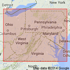
Named the Saltville chert of the Helderberg group in southwestern VA for Saltville, Smyth Co., VA. Consists of chert and sandstone with some thin limestone beds. Thickness ranges from 5 to 60 feet. Overlies Rocky Gap sandstone and correlated with Shriver chert and underlying New Scotland limestone and doubtfully correlated with basal part of Ridgeley sandstone of northern WV and western MD. Unit extends from near Saltville to Gala, Botetourt Co. The Saltville is of Early Devonian age.
Source: GNU records (USGS DDS-6; Reston GNULEX).
For more information, please contact Nancy Stamm, Geologic Names Committee Secretary.
Asterisk (*) indicates published by U.S. Geological Survey authors.
"No current usage" (†) implies that a name has been abandoned or has fallen into disuse. Former usage and, if known, replacement name given in parentheses ( ).
Slash (/) indicates name conflicts with nomenclatural guidelines (CSN, 1933; ACSN, 1961, 1970; NACSN, 1983, 2005, 2021). May be explained within brackets ([ ]).