


- Usage in publication:
-
- Salt Mountain division
- Salt Mountain limestone*
- Modifications:
-
- Original reference
- Dominant lithology:
-
- Limestone
- AAPG geologic province:
-
- Mid-Gulf Coast basin
Summary:
Pg. 589-605. See also Alabama Geol. Survey Rpt. Coastal Plain, p. 107-122, 1894. The uppermost or Salt Mountain division of this group [White Orbitoidal limestone] is seen nowhere east of typical locality and so does not enter into geological features of this section of Alabama [east of Alabama River]. As a matter of fact the character of Salt Mountain limestone, composed as it is of corals and species of echini, and the occurrence of this isolated elevation point rather to Salt Mountain being an atoll or coral island built up in Tertiary seas, rather than any extensive deposit justifying the constitution of a group. Is top division of White Orbitoidal limestone and of Eocene. [Later reports, by Langdon and others, gave thickness of Salt Mountain formation as 100 to 150 feet, and defined it as overlying the white orbitoidal Vicksburg limestone (Marianna limestone of modern nomenclature), and assigned it to the †Coral limestone.]
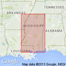
[Named from exposures at Salt Mountain, Clarke Co., southwestern AL.]
Source: US geologic names lexicon (USGS Bull. 896, p. 1898).
- Usage in publication:
-
- Salt Mountain limestone
- Modifications:
-
- Revised
- AAPG geologic province:
-
- Mid-Gulf Coast basin
Summary:
Replaced the descriptive name "Coral limestone" with Glendon limestone and replaced the paleontologic name "Orbitoidal limestone" with Marianna limestone. Both of these limestones are exposed near Salt Mountain, "which is now considered to be a tilted block brought up by the Jackson fault."
Source: US geologic names lexicon (USGS Bull. 896, p. 1898).
- Usage in publication:
-
- Salt Mountain limestone
- Modifications:
-
- Revised
- AAPG geologic province:
-
- Mid-Gulf Coast basin
Summary:
Corr. chart at end of book. Assigned Salt Mountain limestone to a position in lower Eocene Wilcox group between Tuscahoma sand and Nanafalia formation. This is now generally accepted as true position of that limestone. Its identification at this stratigraphic horizon was ascertained through the study of well logs, and does not involve a redefinition of either Tuscahoma sand or Nanafalia formation, because it is not present at type localities of either of those formations, its only known outcrops being at Salt Mountain and at 2 places within a mile of that mountain. (See C.W. Cooke, AAPG Bull., v. 19, no. 8, 1935, p. 1162+, where Salt Mountain limestone is assigned to Wilcox group, lower Eocene.)
Source: US geologic names lexicon (USGS Bull. 896, p. 1898).
- Usage in publication:
-
- Salt Mountain limestone
- Modifications:
-
- Reinstated
- AAPG geologic province:
-
- Mid-Gulf Coast basin
GNC Staff, 1935, [U.S. Geologic Names Committee remark on the Salt Mountain limestone]: U.S. Geological Survey, unpublished Geologic Names Committee note
Summary:
The following comments are from the GNC files: C.W. Cooke accepts the work of Blanpied (1932) who determined the true stratigraphic position of the Salt Mountain as underlying Tuscahoma sand and overlying Nanafalia formation of Wilcox group. Cooke accepts this now as well logs reveal a Wilcox foram in the Salt Mountain limestone. Cooke would not now abandon Salt Mountain as it may be a useful local name. [In 1923, Cooke suggested that the Salt Mountain be replaced with the Glendon and Marianna limestones.] The Geologic Names Committee restored the Salt Mountain limestone to good standing on February 25, 1935, as a unit of formation rank in the Wilcox group. (Cooke is satisfied it is of Wilcox age, and thinks the Oligocene fossils come from adjacent beds and not from the Salt Mountain.)
Source: GNU records (USGS DDS-6; Reston GNULEX).
- Usage in publication:
-
- Salt Mountain limestone*
- Modifications:
-
- Age modified
- AAPG geologic province:
-
- Mid-Gulf Coast basin
Summary:
Age of Salt Mountain limestone is changed from Eocene to Paleocene based on work on forams by A.K. Loeblich, Jr., and Helen Tappan (1957, Jour. Paleo., v. 31, no. 6, p. 1109-1137).
Source: GNU records (USGS DDS-6; Reston GNULEX).
- Usage in publication:
-
- Salt Mountain Limestone*
- Modifications:
-
- Areal extent
- AAPG geologic province:
-
- Mid-Gulf Coast basin
Summary:
Paleocene Salt Mountain(?) Limestone geographically extended from western Alabama to Florida Panhandle in subsurface. Overlies Midway Group, undifferentiated; underlies Nanafalia equivalent.
Source: GNU records (USGS DDS-6; Reston GNULEX).

- Usage in publication:
-
- Salt Mountain Limestone*
- Modifications:
-
- Overview
- AAPG geologic province:
-
- Mid-Gulf Coast basin
Summary:
Pg. 76. Salt Mountain Limestone of Wilcox Group. White massive indurated fossiliferous limestone, with sand at the base. Thickness ranges from 90 feet in outcrop in Clarke County to 36 feet in the subsurface of Mobile County. The formation is only exposed in the vicinity of Salt Mountain, southeast of Jackson, Clarke County. [Correlative with "OSTREA THIRSAE beds".] Age is Paleocene (Sabine; middle Thanetian).
See also D.W. Langdon, 1891, GSA Bull., v. 2, p. 589-605; L.D. Toulmin, 1940, Geol. Survey Alabama Bull., no. 46.
Source: Publication.
- Usage in publication:
-
- Salt Mountain Limestone*
- Modifications:
-
- Overview
- AAPG geologic province:
-
- Mid-Gulf Coast basin
Summary:
Salt Mountain Limestone of Wilcox Group. Lies above Coal Bluff Member of Naheola Formation of Midway Group. Correlative with part of Nanafalia Formation of Wilcox Group of updip (north) area (parts of OSTREA THIRSAE beds and Gravel Creek Sand Member). Age is late Paleocene (early Thanetian; early Sabinian Provincial Age); nannofossil zones NP6 to NP7, planktic foram zone P4 (PR. PSEUDOMENARDII zone).
Source: Publication.
For more information, please contact Nancy Stamm, Geologic Names Committee Secretary.
Asterisk (*) indicates published by U.S. Geological Survey authors.
"No current usage" (†) implies that a name has been abandoned or has fallen into disuse. Former usage and, if known, replacement name given in parentheses ( ).
Slash (/) indicates name conflicts with nomenclatural guidelines (CSN, 1933; ACSN, 1961, 1970; NACSN, 1983, 2005, 2021). May be explained within brackets ([ ]).