The National Geologic Map Database is migrating to a new infrastructure. We apologize for any service disruptions during this process.
|
|---|


- Usage in publication:
-
- Salmon River assemblage*
- Modifications:
-
- Redescribed
- AAPG geologic province:
-
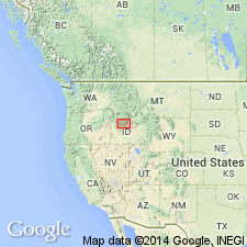
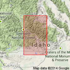
- Idaho Mountains province
Summary:
Redescribed from Salmon River sequence to Salmon River assemblage. Is composed of dark-gray to nearly black argillite, calcareous siltstone, turbidite, fine-grained quartzite, and some pure limestone. Has small-scale current structures, sole markings, and local contorted beds. Overlies Ordovician rocks. Underlies Grand Prize Formation (new). Age is Late Mississippian (late Chesterian), Late Devonian, and Late Cambrian, based on fossils (conodonts). Deposits were transported from the west (distance unknown).
Source: Modified from GNU records (USGS DDS-6; Denver GNULEX).
- Usage in publication:
-
- Salmon River assemblage*
- Modifications:
-
- Age modified
- Overview
- AAPG geologic province:
-
- Idaho Mountains province
Summary:
Where it occurs in area south of Salmon River in White Cloud Peaks, Custer Co, ID, Idaho Mountains province, Salmon River largely correlates with Devonian Milligen Formation. Salmon River and Milligen have similar lithology and stratigraphy; both contain thick sections of homogeneous black argillite, abundant thin-bedded fine-grained turbidite sequences, and intercalated blue-gray, locally tremolitic, limestone. Both Salmon River and Milligen host inferred syngenetic sulfide deposits with identical lead-isotope signatures. Has been reported to contain Late Cambrian and Late Devonian conodonts and Late Mississippian fossils. However, authors are doubtful that rocks containing Late Cambrian and Late Mississippian fossils are part of Salmon River; they believe that the majority of the Salmon River is Devonian in age.
Source: GNU records (USGS DDS-6; Denver GNULEX).
- Usage in publication:
-
- Salmon River assemblage*
- Modifications:
-
- Age modified
- Overview
- AAPG geologic province:
-
- Idaho Mountains province
Summary:
Considered as primarily Devonian age in White Clouds Peaks, Custer Co, ID, Idaho Mountains province. Is similar lithologically and stratigraphically to Devonian Milligen Formation. Salmon River in White Cloud Peaks has yielded Middle to Late Devonian conodonts; the reported Cambrian and Mississippian dates for the Salmon River assemblage are derived from rocks exposed to north of main part of White Cloud Peaks that are interpreted as structural imbrications within the assemblage. Unit is considered lateral equivalent of Devonian Milligen Formation exposed to the south.
Source: GNU records (USGS DDS-6; Denver GNULEX).
For more information, please contact Nancy Stamm, Geologic Names Committee Secretary.
Asterisk (*) indicates published by U.S. Geological Survey authors.
"No current usage" (†) implies that a name has been abandoned or has fallen into disuse. Former usage and, if known, replacement name given in parentheses ( ).
Slash (/) indicates name conflicts with nomenclatural guidelines (CSN, 1933; ACSN, 1961, 1970; NACSN, 1983, 2005, 2021). May be explained within brackets ([ ]).