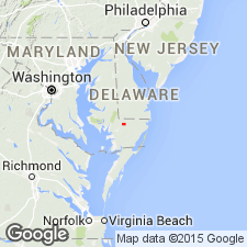
- Usage in publication:
-
- Salisbury Formation
- Modifications:
-
- Original reference
- Dominant lithology:
-
- Sand
- Gravel
- AAPG geologic province:
-
- Atlantic Coast basin
Summary:
Pg. 8-16, figs. 7, 9. Salisbury Formation of Columbia Group. Term Salisbury aquifer was introduced by Heindl and Otton (1963, USGS Open-file Rpt.) to describe post-Miocene water-bearing sands and gravels of Salisbury well field area. Rasmussen and Slaughter (1955, Maryland Dept. Geol. Mines Water Res. Bull., no. 16) divided same sediments into two geologic "formations" designating them Beaverdam Sand of Pleistocene age and the "red gravelly" sand of Pliocene(?) age. Latter unit was tentatively correlated with high-level Pliocene terrace gravels (Brandywine Formation) cropping out west of Chesapeake Bay. In this report the Beaverdam facies and the "red gravelly" facies are herein considered subdivisions of the newly defined Salisbury Formation. The "red gravelly" facies is as much as 190 feet thick and the Beaverdam facies as much as 115 feet thick. Underlies Walston Clay. Overlies Yorktown and Cohansey Formations. Age is Pleistocene (Sangamon).
Type sections (subsurface): (1) well Wi-Cf 147 in Allen Company orchard south of Naylor Mill Road, and (2) well Wi-Ce 159 in Salisbury well field, southeastern MD.
Source: US geologic names lexicon (USGS Bull. 1350, p. 659).
For more information, please contact Nancy Stamm, Geologic Names Committee Secretary.
Asterisk (*) indicates published by U.S. Geological Survey authors.
"No current usage" (†) implies that a name has been abandoned or has fallen into disuse. Former usage and, if known, replacement name given in parentheses ( ).
Slash (/) indicates name conflicts with nomenclatural guidelines (CSN, 1933; ACSN, 1961, 1970; NACSN, 1983, 2005, 2021). May be explained within brackets ([ ]).

